


Waikiki flood concerns spur push for Hawaii shore protection
 Beach loss fronting armored shorelines are a common sight. Image courtesy of Alisha Summers.
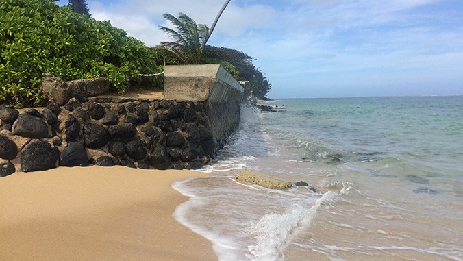
Below is an excerpt from a Washington Post story published on April 21, 2019.
Predicting Honolulu will start experiencing frequent flooding within the next 15 to 20 years, state lawmakers are trying to pass legislation that would spend millions for a coastline protection program aimed at defending the city from regular tidal inundations.
The highest tides of recent years have sent seawater flowing across Waikiki Beach and onto roads and sidewalks lining its main thoroughfare, and interactive maps of the Hawaiian Islands show that many parts of the state are expected to be hit by extensive flooding, coastal erosion and loss of infrastructure in coming decades.
That’s an alarming scenario for a state where beach tourism is the primary driver of the economy, leading some lawmakers to insist that planning for rising tides should start now.
“The latest data on sea level rise is quite scary and it’s accelerating faster than we ever thought possible,” said state Rep. Chris Lee, a Democrat and lead author of a bill calling for the creation and implementation of the shoreline protection plan. The project would focus on urban Honolulu but act as a pilot program for other coastal communities around the state.
The bill is moving forward two years after a state-mandated sea level rise adaptation report was made public to act as a guideline for future legislative action and planning.
Research included in the report suggests Hawaii will see a 3-foot (0.9 meters) rise in ocean levels by the end of this century. It predicts that more than 6,000 of the state’s buildings and 20,000 people across all of Hawaii’s islands will experience chronic flooding. Dozens of miles of roadways, utility infrastructure and beaches will be washed away, the report said. The state’s ports and low-laying airports are also highly vulnerable.
The report was updated in September to included newly published research warning that previous estimates of inundation areas in Hawaii were underestimated by 35% to 54%.
University of Hawaii researcher Tiffany Anderson, who led the study, said traditional sea level forecasts use what is known as the “bathtub model” to measure where water will rise and flood land. But she was surprised by the dramatic increase revealed when she factored in more variables such as beach erosion and wave energy fluctuations, which are not used in traditional climate change flooding predictions.
“We’ve long suspected processes like shoreline erosion, waves overtopping and inundation would be additional factors for Hawaii,” Anderson said. “We found out it covers a lot more land … I wasn’t expecting such a large increase due to these other two processes.”
Read the full story in The Washington Post.