

-

Pacific Islands Benthic Habitat Mapping Center
Providing high-resolution habitat maps that extend to deeper waters where satellite and diver-based techniques are not feasible, including bathymetry, backscatter imagery, optical validation, and geomorphology data.
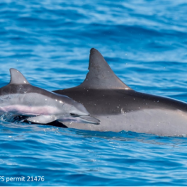
Ocean Life Earth -

Pacific Drought Knowledge Exchange (PDKE)
PDKE seeks to facilitate drought knowledge exchange and enable collaborative relationships among drought stakeholders in Hawai‘i and in Pacific Island Nations.
Ocean Life Climate Atmosphere Earth -
Vog Measurement and Prediction
Daily, map-based predictions of vog concentrations in the Main Hawaiian Islands, derived from measurements and numerical models of weather in the region.
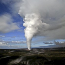
Atmosphere Earth -

Coastal Imagery Data Download
Providing easy-to-access coastal imagery and data for the main Hawaiian Islands. Datasets are island-specific and may include a wide variety of information such as coastal geology, aerial photography, erosion maps, shoreline imagery, bathymetry, and vector data.
Earth -

The Generic Mapping Tools (GMT)
GMT is an open source collection of tools for manipulating geospatial data sets and producing tailored maps, plots and 3D perspectives.
-
Hawai‘i Undersea Research Laboratory (HURL) Archive
Since 1980, HURL has completed nearly 1900 dives representing 9300 hours underwater. This archive is an open-access repository of the data and imagery collected, as well as an identification guide to the deep-sea animals of the Pacific and the archaeological artifacts discovered throughout the years of HURL’s operation
Ocean Life Earth -

PacIOOS Voyager
Pacific Islands Ocean Observing System (PacIOOS) interactive map interface for visualizing and downloading oceanographic observations, forecasts, and other geospatial data and information related to the marine environment and beyond.
Ocean Life Climate Atmosphere -

Pacific Islands Ocean Observing System (PacIOOS)
Supporting a variety of data servers, output formats, viewers, and services to make both real-time and archived ocean data from throughout the Pacific easily accessible.
Ocean Life Climate Atmosphere -

ALOHA Cabled Observatory (ACO) Real-time Data Display
The ALOHA Cabled Observatory (ACO) is a system of hardware and software that extends electric power and the Internet offshore, supporting sustained real-time observations including temperature, salinity, oxygen, currents, pressure, sound, images, and seismography in the deep ocean at a depth of about five kilometers.
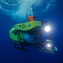
Ocean -
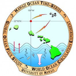
Hawaii Ocean Timeseries (HOT) Database
The HOT project is committed to providing free and open access to its data set in a timely manner, and the use of these data is encouraged. We are now posting our calibrated CTD temperatures and salinities, bottle salinities and nominally calibrated CTD dissolved oxygens within approximately one month of each cruise; and calibrated CTD dissolved oxygens and bottle oxygen data within approximately two months of each cruise
Ocean -

Woods Hole – Hawaii Ocean Timeseries Site (WHOTS)
The Woods Hole Oceanographic Institution (WHOI) Hawaii Ocean Timeseries (HOT) Site (WHOTS) is a coordinated part of HOT, and consists of a mooring that has been providing measurements of high-quality air-sea fluxes and the associated upper ocean response at Station ALOHA, about 100 km north of O‘ahu.
Ocean Atmosphere -

Hawai‘i Ocean Time-series
Physical and biogeochemical data from Station ALOHA, north of O‘ahu, collected in real-time and via monthly cruises and analyses.
Ocean -

Hawai‘i Mapping Research Group
Providing online seafloor mapping data archives for bathymetric survey data within the main Hawaiian Islands.
Ocean -
Coral Reef Assessment and Monitoring Program
Providing coral reef monitoring data from throughout the State of Hawai‘i, including benthic data, fish data, and photoquadrats.
Life -

Hawai‘i Shoreline Erosion Data
Shoreline change data intended to assist in decision-making in the coastal zone. Erosion maps, historical mosaics, aerial photography, oblique photography, and air coverage photos are only some of the datasets available for O‘ahu, Maui, and Kaua‘i.
Earth -

HawaiiView
A comprehensive archive of downloadable satellite data that covers the entire state of Hawai‘i, including HawaiiVis, radar, cloud-free image mosaics, digital elevation and other remote sensing data products.
Earth Space -

Sea-Level Rise Projections
Sea level rise scenarios for regions in American Samoa, O‘ahu, Kaua‘i, Moloka‘i, Maui, and Hawai‘i. Scenarios within the Main Hawaiian Islands are city specific and account for up to four feet above the modern mean higher high water tidal surface.
Climate Earth -

MODIS HOTSPOTS
Current and historical satellite-derived images dating back to 2002. Daily and eight-day images of sea surface temperatures and chlorophyll levels around the main Hawaiian Islands may be downloaded as single images or as composite movies.
Ocean Climate -

NASA Pacific Region Planetary Data Center
Serving as an archive of planetary data and a preview facility for available data products. The PRPDC has both local and remote databases of lunar and planetary images that are stored in a variety of formats.
Space -

Asia-Pacific Data-Research Center
A broad directory of easy-to-access climate datasets and products. Variable-specific datasets can be searched for and downloaded from various servers in different data types, grid types, time coverages, and disciplines.
Climate Atmosphere -

UH Meteorology Server
Providing a wide array of current and archived data including: satellite and radar imagery; marine, vog, and weather forecasts; numerical models; lightning products; and weather observations.
Climate Atmosphere Earth -

Joint Archive for Shipboard ADCP
An online inventory allowing shipboard ADCP data to be downloaded by project, region, or ship in different list formats. High resolution datasets in CODAS formats are available by request.
Ocean