


Hawai‘i coastal flooding expected during July 2017 king tides after breaking 112-year records
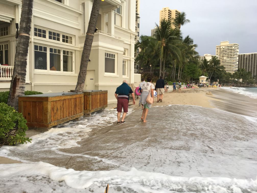 Tides at the Moana Surfrider on Waikiki Beach in late April 2017. Photo courtesy of Hawaii Sea Grant King Tides Project.
The highest water levels of the summer are expected around the upcoming peak astronomic tides of the year, known as “king tides,” occurring over a few days around May 26, June 23 and July 21 in Hawaiʻi. These may produce flooding events similar to what occurred in late April, and University of Hawaiʻi researchers say summer will provide a glimpse of what will eventually become routine with continued global warming and sea-level rise.
Localized impacts may include coastal erosion, wave over-wash and temporary flooding in low-lying backshore areas around storm drain systems. Impacts may be more severe if the upcoming king tides coincide with an elevated surf event, which occur most often on south and east shores this time of year, and/or during heavy rains. Actual water levels along exposed coasts will largely depend on wave heights during the high tides.
The University of Hawaiʻi Sea Grant Center for Coastal and Climate Science and Resilience (Hawaiʻi Sea Grant CCSR), University of Hawaiʻi Sea Level Center and Pacific Islands Ocean Observing System (PacIOOS) have been tracking high ocean water levels in the region, and are advising that the state likely will continue to experience unusually high tide levels through the summer.
“The oceanic and atmospheric processes that contribute to this prolonged period of high water levels in the Hawaiʻi region occur naturally in cycles. But as sea levels continue to rise with global warming, we will see more and more instances when not just king tides but ordinary high tides combine with high water levels to reach flood stage, with adverse impacts to our beaches, coastal infrastructure, wetlands and low-lying areas of the islands,” said Mark Merrifield, professor of Oceanography and director of Hawaiʻi Sea Grant CCSR and UH Sea Level Center.
Property owners who have experienced flooding and erosion problems in the past, particularly those on south and windward shores, should anticipate impacts similar to those experienced during the high tides of late April. Boating and ocean recreation such as paddling and fishing may also experience unusual water levels and currents in addition to navigation hazards.
Chip Fletcher, professor of Geology & Geophysics and Associate Dean of SOEST adds, “Water levels may reach more than 1 foot above typical high tide and produce unusual flooding in low-lying regions. Within a few decades this will be the new normal. Hawaiʻi should consider this a practice run, and reevaluate policies and development practices accordingly.”
Community members, businesses, and agencies also are encouraged to regularly check PacIOOS’ six-day high sea level and wave run-up forecasts to help increase preparedness and resiliency. Visit hawaiisealevel.org for more resources and information on how to get involved.
UPDATES Articles in the Honolulu Star Advertiser and at Hawaii News Now about the 21-23 July 2017 tides, which will be compounded by an east swell is building from distant Hurricane Fernanda. The combination of the summer’s highest tides with a sizable swell has the potential to generate substantial coastal erosion, wave overwash and temporary flooding along low-lying areas of east-facing shores, including the Windward Coast and the Ka Iwi Coast. Senator Brian Schatz talks about king tides on the UH Sea Grant College Program’s Voice of the Sea; read more about it in the UH System News.
Read more about it in The Atlantic, the UH System News, the Honolulu Star Advertiser, The Maui News, The Garden Island, U.S. News and World Report, at Reuters, and read a summary overview in Honolulu Magazine; see also the related USGS press release. Watch the video reports on the impact of rising tides at Hawaii News Now here, here, and here, and at KHON2.