[ Bathymetry | Backscatter | Optical Validation | Geomorphology ]
The collection and analysis of photographic data to ground truth and interpret multibeam data layers with the goal of characterizing seafloor habitats.
Coral Cover Map

Download this image as a high-res JPG or PDF
| Descriptions of optical data products. |
| Download: Accessory Files |
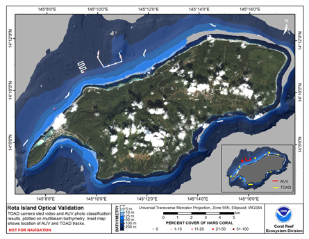
This map displays optical validation observation locations and percent coverage of scleractinian coral overlaid on bathymetry. Optical data were collected by CRED TOAD camera sled aboard the NOAA ship Oscar Elton Sette on cruises OES0307 and by the CRED-NWFSC SeaBED AUV during Oscar Elton Sette cruise SE1002.
This map includes classified video data from TOAD camera sled tows conducted at Rota during 2003 (cruise OES0307), and classified photographs from selected AUV dives conducted at Rota in 2010 (cruise SE1002). During cruise SE1002, 3 AUV dives were conducted at Rota, however, as the AUV was still undergoing testing and trials, two of these dives repeated the same route. Therefore, only photos from 2 dives have been classified for this map. These were selected due to covering distinct routes, and were conducted during the day/night.