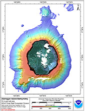
[ Bathymetry | Backscatter | Optical Validation | Geomorphology ]
Alamagan is an active volcanic island located at latitude 17 36’N, longitude 145 50’E, approximately 185 km north of Saipan. It is 4.8 km long and 4 km wide with an area of approximately 11.2 km2 and a maximum elevation of 744 m.
Click thumbnail maps below to explore PIBHMC’s data sets.
Bathymetry |
Backscatter |
Optical Validation |
Geomorphology |


