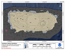
[ Bathymetry | Backscatter | Optical Validation | Geomorphology ]
Anatahan is a small volcanic island 32.4 square kilometers in size. Prior to this island’s eruption on May 6, 2003, feral goats were creating severe erosion problems and the resulting sediment runoff was impacting the nearshore environment. A feral animal control program was started by the U.S. Fish and Wildlife Service (USFWS) and the Northern Island Mayor’s Office, with financial support from the U.S. Navy. Ash fallout from the 2003 eruption caused extensive damage to nearshore reef habitats, especially on the northern side.
Click thumbnail maps below to explore PIBHMC’s data sets.
Bathymetry
Not yet available
|
Backscatter |
Optical Validation |
Geomorphology
Not yet available
|

