[ Bathymetry | Backscatter | Optical Validation | Geomorphology ]
Gridded at: 60 meters • 5 meters
Zipped data files contain 1) grid data file (GMT or ASCII), 2) JPG and PDF of image, and 3) explanatory metadata text file (identical to linked file listed below).
* Ikonos imagery & USGS Digital Ortho Quarter Quads NOT included with download.
60 meter grid

Download this image as a High-res JPG or PDF
Bathymetric data files
- View Metadata: Metadata text
- Zipped Data: NetCDF/GMT (4.2 MB) • Arc ASCII (4.3 MB)
Top of the page
5 meter grid

Download this image as a High-res JPG or PDF
Bathymetric data files
- View Metadata: Metadata text
- Zipped Data: Arc ASCII (14.2 MB)
Top of the page
Merged Multibeam Bathymetry, WV-2 Derived Depths
5 meter grid
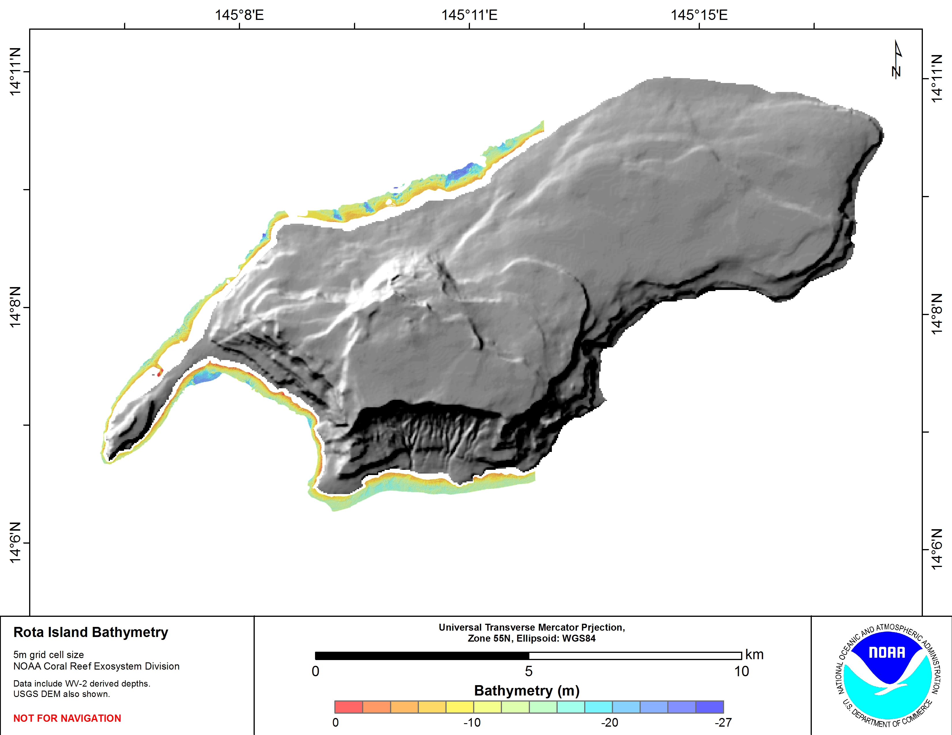
Download this image as a High-res JPG or PDF
Bathymetric data files: WV-2 derived depths data files
- View Metadata: Metadata text
- Zipped Data:Arc ASCII
Top of the page
Merged Multibeam Bathymetry, WV-2 Derived Depths
Coverage Map
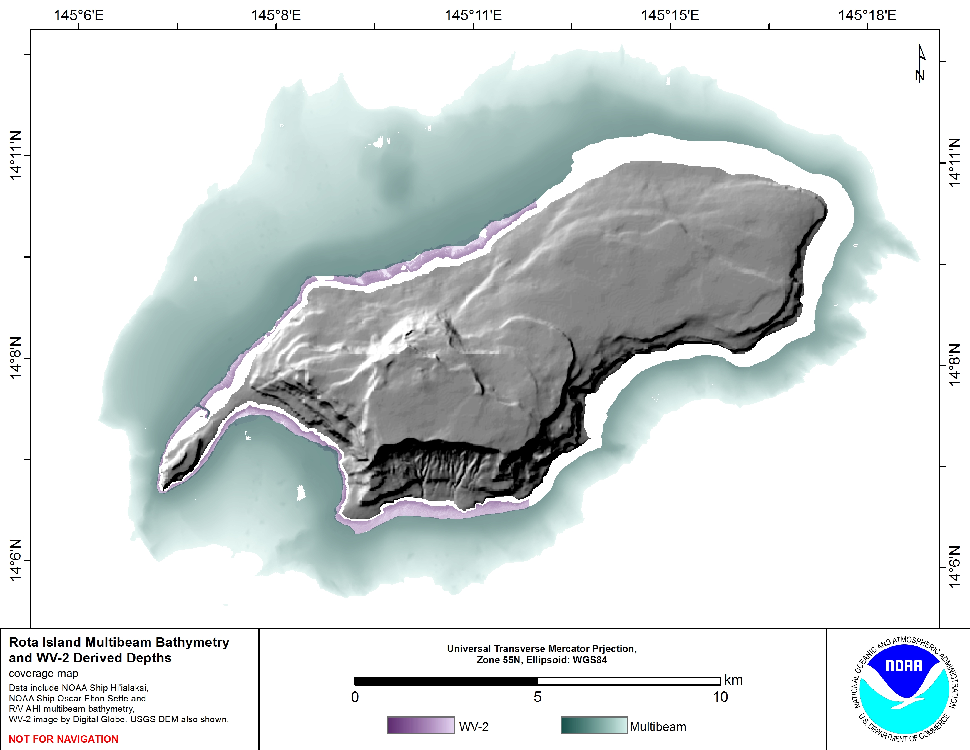
Download this image as a High-res JPG or PDF
5 meter grid
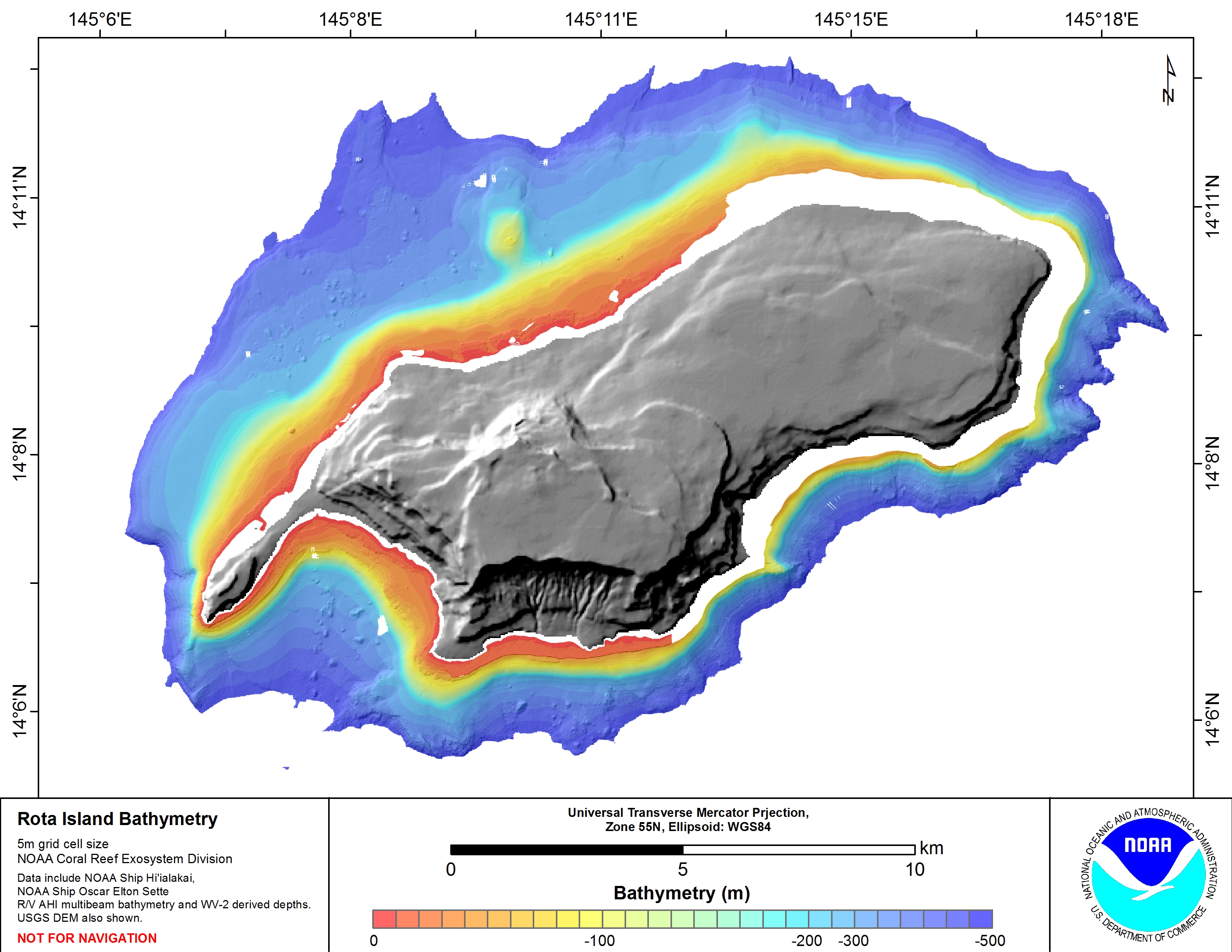
Download this image as a High-res JPG or PDF
Bathymetric data files: WV-2 derived depths, and multibeam from NOAA Ship Hi’ialakai & R/V AHI data files
- View Metadata: Metadata text
- Zipped Data:Arc ASCII