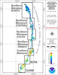
Click on the area names above to go to that data set page. Click in an unlabeled area to see a larger
version of this map.
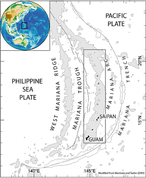
Geological setting of the Mariana Region. Modified from Martinez and Taylor (2003). |
The 290 km long Mariana Archipelago encompasses 14 islands of the U.S. Commonwealth of the Northern Mariana Islands (CNMI) and the U.S. Territory of Guam, as well as numerous offshore banks. The Marianas can be divided into two groups geologically: the older southern island arc that includes Guam, Rota, Tinian, Saipan (& Marpi Bank), Farallon de Mendinilla, and Aguijan and the younger, volcanic northern islands that include Anatahan, Sarigan, Guguan, Alamagan, Pagan, Agrihan, Asuncion, Maug (with Supply Reef) and Farallon de Pajaros.

The flat-topped Forbidden Island, an uplifted fossil coral reef platform on the island of Saipan. Photo by Molly Timmers. |
The Southern Mariana Islands, all similar in structure, are a part of the frontal arc of the Mariana arc-trench system and are dated as late Eocene to early Miocene (15-20 Ma). Though the southern islands are volcanic in origin, they are nearly all covered with uplifted limestone from ancient coral reefs; these episodically uplifted limestone terraces create a flat “layer-cake” topography with numerous caves.
The Northern Mariana Islands are part of the Mariana Arc, where the Pacific plate is being subducted under the Philippine plate. The islands from Anatahan to Farallon de Pajaros are all stratovolcanoes (volcanoes composed of both lava flows and pyroclastic material) that result from the re-melting of subducted material.
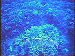
Luxuriant coral growth at Stingray Shoals in the WMR, as recorded by underwater camera sled at a depth of approximately 30 m. |
The West Mariana Ridge (WMR) is a remnant volcanic island arc that forms a series of seamounts, lying 145 to 170 km west of and parallel to the main island chains. The WMR is of intermediate age, being younger than the southern island arc and older than the northern island arc. Some of these seamounts rise to within 13 m of the surface. The absence of terrestrially-derived sediments, recent volcanic ash, and infrequent direct anthropogenic impact at the WMR contribute to the near-optimal conditions for coral growth. Accordingly, some of the shallower structures feature well-developed reef ecosystems, with lush gardens of stony corals.
The southern islands have the oldest and most developed reefs in the Mariana Islands. The reefs are generally most developed on the western (leeward) sides of the islands. The geologically younger northern islands are primarily made up of very recent (4,000 year old) volcanic materials. The extent of reefs around these islands is varied. In general, the younger islands have sparse, low diversity coral reef communities. Around only a few of the northern banks and islands (e.g. Maug, Guguan, Stingray Shoals), diverse coral communities with as many as 60 coral species have been observed.
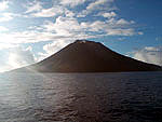
The northernmost island in the Mariana Archipelago, Farallon de Pajaros, has experienced recent volcanic activity, and steam was observed issuing from the crater during cruise OES0307. |
The human history of the Mariana Archipelago began about 2000 B.C. when Asians, who were the ancestors of the Chamorro people, arrived in the islands. Contact with the western world began in 1521 when Magellan arrived in Guam. The Marianas were claimed by the Spanish in 1565 and a century later in 1668 Spanish missionaries arrived and named the islands after Mariana of Austria, the widow of Spain’s Phillip IV. Disease and conflicts with the Spanish decimated the Chamorro population from 150,000 before annexation to 5,000 in 1741. All of the remaining Chamorro people were sent to Guam in 1720. Germany bought the islands from Spain in 1899 (with the exception of Guam, which was awarded to the United States after the Spanish American War) with the intent of establishing copra plantations; during this period Germany also let contracts for collection of exotic bird feathers for the European and Japanese hat trade. After WWI the League of Nations stripped Germany of all its overseas possessions and awarded Japan administrative authority over the Mariana Islands, except for Guam. Japan established sugar plantations and fishing operations with an influx of 40,000 immigrants mostly from Japan, the Philippines, and the Caroline Islands. During WWII Japan took Guam a few days after Pearl Harbor in 1941 and held the remainder of the archipelago with troops or settlers on Guam, Rota, Tinian, Agrihan, Saipan, Anatahan, and Pagan Islands. After intense fighting, the United States recaptured Saipan, Tinian, and Guam in June and July 1944. Japanese survivors who did not believe the war was over were evacuated from Anatahan in 1951 and one last survivor was found on Guam in 1972. The United Nations awarded the Mariana as a trust territory of the United States and the population voted to become the Commonwealth of the Northern Mariana Islands (CNMI) in 1975, while Guam remains a Territory. The United States government leases over 16,000 acres of land on Tinian and 42,000 acres on Guam, primarily for military use. Military activities are a significant source of income in Guam and to a lesser extent in Saipan and Tinian; the US proposes to move 8,000 additional military personnel to Guam after 2012. Tourism and the garment industry in Saipan, both of which have suffered economic set backs recently, have also been primary income sources. For a more extensive discussion of the history of the Mariana Archipelago, visit http://sio.ucsd.edu/marianas/history/index.cfm.
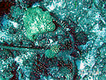
An anchor at Stingray Shoals provides evidence of anthropogenic activities and impacts, even at the most remote coral reefs in the archipelago. |
A variety of resource management issues are present within the Mariana Archipelago. The majority of the Archipelago’s 244,000 residents live on four islands: Rota, Tinian, and Saipan, and Guam, while small communities are found on some of the northern islands, such as Agrihan and Pagan Islands. Anthropogenic effects are major concerns in the southern populated islands, and the local governments are working to resolve these problems. CNMI and Guam have twelve Marine Protected Areas (MPAs), many of which have been established in the last decade. Fishing pressures are strong, especially on the banks near populated areas. Defense activities raise other issues. Large vessels stocked with military supplies from the U.S. Navy’s Military Sealift Command Prepositioning Program routinely anchor at the Garapan Anchorage outside of Saipan Harbor. The anchorage is located on a shallow shelf adjacent to the island of Saipan and bank just offshore of it. Both structures include coral reef resources, which are vulnerable to impacts from anchoring. The Navy also uses the island of Farallon de Mendinilla as a bombing range. The poorly charted banks adjacent to this island are a prime fishing ground when vessels are allowed into the area. In addition to these human pressures, severe storms and active volcanism have impacts on coral reef ecosystems in the archipelago.
Territory of Guam
Guam(Guahan in native Chamorro) is the southern-most island of the Mariana Archipelago and is located at 13° 28’ N, 144° 47’ E. It has a total area of 541.3 sq. km. and the highest point is Mount Lamlam at 406 m. It had an estimated population of 173,456 in 2007. In 1950 under the Guam Organic Act, the island became an organized, unincorporated territory of the United States under the jurisdiction of the Office of Insular Affairs, Dept. of the Interior (DOI).
Guam’s history runs parallel to the other islands of the Mariana Archipelago until the late 1800’s. A native Chamorro population was established as early as 2000 B.C., Ferdinand Magellan established contact with the West in 1521, and the Spanish ruled between 1565 and 1898. Guam was ceded to the United States in 1898 after the Spanish American War, purchased for $20 M in 1899, and placed under the control of the U.S. Navy. Guam was used as a refueling and communication station and was on the Pan American Airways China Clipper route between 1935 and WWII.
On Dec. 8, 1941, four hours after the attack on Pearl Harbor started in Hawaii, the Japanese began aerial bombardment of Guam. On Dec. 10, 1941 a force of over 5,500 Japanese troops landed at five sites around Guam; the U.S. defensive force consisted of only 274 Navy, 153 Marines, and 120 Insular Troops with vintage WWI weapons. After a brief battle, realizing the hopelessness of the situation, Gov. George McMillan surrendered. The population of Guam suffered under the Japanese occupation and approximately 600 Chamorros were executed. American forces landed in Guam on July 21, 1944, and 7,000 U.S. and 11,000 Japanese lost their lives in the ensuing three week battle, which the U.S. won. During the battles the city of Hagatna was mostly destroyed. Searches for Japanese holdouts continued for many years after the battle, and it was not until 1972 that the last Japanese soldier was discovered in a cave on Guam. The island was used as the command post for the U.S. Western Pacific until 1945 and U.S. Navy control was re-established in 1946.
In 1949 President Truman signed the Guam Organic Act and the Territory of Guam was created. It was not until 1962 that the requirement for a security clearance for travel to Guam was lifted. Since that time, there has been significant migration to Guam from surrounding countries. Chamorros are now about 37% of the population, 26% Filipino, 11% other Pacific islands and the remaining 26% a mixture of Caucasian, Korean, and Japanese.
Sometime before 1952 the invasive South Pacific Brown Tree snake was accidentally introduced to Guam. These snakes can reach lengths of 11 feet and densities of 12,000 per square mile. The widespread negative impacts have included extirpation of native forest vertebrates, thousands of power outages, less of domestic birds and pets, and severe impacts on humans – especially children.
Guam is located about 80 n.mi. west of the Mariana trench, is part of the Mariana frontal arc, and has been repeatedly elevated and submerged. It is the southernmost of the volcanic islands and banks that make up a series of volcanic arcs that extend to Japan. The oldest formations on Guam have been dated as mid- to late Eocene (48-33 Ma). The geology of the island of Guam is unique in that the southern part of the island is dominated by volcanic features while the northern part is uplifted coral limestone very similar to the geology of Rota, Tinian, Aguijan, and Saipan. The northern limestone plateau is surrounded by cliffs and was formerly densely forested but is now deforested with no running water. The southern half is very mountainous and mostly basalt that has erupted through the uplifted coral limestone. Remnants of 7 Ma limestone formations are found at considerable elevations. There are numerous bays, canyons, and valleys on the flanks of this volcanic region and much of this area is covered by grasslands.
|
3D Visualization of Guam Bathymetry (3x vertical exaggeration) |
Multibeam data were collected in 2003 and 2007; mapping was completed between 300 and 1000 m around the island with coverage down to 2500 m in some places. Shallow (20-300 m) mapping was completed only in areas that had been defined as critical by management agencies (e.g., marine protected areas, reserves, Tumon Bay, and the SW coast) due to time limitations and equipment problems. The bathymetric data show canyon structures on the SW coast, mass wasting and complex structure on the N shore, and somewhat featureless slopes on the NW and E side of the island. Limited mapping was also completed around Santa Rosa Reef, which lies south of Guam.
References:
- The Brown Treesnake on Guam.
- Hawkins, J.W., 2003. Geology of supra-subduction zones. In Ophiolite Concept and the Evolution of Geological Thought. Dilek, Y. and Newcomb S. editors. 504 pp.
- Liberation: Guam Remembers.
- War in Guam: Archeology and Geology.
- The World Factbook..
Top of the page

Rota Island
Rota island is the southernmost island of the Commonwealth of the Northern Mariana Islands (CNMI) and lies about 60 km northeast of Guam and 90 km southwest of Tinian at latitude 14° 10’ N, longitude 145° 14’ E. The island is small (85.5 sq. km.), 17 km long and 8 km wide with a maximum altitude of 496 m on Mt. Manira. Sinapalo and Song Song are the two primary communities on the island.
Rota was primarily used for agricultural purposes during the Japanese period from WWI to the end of WWII and was not extensively developed. Rota saw no active fighting during WWII; it therefore retains much of its native vegetation, whereas on Guam, Tinian and Saipan, the vegetation was largely destroyed during and after WWII. The population on Rota increased 43% from 2,295 in 1990 to 3,283 in 2000 (U.S. Census Bureau) and has the largest percentage of Chamorro population of any of the islands. While still largely undeveloped, tourism is becoming increasingly important to the Rota economy.
|
Multibeam bathymetry in Sasanhaya Marine Preserve |
Multibeam data were collected at Sasanhaya Marine Preserve in 2003 by the R/V AHI. In 2007 both the AHIand the Hi’ialakai conducted mapping operations around Tinian. In addition, personnel from NOAA’s Office of Coast Survey used the launch to update nautical charting data in Rota Harbor. Continuous bathymetric coverage was achieved from approximately 350 to 1000 m with partial coverage down to 1900 m. Because of time limitations, only about 40% of the shallow waters surrounding Rota have been mapped.The seafloor west of Rota steps down to the west across a series of NE-trending scarps, whereas north of Rota smaller scarps trend both E-W and NW-SE. There is also clear evidence of coral and sand habitats in Sasanhaya Marine Preserve.
Top of the page

Aguijan Island
Aguijan Island (also spelled Aguigan) lies in the southern portion of CNMI, and is located 8 km southwest of Tinian Island at latitude 14° 52’ N, longitude 145° 34’ E. Tinian and Aguijan form the Tinian Municipality. This small island measures only 4 km by 1 km with an area of about 7.3 sq. km.. Its maximum elevation is 57 m and steep cliffs surround the island; thus it is uninhabited and seldom visited. It is also called Goat Island due to a population of introduced feral goats that was later removed in order to minimize defoliation. Aguijan was under German control before it was handed over to the Japanese after WWI. During WWII the Japanese maintained a garrison at Aguijan and this garrison surrendered to the U.S. Coast Guard on Sept. 4, 1944. In 1998 it was estimated that Aguijan Isand had a population of 10-15 Micronesian megapodes, a pigeon-sized bird of the forest floor. A neighboring islet, Naftan Rock, was used as a bombing target and unexploded ordnance remains in the surrounding waters.
Deep (> -300 m) multibeam data were collected around Aguigan in 2007 by the Hi’ialakai. These data show parallel structures aligned in a southwest-northeast directions to the southwest of the island. No shallow data were collected around Aguijan due to time limitations.
Top of the page

Tinian Island
Tinian Island lies in the southern portion of CNMI at latitude 15° N, longitude 145° 38’E, 4.4 km south of Saipan and 160 km north of Guam. Tinian and the nearby Aguijan Island form the Tinian Municipality. Tatsumi Reef, a popular fishing area, lies three km southeast of Tinian. The major population center is San Jose. Tinian has a land area of 102 sq. km. and measures 19.9 by 9.5 km with a maximum elevation of 166 m. In 2000 the U.S. census recorded a population of 3,540, a 363% increase from the 1980 population of 765.
|
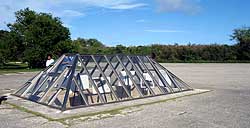
A pit on Tinian where one of the atomic bombs of WWII was loaded for launch to Hiroshima and Nagasaki. |
Under Japanese control between WWI and WWII, Tinian was a major sugarcane growing and processing center until WWII. The island was captured by U.S. forces in mid-1944; and subsequently what were then the world’s longest runways were built. These runways were used to launch U.S. planes for attacks on Japan, including the atomic bombs dropped on Hiroshima and Nagasaki. Two-thirds of Tinian – over 16,000 acres, is currently leased to the U.S. military and the Navy conducts training operations regularly. In 1997 a casino was constructed on Tinian, and a major source of revenue on the island comes from tourists who come from Saipan on day trips via boat or air.
|
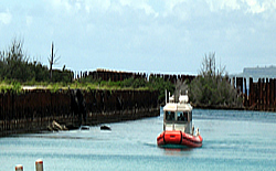
R/V AHI inside Tinian Harbor during MARAMP cruise 2007. |
Multibeam data were collected around Tinian in both 2003 and 2007 and optical validation data were collected in 2001 and 2003. Almost complete multibeam coverage was achieved between 20 and 500 m with significant amounts of data down to 1500 m. The data reveal erosional channels and mass wasting to the east and west of the island, some areas with possible deep (> 50 m) coral beds, and two ridges between Saipan and Tinian.
Top of the page

Saipan
Saipan lies in the southern portion of CNMI at latitude 15° 12’ N, longitude 145° 45’E, 4.4 km north of Tinian Island. The island is approximately 20 km long and 9 km wide with an area of 122 sq. km. Of the eight communities on Saipan, Garapan and Chalan Kanoa are the principal population centers. In 2000 the U.S. Census recorded a population of 62,392 (90% of the total CNMI population of 69,221), which is a 420% increase from the 1980 population of 14,549.
Saipan has been continuously populated since the Chamorro arrived about four centuries ago and was under Spanish and then German rule until 1914. It became a protectorate of Japan and was a major sugarcane growing and processing center until WWII. In summer 1944, the U.S. military landed in Saipan with a huge invasion force and simultaneously attacked a nearby Japanese fleet. Fierce land battles were fought in Saipan with heavy losses on both sides. After WWII the United Nations gave the U.S. exclusive rights to administer CNMI and maintain military bases there. From 1949 to 1962 the Central Intelligence Agency (CIA) closed off the northern half of Saipan. Two of Saipan’s major sources of income – Japanese tourism and the garment industry – have been severely reduced in the last several years and CNMI’s economy faces severe pressures. There is a large offshore anchorage where commercial and military ships are anchored, providing another source of income; the U.S. military has proposed to increase the number of ships in the anchorage.
|
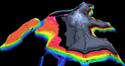
3D Visualization of Saipan Bathymetry |
Multibeam data were collected around Saipan in both 2003 and 2007, and limited optical data were collected in 2001 and 2003. In addition, the US Navy contracted NOAA to collect extensive video data in the anchorage area in 2004. Almost continuous multibeam coverage is available from depths of 20 m to over 500 m with some data as deep as 2000 m. Features related to mass wasting and erosion, such as debris blocks and canyons and channels, characterize the seafloor around Saipan. Prominent submarine canyons east of Saipan extend from the ~100m submarine shelf-edge to ~3000 m over distances of greater than 20 km. A number of shallow terraces related to previous stands of the sea were mapped in the frontal arc. On the western side of Saipan at the Garapan Anchorage, there are two large, offshore banks with an area of over 50sq. km.range, which vary in depth from 20-100 m and are some of the most coral rich areas in CNMI.
Top of the page

Marpi
Marpi Bank is a steep-sided, flat-topped submerged bank approximately 28 km north of Saipan, located at latitude 15° 26’ N, longitude 145° 52’ E. It is approximately 9 km long by 4 km wide and is oriented in a northeast to southwest alignment similar to Tatsumi Reef, which lies south of Tinian. The shallowest point shown on NOAA’s Nautical Chart 81067 is 26 fathoms (53 m). Marpi Bank is also a popular fishing location. In 2003 and 2007 Marpi Bank was surveyed using multibeam sonars on the R/V AHIand the NOAA Ship Hi’ialakai.
Top of the page

Anatahan
|
Anatahan Island – MARAMP cruise 2007. |
Anatahan is a small volcanic island 120 km north of Saipan. It is 9 km long and 3 km wide with an area of 32.4 sq. km. It is located at latitude 16.35°N, longitude 145.67° E and its maximum elevation is 788 m. Small sporadic human settlements have occurred on many of the northern islands. In the early German period (1902), administrator Georg Fritz found evidence of huts from Carolinian workers who had harvested copra, but no archaeological evidence of Chamorro habitation. During the Japanese period (1914-1944) Anatahan had a small population of Carolinian islanders and Japanese working on a copra plantation. In 1944, 32 survivors from a Japanese shipwreck arrived on Anatahan, where one female and one male Japanese settler still remained. These Japanese did not believe that WWII had ended until 1951 when the few remaining survivors were removed from the island.
According to the US Fish and Wildlife Service Report FR Doc 05-240, Anatahan has had a feral goat and pig population for at least the past 40 years. Resulting damage to the native forest and erosion were observed to have escalated in the 1990s, possibly exacerbated by an El Nino-related drought in the late 1990s. This damage is of particular importance because of its impact on the threatened Mariana fruit bat population. Photographic evidence spanning from 1983 to 2000 documented widespread loss of forest, but remnants of a mixed broadleaf forest (Aglaia-Elaeocarpus) do still exist on Anatahan. An ungulate eradication program was started in 2002, but this was interrupted by the 2003 volcanic eruptions. In 1990 all 266 Northern Mariana residents from Anatahan, Alamagan, and Agrihan were evacuated to Saipan when the Anatahan eruption threatened.
|
Ash covered coral – Photograph by Stephanie Holzwarth, CRED |
The first historical eruption of Anatahan Volcano began violently and suddenly on the evening of May 10, 2003 and continued until June 2003; low level seismic activity and tremors have continued, but decreased since that time. Access to the island has been severely limited due to this eruptive activity.
Underwater surveys in September 2003 showed that coral communities had been largely covered with volcanic ash. Low visibility conditions and/or time limitations in subsequent years have hindered or precluded further observations.
 |
Only a limited amount of multibeam data was collected in 2007 during the recovery of a single moored oceanographic instrument. However, several previous academic and government cruises have collected multibeam data around Anatahan. Data collected by NOAA CRED is shown in color, while the previously collected multibeam data sets are shown as grayscale. Ikonos imagery (Space Imaging Inc.) shows the land area of Anatahan.
Top of the page

Sarigan
Sarigan is a volcanic island located at latitude 16º 42’N, longitude 145º 46’E, approximately 175 km north of Saipan, 20 km south of Zealandia Bank, and 42 km north of Anatahan Island. It is approximately 2.5 x 2.5km with an area of 4.9 sq. km. and a maximum elevation of 549m.
Archaeological studies by Georg Fritz, the first administrator of the German colonial district of the Mariana Islands, found pottery and latte stones, a symbol of Chamorro culture and identity, on Sarigan Island. Under the German and Japanese administrations, Sarigan was cultivated as a copra plantation and residents lived there from 1900 to 1945 when they were evacuated. Between 1909 and 1912 the German authorities leased eight islands including Sarigan to exploit the bird populations for the Japanese and European hat plumage trade. Tropic birds, brown boobies, frigate birds and white terns were the primary species of interest. At one point there were 14 Carolinian and Japanese bird catchers on Sarigan, but because of low bird counts all but two were removed. Some native forest remains on Sarigan, but it was being decimated by feral pigs, goats and cats. Therefore between 1995 and 1997 the Dept. of Fish and Wildlife launched a massive campaign to eradicate feral animals, and Sarigan is still monitored on a monthly basis. Remnants of a mixed broadleaf forest (Aglaia-Elaeocarpus) still exist on Sarigan. This island has been chosen as a potential site for relocating native bird species, which are in danger because of the brown tree snake on Guam and other southern islands. The micronesian megapode, a pigeon sized bird found on the forest floor, still exists on Sarigan with 500-800 birds on Sarigan and between 1500 and 2000 birds in the entire Archipelago.
|
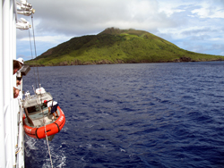
R/V AHI being recovered with Sarigan in the background. Stands of coconut trees are seen near the shore, and the crater is visible at the top of the island. |
On Sarigan, a low truncated cone with a 750-m-wide summit crater contains a small ashcone. The youngest eruptions produced two lava domes from vents above and near the south crater rim. Lava flo from each dome reached the coast and extended out to sea, forming irregular shorelines. The northern flow overtopped the crater rim on the north and northwest sides. The sparse vegetation on the flows indicates they are of Holocene age. There are no known historic eruptions on Sarigan, but a seismic swarm with more than 63 earthquakes was recorded in August 2005.
|
A bathymetric rise to the east of Sarigan, only partially mapped, rises from 1900 to 500 m below sea level. |
In 2007, multibeam data were collected around Sarigan in -10 and -1900 m depths. A small shelf extends 2 km east of the island with two platforms – one at 40-50 m and a deeper one at 130-140 m. Evidence of mass wasting and erosion surround the island with a small secondary feature, possibly another cone, on the southern flank of the volcano. About 33 km to the east of Sarigan an intriguing feature, only partially mapped, rises from -1900 to -500 m.
Top of the page
Guguan
Guguan is a dormant volcanic island located at latitude 17° 19’ N, longitude 145° 50’ E, approximately 185 km north of Saipan. It is 3 km long and 2 km wide with an area of approximately 4 sq. km. and a maximum elevation of 287 m.
German administrator Georg Fritz found no archaeological record of Chamorro occupation on the northern part of Guguan Island. Between 1909 and 1912 the German authorities leased eight islands including Guguan to exploit the bird populations for the Japanese and European hat plumage trade. Three Japanese bird catchers on Guguan were listed as having caught 1370 tropicbirds, 160 boobies, and 200 frigate birds in a five month period. Guguan is a Northern Mariana Conservation Area and was declared a wildlife preserve in 1980 by the Marina Constitution.
|
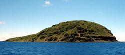
Guguan Island – MARAMP cruise 2007. |
Guguan has an eroded volcano on the south, a caldera with a post-caldera cone and a northern volcano, which has a breached summit crater that fed lava flows to the west. The only known eruption took place between 1882 and 1884 and produced the northern volcano and lava flows that reached the coast.
Multibeam sonar data were collected around Guguan in 2007 in water depths between 20 and 800 m on all sides and to almost 2000 meters on the eastern side. The multibeam bathymetry data show two shelves extending 2 km offshore around the southern portion of the island – one in depths of 25 to 50 m and the second in 80 to 120 m depths. The steep underwater flanks of the volcano show much less evidence of mass wasting and erosion than do other volcanoes in the chain. Fifteen km to the southeast sparse multibeam data hint at a structure that may be similar to the one seen to the east of Sarigan.
Top of the page

Alamagan
Alamagan is an active volcanic island located at latitude 17° 36’ N, longitude 145° 50’ E, approximately 185 km north of Saipan. It is 4.8 km long and 4 km wide with an area of approximately 11.2 sq. km. and a maximum elevation of 744 m.
On Alamagan in 1901 Georg Fritz, the first German administrator, found several latte sets, a symbol of the Chomorro culture, made of basalt columns, a stone paved area and a stone-lined well or pit filled with pottery. Just before Fritz’ arrival, workers found sixteen crescent shaped stones with holes at each end. Alamagan was leased by the German government to the Pagan Gesellschaft for copra production, but was hit by typhoons in 1904, 1905, 1906, and 1907, resulting in 50% reduction of copra production. Alamagan has been sporadically populated since that time.
|
House on Alamagan Island – MARAMP cruise 2007. |
In 1990 all 266 Northern Mariana residents from Anatahan, Alamagan, and Agrihan were evacuated to Saipan when the Anatahan eruption threatened. The 2000 census recorded a population of 6 inhabitants on Alamagan. Cows, pigs, and goats are also common on the island. Alamagan is the only one of the northern islands that is home to an endemic endangered bird species, the Nightengale Reed Warbler; it also had an estimated population of 30 endangered Mariana megapode in 1995. Alamagan has recently been selected by the Western Pacific Fisheries Management Council as a site for a remote fishing station.
Alamagan has a 350-m deep summit crater east of the center of the island. Pyroclastic flow deposits have been dated at 870 AD +/- 100 years, but reports of historic eruptions in 1864 and 1887 are unverified.
Multibeam sonar data were collected around Alamagan in 2007 in water depths between 20 and 1000 m on all sides and to greater than 2000 meters on the eastern side. The multibeam data show a narrow 3 km long shelf running out from the southeastern shore of the island with depths ranging from 25 to 100 m. Extensive evidence of mass wasting can be found on all sides of the island.
Top of the page

Pagan
|
Pagan Volcano – MARAMP cruise 2007. |
Pagan is an active volcanic island located at latitude 18° 07’ N, longitude 145° 48’ E, approximately 310 km north of Saipan. It is 17 km long and 7 km at the widest with an area of approximately 47.2 sq. km. and a maximum elevation of 570 m. It is the 4th largest of the islands of CNMI.
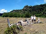
Crew from NOAA ship Hi’ialakai near wreck of Japanese airplane |
On Pagan in 1901 Georg Fritz, the first German administrator, found several basalt latte sets — a symbol of the Chamorro culture – as well as sling stones and cultivated plants that are all signs of previous occupation. Pagan was leased by the German government to the Pagan Gesellschaft for copra production, but was hit by typhoons in 1904, 1905, 1906, and 1907, resulting in 50% reduction of copra production. Pagan has been sporadically populated since that time and was a Japanese military outpost in WWII; signs of the Japanese occupation and WWII are still abundant. The commander of Pagan Island surrendered almost at the same time as the overall Japanese surrender in early September, 1945.
In 1981, 53 residents were evacuated after a major volcanic eruption on Pagan. Residents have been petitioning to return, but there has been reluctance on the part of the government due to continued volcanic threat. During the MARAMP 2007 scientific cruise, there were five seasonal residents on the island. Goats are also common on the island, but because much of the arable land was covered by the 1981 eruption most of the livestock was depleted by starvation at that time. Pagan was also home to an estimated 2500 fruit bats in 1989. It is believed that the Pagan megapode may have become extinct on Pagan after the 1981 eruption. There is a shallow brackish lake on the northern part of the island and remnants of a mixed broadleaf forest (Aglaia-Elaeocarpus) still exist.
Pagan is one of the largest and most active of the Mariana volcanoes and is formed by two volcanoes connected by a narrow isthmus. The northern volcano, Mount Pagan, has a summit height of 570 m and a 7 km diameter crater. Almost all the historic eruptions, dating back to the 1600’s, have originated from Mount Pagan. After the 1981 eruption, volcanic activity continued steadily through 1994. In December 2006 through January 2007 ashfall and ash plumes were observed from Mount Pagan. South Pagan has a summit height of 548 m and a 4 km wide caldera.
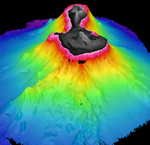
3D Visualization of Pagan Island. |
Multibeam sonar data were collected around Pagan in 2007 in water depths between 20 and 1900 m on all sides and to greater than 2500 meters on the eastern side. The multibeam data show a 2.8 x 3 km long shelf running out from the southern shore of the island. Three distinct levels are seen — at 20-30 m depths, 45-50 m depths, and at 90-130 m depths. There is a narrow anchorage area on the western side of the isthmus in 15-50 m water depths. A small peninsula on eastern side of the island is a dike complex surrounded by a small shelf in 18-300 m water depths. In all other areas there are steep slopes down to 700 m or deeper with evidence of mass wasting and erosion, especially on the north and south flanks.
Top of the page

Agrihan
Agrihan (also spelled Agrigan or Grigan) is a dormant volcanic island located at latitude 18° 46’ N, longitude 145° 40’ E, approximately 390 km north of Saipan. It is 10 km long and 7 km wide with an area of approximately 47 sq. km. and a maximum elevation of 965 m. It is the highest point in CNMI and the largest single volcano.
Agrihan was the site of the last stand of the Chamorro against the Spanish after which all Chamorro were removed to Guam. According to the Encyclopedia Britannica, colonists from the United States and Hawaii established plantations in 1810, but were expelled by the Spanish. During the German period of colonization, Agrihan was one of the islands that was leased for the purpose of collecting bird feathers for the European and Japanese hat trade between 1909 and 1912. Agrihan has fertile highlands with palm trees on the lower slopes and phosphate deposits. Remnants of a mixed broadleaf forest (Aglaia-Elaeocarpus) exist on Agrihan. It has been sporadically populated. Residents were evacuated in 1917, the only historic volcanic eruption. In 1990 all 266 Northern Mariana residents from Anatahan, Alamagan, and Agrihan were evacuated to Saipan when the Anatahan eruption occurred.
Agrihan has a small caldera 1 x 2 km that is breached to the NW, where a lava flow extends to the coast and forms a delta. The only historic eruption was in 1917 when large blocks and 3 m of ash were deposited on a village on the SE coast.
Multibeam sonar data were collected around Agrihan in 2007 in water depths down to 1700 m on all sides. The multibeam data show a 1-km wide shallow shelf on the southwest corner of the island in water depths down to 50 m. Steep drop offs are seen on and there is extensive evidence of mass wasting and erosion on all flanks of the island.
Top of the page

Asuncion
|
The picture shows the steep Asuncion sea cliffs. Landslide scars are visible in the left side of the photo. |
Asuncion is a dormant volcanic island located at latitude 19° 41’ N, longitude 145° 14’ E, approximately 490 km north of Saipan. It is 3.7 km long and 3.3 km wide with an area of approximately 7.3 sq. km. and a maximum elevation of 857 m with extremely steep slopes.
Although currently uninhabited, extensive coconut groves might indicate that some copra production was once done there. In addition, Asuncion was leased by the German authorities from 1909 to 1912 for the purpose of harvesting bird feathers for the European and Japanese plumage trade. Six bird catchers were supposed to be on Asuncion, but human corpses were seen on the beach in 1910 when visited by the German station chief. Asuncion has the most extensive native forest found on the northern islands, with a scrubby, mixed-broadleaf forest dominated by Terminalia spp. These deciduous, indigenous trees have edible kernels that may have been favored by early human inhabitants. The seed of the tree is dispersed by fruit bats which feed on the husk. There are an estimated 400 of the threatened fruit bats and less than 25 Micronesian megapodes, a pigeon-sized bird of the forest floor on Asuncion, which is a Northern Marianas Islands Conservation Area and was declared a wildlife refuge in the early 1980’s by the Mariana Constitution.
Asuncion is the steepest of the northern volcanoes and is marked by landslide scars and sea cliffs. During oceanographic surveys at Asuncion, small landslides are frequently observed. The southern flanks and western flanks of the volcano are mantled by ash deposits that may have originated during eruptions in historical time. An explosive eruption in 1906 also produced lava flows that descended about half way down the western and SE flanks, but several other historical eruption reports are of uncertain validity.
Multibeam sonar data were collected around Agrihan in 2007 in water depths down to 1100 m on all sides. The multibeam data show a 2.5-km wide shallow shelf on the southwest corner of the island with two terraces at 15-30 m and at 95-140 m. There are steep drop offs on all sides of the island and canyons and evidence of mass wasting and erosion only on the southern part of the island.
Top of the page

Maug
|
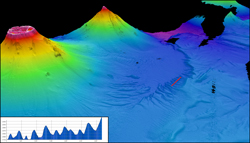
Maug Caldera multibeam depth data. |
Maug (Guam spelled backwards) is a unique structure in the Mariana islands, consisting of three separate small islands (Higashi-shima – East Island, Kita-shima – North Island, and Nishi-shima – West Island) and a submerged caldera. It is located at 20° 2’ N, longitude 145° 13’ E, approximately 530 km north of Saipan. The outer shores of the three islands’ diameter is 3.3 km land while the submerged caldera has a diameter of approximately 2.2 km. The three islands have a total area of approximately 2.1 sq. km. and a maximum elevation of 227 m.

The steep sides of Maug crater – MARAMP cruise 2007. |
The three steep islands are vegetated mostly by low scrub, grass and a few palm trees. Maug was leased by the German authorities from 1909 to 1912 for the purpose of harvesting bird feathers for the European and Japanese plumage trade. Maug is a Northern Mariana Conservation Area and was declared a wildlife sanctuary in the early 1980’s by the Mariana Constitution; it is free of feral animals. The Mariana megapode, a pigeon-sized bird of the forest floor, is found on all three islets with an estimated population of 150 as of 1998. Fruit bats were once found on Maug, but are not currently thought to be present. Underwater, the corals of Maug are some of the richest of the Northern Mariana Islands.
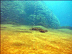 |
Bubbles from seafloor in Maug crater with rich corals in background – MARAMP 2007. |
No eruptions are known from Maug since its discovery in 1522. However, hydrothermal activity has been detected by NOAA cruises in the past several years.
|
Channels on the northeastern flank of Maug. Supply Reef is in the background. |
Multibeam sonar data were collected in and around Maug in 2007 in water depths down to 2000 m on all sides and to 3000 m in some places. The multibeam data show a peak with depths as shallow as 22 m in the center of the caldera and over 225 m deep on the caldera floor. The deeper multibeam data surrounding the island are some of the most interesting data collected during MARAMP 2007. The perspective view shown here highlights the region between and to the east of Maug and Supply Reef where channels on the volcanoes flanks terminate in a narrow basin. The eastern boundary of the basin is a sinuous ridge also incised by channels and canyons originating at the ridge crest. The SW-NE profile above gives a sense of the size of these features.
Top of the page

Supply Reef
Supply is an active submarine volcano located at latitude 20° 09’ N, longitude 145° 6’ E, approximately 547 km north of Saipan. It lies about 10 km northwest of Maug Island and is joined to Maug by a saddle at a depth of approximately 1600 m. Its shallowest point is 7.9 m as determined by multibeam mapping done in 2007. Hard and soft corals have been observed on Supply Reef by divers and underwater cameras.
Seismic activity has been recorded and/or discolored water observed in the vicinity of Supply Reef in March 1969, September 1985, and September 1989.
Multibeam sonar data were collected around Supply Reef in 2007 in water depths down to greater than 2000 m on all sides except the east side where previously collected multibeam data exist. The multibeam data show a 320-m diameter caldera-like summit ranging in depth from 7.9 to approximately 30 m with steep drop-offs on all sides. Mass wasting and erosion are apparent only on the northern underwater flank of Supply Reef.
Top of the page

Farallon de Pajaros
Farallon de Pajaros (from Urraca – Spanish for magpie) means Isle of the Birds. It is the most active volcanic island in the Mariana Archipelago and is located at latitude 20° 31’ N, longitude 144° 54’ E, approximately 595 km north of Saipan. It is 2 km long and 1.7 km wide with an area of approximately 2.5 sq. km. and a maximum elevation of 360 m. Because of its frequent volcanic activity dating back to the mid-19th century, it has also been called the “Lighthouse of the Western Pacific.”
|
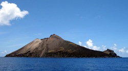
Farallon de Pajaros volcano – MARAMP cruise 2007. |
The slopes of Farallon de Pajaros are mostly precipitous, bare lava flows and the summit crater is only partly vegetated. Farallon de Pajaros was declared a wildlife sanctuary in the early 1980’s by the Mariana Constitution. Seabirds that are able to nest on bare lava flows are found on Farallon de Pajaros, including masked boobies and a large colony of sooty terns. No fruit bats or Mariana megapode, a forest floor bird, are thought to be present on the island.
Farallon de Pajaros has erupted at least 16 times since 1864, but monitoring has been difficult because of the remoteness of the island. Most of the eruptions are explosive and about half have produced lava flows. The symmetrical summit is the central cone within a small caldera cutting an older edifice, remnants of which are seen on the SE and southern sides near the coast. Flank fissures have fed lava flows during historical time that form platforms along the coast. Both summit and flank vents have been active at Farallon de Pajaros in historical times.
Multibeam sonar data were collected around Farallon de Pajaros in 2007 in water depths down to at least 1000 m on all sides. The multibeam data show a tiny 300-m wide shelf with depths of 20-30 m on the SE side of the island and a much larger one (1.4 x 1.4 km) with depths between 65 to 250 m on the northeastern side of the island. Steep slopes are seen on all sides of the island with little evidence of mass wasting or erosion.
Top of the page

References
- Census, 2001. 2000 Population Counts for the Commonwealth of the Northern Mariana Islands. US Dept. of Commerce.
- Cross, W., and Feise, G.W., Jr. 2005. Anatahan: Lost Survivors of the “Island of the Living Dead”. Military Monograph 71, Merriam Press, Bennington, Vermont, 15 pp.
- Endangered and Threatened Wildlife and Plants; Mariana Fruit Bat (Pteropus mariannus mariannus): Reclassification From Endangered to Threatened in the Territory of Guam and Listing as Threatened in the Commonwealth of the Northern Mariana Islands, Federal Register, 2005, vol. 70, no. 4.
- Fancy, S.G, Craig, R.J., and Kessler, C.W. 1999. Forest Bird and Fruit Bat Populations on Sarigan, Mariana Islands. Micronesica 31(2), pp. 247-254.
- Hawkins, J.W., Geology of supra-subduction zones – Implication for the origin of ophiolites, in Ophioloite Concept and the Evolution of Geologic Thought, Dilek, Y., and Newcomb, S. (eds), Geologic Society of America Special Paper 373.
- National Park Service, DOI, 2001. Special Study North Field Historic District, Tinian, Commonwealth of the Northern Mariana Islands.
- Smithsonian Global Volcanism Program, Volcanoes of Japan, Taiwan, and the Mariana(s) (sic)
- Spennemann, Dirk HR. 2006, COMBINING CURIOSITY WITH POLITICAL SKILL: The Antiquarian Interests and Cultural Politics of Georg Fritz. Micronesian Journal of the Humanities and Social Sciences, Vol. 5, no. ½. November, pp. 495-504.
- Starmer, J., Bearden, C., Brinard, R., de Cruz, T., Hoeke, R. Houk, P. Holzworthe, S., Kolinski, S., Miller, J., Schroder, R., Timmers, M., Trianni, M. Vroom, P., 2005. The State of Coral Reef Ecosystems of the Commonwealth of the Northern Mariana Islands in The State of Coral Reef Ecosystems of the United States and Pacific Freely Associated States: 2005. NOAA Technical Memorandum NOS NCCOS 11.
- U.S. Fish and Wildlife Service Pacific Region, Regional Seabird Conservation Plan, Pacific Region. 73 pp.
- Wiles, G.J., Lemke, T.O., and Payne, N.H. 1989. Population Estimates of Fruit Bats (Pteropus mariannus) the the Mariana Islands. Conservation Biology, vol. 3, no. 1, pp 66-76.
- http://volcano.oregonstate.edu/vwdocs/volc_images/southeast_asia/mariana/falleron.html
- http://www.guam.net/pub/sshs/depart/science/mancuso/marianas/intromar.htm
- http://www.oceandots.com/pacific/mariana
- http://www.crm.gov.mp
- http://www.worldwildlife.org/
- https://www.fws.gov/pacific/migratorybirds/
- http://www.uog.edu
- http://www.britannica.com/eb/article-9050895/Mariana-Islands


