[ Bathymetry | Backscatter | Optical Validation | Geomorphology ]
Download 5 meter grid:
Slope, Rugosity, BPI Structures, BPI Zones
Zipped data files contain 1) Arc ASCII or GeoTIFF file, 2) layer (.lyr) file for symbology, 3) high-res JPG/PDF of image, and 4) explanatory metadata text file (identical to linked file listed below).
Slope – 5 meter grid
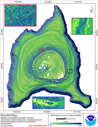
Slope: Cell values reflect the maximum rate of change (in degrees) in elevation between neighboring cells. Slope was derived with the ArcGIS Spatial Analyst extension.
Download this image as a high-res JPG or PDF
Slope data files
- Arc ASCII: Metadata text • Zipped data
Rugosity – 5 meter grid
Rugosity:Cell values reflect the surface area / planimetric area ratio for the area contained within that cell’s boundaries. They provide indices of topographic roughness and convolutedness. (Jenness 2003)
Download this image as a high-res JPG or PDF
Rugosity data files
- Arc ASCII: Metadata text • Zipped data
BPI Structures – 5 meter grid
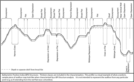
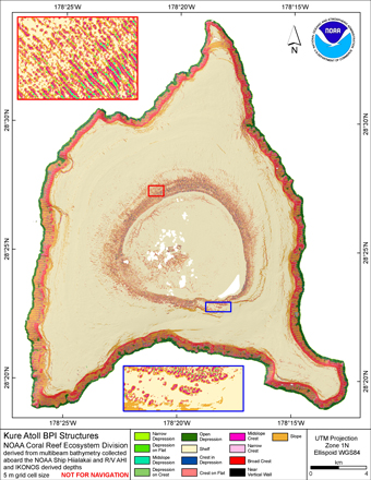
BPI Structures: Derived from two scales (20 & 250) of BPI; slope; and depth. Three ranges of slope defined flats, slopes and near vertical: x < 5; 5 < x < 70.
 |
| A visual description of BPI Structure classes (Click image for larger view.) |
Download this image as a high-res JPG or PDF
BPI Structures data files
- Arc ASCII: Metadata text • Zipped data
BPI Zones – 5 meter grid
BPI Zones: Derived from a broad scale (250) BPI grid and slope. Two ranges of slope defined flats and slopes: x < 5 and 5 < x < 70.
Download this image as a high-res JPG or PDF
BPI Zones data files
- Arc ASCII: Metadata text • Zipped data


