Climate Science and Impacts
Research conducted under this theme is focused on understanding oceanic and atmospheric processes associated with global and regional climate change on various temporal scales, including the impacts of climate variability. Activities under this theme include research to determine effective regional adaptation strategies, and developing and studying new climate information products and tools appropriate for evolving user needs, with a focus on the Indo- Pacific region. Research conducted under this theme is also designed to ensure that tide gauge data sets from the global network are maintained and that the data meet international quality standards for climate change and oceanographic research (e.g., https://uhslc.soest.hawaii.edu ). Through training and ongoing technical support, the goal is to build capacity within each participating country or region to maintain local contributions to the global network. This activity includes assistance with maintenance and operation of 60+ sea level stations, primarily in developing countries. Research is also undertaken towards developing informative products and improving forecasts of sea-level changes. This theme also includes the provision of technical and scientific support for the Argo float program ( https://argo.ucsd.edu ).
Vulnerability of Military Installations to Coastal Flooding
The purpose of the project is to advance techniques that can be used to assess the vulnerability of various environments to the impacts of coastal flooding. The results will lead to an improved understanding of which components of DoD facilities and infrastructure are potentially vulnerable to coastal flooding and how they could be affected, as well as how species and ecosystems associated with DoD lands and waters will respond in a changing climate. This will provide region-specific tools and models to inform decision and policy making, and the results will have broad interest within the region and the nation.Read more in the Annual Reports.

Wave-driven flooding next to Naval Base Coronado, Calif.; Merrifield et al. (2021): Natural Hazards 108:2591–2612.
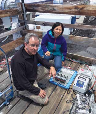
Atmospheric Gases in the Troposphere Measured in Hawai‘i
The project collects and analyzes high altitude (11,144 feet) measurements of elemental mercury (Hg0), reactive gaseous mercury (RGM), and particulate mercury (HgP) at the Mauna Loa Observatory. The objectives of this task will be to accumulate a long-term record of ambient Hg0, RGM, and HgP chemistry to (i) support atmospheric mercury chemistry research, (ii) establish a baseline mercury measurement station, (iii) investigate the long range transport of mercury from South East Asia across the Pacific, and (iv) implement improved methodologies for measurements of atmospheric mercury species. In addition, other data are measured and collected which may elucidate the transport and transformation mechanisms of atmospheric mercury.Read more in the Annual Reports.
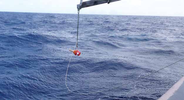
Profiling Float Array Implementation and Ocean Climate Research
CIMAR works with U.S. and International Argo Project partners, especially NOAA/PMEL, on three aspects of the Argo Program. The first objective involves conventional Argo float testing, deployment, and data/engineering evaluation. The second objective involves Deep Argo float testing, deployment, and data/engineering evaluation. The third objective involves delayed-mode quality control of conventional and Deep Argo float data and ocean climate research using data from these floats and other sources.Read more in the Annual Reports.