ESVI: Earth Science on Volcanic Islands
2024 Mentors
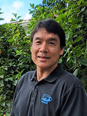
Garrett Apuzen-ItoResearch InterestsMy research focuses on the geodynamic processes of the convecting mantle, lithosphere, and crust associated with magmatism and tectonics throughout the ocean basins. The research tools I use include geophysics (seismology, gravity, topography), geochemistry, and numerical models. Recently, my students and I have been using high-performance computer simulations of mid-ocean ridges in which seafloor spreading is accommodated by a combination of magmatic intrusions and normal faulting. This work provides insight into how magmatism and tectonic processes interact at divergent plate boundaries and how the seafloor is created. Click here to see a video of a 3-D computer simulation. Potential ProjectsContinental rift zones are where continents break apart and eventually create ocean basins. The eastern edge of North America, for example, is an old rifted continental rift zone, which led to the opening of the Atlantic Ocean. Active continental rifting is occurring, for example, in the Western U.S. and east Africa. I invite an REU student to work with me on computer simulations to explore how the filling of an incipient water way at a continental rift zone impacts the system as water percolates into the crust and pressurizes cracks and lubricates fault zones. This project is for students who have interests in math, physics, and high-performance computer modeling. |

Arjun AryalResearch InterestsMy research involves the use of data-driven approaches and numerical modeling to study geologic deformation processes caused by landslides, volcanoes, earthquakes, and other geologic phenomena. I use geodetic observation tools such as a Ground-based Laser Scanner, GPS, and InSAR to measure 3-D ground movement rates (millimeters to meters) to characterize processes such as interseismic activity on faults, inflation/deflation of volcanoes, subsidence related to extraction of groundwater, or coastal subsidence/uplift from sea-level changes. I also use the kinematic information or ground displacements (surface manifestation of the underlying geologic processes) to constrain geophysical models. For example, we can use ground movement measured from repeat laser scanner observations of a landslide to characterize the subsurface slip geometry of the landslide. These types of studies are useful for working towards better forecasting of natural hazards, or can offer a new perspective on the management of groundwater resources. This work is computationally intensive and involves primarily coding, data processing, and statistical analysis. Potential Projects
|
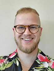
Sloan CoatsResearch InterestsThe term Common Era refers to the last ~2000 years, but it also has a scientific connotation, as this is the era common to paleoclimate reconstructions, observational data, and simulations from state-of-the-art climate models. I leverage these disparate sources of climate information to better understand variability on decadal and longer timescales—things like “megadroughts” over southwestern North America and trends in tropical Pacific sea surface temperatures. My work typically involves the development and implementation of novel statistical methods, including machine learning, as well as the use of climate modelling—particularly with the National Center for Atmospheric Research models. Potential Projects
|

Xiaolong (Leo) GengResearch InterestsMy research focuses on developing a comprehensive and quantitative understanding of coastal groundwater dynamics governing various biogeo- chemical processes in nearshore aquifers. My current research investigates the impact of evaporation and waves on groundwater dynamics in tidally influenced beaches. Potential Projects
|
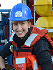
Helen JaniszewskiResearch InterestsMy research involves understanding the crustal and mantle structure beneath tectonically active regions such as subduction zones and volcanoes. Using seismic measurements, we can characterize the geophysical structure of these regions, and relate these to deformation processes, such as inflation/deflation due to magma, or seismogenic coupling. These types of studies are useful for working towards better understanding of natural hazards. I typically work with students that have a strong interest in physics, math, and computer programming, and students can expect to learn about seismic data availability and processing, seismic imaging techniques, processing, and modeling techniques. We may work with either or both onshore and offshore data. Potential Projects
|
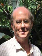
James PotemraResearch InterestsOur group uses direct measurements of ocean properties, such as temperature, sea level, waves, etc. to better understand ocean dynamics. This research has two broad foci: one involves the role of the ocean in the Earth's climate, the other is directed at providing data and products to the public. Through collaborations with the Oceanography Department, Ocean Resources Engineering and the Center for Microbial Oceanography, a series of measurements are routinely collected at Station ALOHA, a region roughly 100 miles north of Oahu. Here we maintain a sea-floor observatory called ACO. This provides real-time information about the deep ocean, including video, sounds, and various physical properties. We also conduct monthly cruises to Station ALOHA as part of the Hawaii Ocean Time-series (HOT) program. During these 5-day expeditions, a wide range of measurements are made, and various samples are taken and then processed back on campus. Finally, the third component at Station ALOHA is a “ocean reference site”, a surface mooring (buoy), that measures atmospheric conditions (wind speed, rainfall, etc.) and subsurface ocean quantities. All of these measurements provide us with relatively long-term time-series that can provide insights to how the ocean environment is changing, and the analyses may help better understand climate change. A second area where ocean observations are collected and used is within a program called the Pacific Islands Ocean Observing System (PacIOOS). This effort is aimed at providing real-time and forecast information to a wide range of ocean users, including coastal managers, planners, tourists, surfers, and so on. PacIOOS maintains observations in all the American Affiliated Pacific islands including Hawai‘i. We have a wide array of coastal measurements and numerical models, and then try to provide these data via web-based services. Potential Projects
|

Godwin SeveraResearch InterestsMaterials science is a crosscutting discipline finding importance in numerous areas including space exploration and clean energy. My research focuses on exploring innovative approaches to achieving superior material properties for emerging applications including space radiation protection, reversible hydrogen storage for fuel cells and, gas separation and purification. My work typically entails syntheses and detailed characterization of the new advanced materials with the desired performance metrics. Typical students in this research have interest in chemistry, materials science, physics, engineering and clean energy technologies. Potential Projects
|
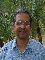
Shiv SharmaResearch InterestsMy research interests are in the applications of micro- and remote Raman spectroscopy, Laser-Induced Breakdown Spectroscopy (LIBS) and Laser-Induced Fluorescence (LIF) spectroscopy for Earth and planetary exploration. Currently I am involved with NASA’s Mars 2020 Rover Mission for understanding surface geology and identify the compositions and structures of the rocks and surface minerals in the Jezero Crater on Mars using SuperCam instrument. Details about SuperCam instrument are available here. Potential Projects
|
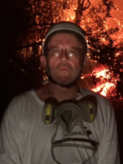

Team Mentors: Bruce Houghton and Natalia Gauer-PasqualonResearch Interests Our research group focuses on the study of erupting volcanoes, and the dynamics and processes of explosive eruptions. We study volcanoes in Hawaii and Iceland by conducting fieldwork integrating video analysis with study of volcanic products. We work on very fine time (sub-second) and length (< meters) particularly for 21st-century, basaltic fissure-fed eruptions. We work in full partnership with the Hawaiian Volcano Observatory, University of Iceland and INGV (Italy). The results of our research quantify the behavior of magma above and beneath the Earth's surface, contributing to the evaluation of volcanic risk, and defining hazards for communities living near volcanoes. Potential Projects
|


Team Mentors: Peng Jiang and Annie ChienResearch Interests Our current research focuses on oceanic magmatism, mantle source lithology and metasomatic history, and deep Earth’s materials recycling beneath mid-ocean ridges (MOR) and hotspots, via integrated textural and in-situ chemical/isotopic analyses on various mineral phases (e.g., olivine, spinel, pyroxene, plagioclase) in the erupted lavas. The studied regions include 8°20’ seamount chain and the nearby Siqueiros Transform in the northern East Pacific Rise (NEPR), the Juan de Fuca Ridge, the 13°-23° southern East Pacific Rise (SEPR) on-axis ridge lavas and the off-axis Rano Rahi Seamounts, as well as Honolulu Volcanics (in Hawaii). Mineral phases in lavas from these regions either crystallized from melts or were captured from mantle as mantle xenocrysts: the textures and in-situ chemical/isotopic compositions (via Electron Microprobe or Ion Microprobe techniques) of which can provide direct constrains on magmatic differentiation processes and/or mantle source characteristics (e.g., peridotite vs. pyroxenite lithologies, mantle metasomatism history). These constraints are crucial in understanding deep Earth dynamics (materials recycling), mantle heterogeneity, and magmatic processes that shape oceanic crusts. Potential Projects
|
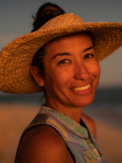

Team Mentors: Haunani Kane and Kainalu StewardResearch Interests Our research combines coastal geomorphology, paleo environmental reconstructions, spatial analysis, and the perspectives of native islanders to investigate how islands, reefs, and island people are impacted by changes in climate. Potential Projects
In 2018 a catastrophic hurricane struck atoll islands in the Papahānaumokuākea Marine National Monument. Satellite imagery documents both island loss and subsequent recovery. This project will involve mapping shorelines from monthly satellite and UAS (drone) imagery to determine how seasonal physical parameters (swell magnitude and direction, wind, extreme tides, etc) influence island recovery and long term stability. Students will also gain experience in conducting coastal surveys including UAS and RTK-surveying methods. Professional development skills will also be acquired through stakeholder outreach, presentations, and meetings.
|

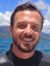
Team Mentors: Brian Popp and Chris WallResearch Interests Coral reefs are among the most diverse ecosystems on earth. Reef corals – the ecological engineers of tropical reefs – exist in a mutualistic symbiosis with microalgae (Symbiodiniaceae), which provide photosynthetically-derived nutrition for their coral animal hosts. However, corals exploit alternative sources of nutrition, as well, including feeding on zooplankton (i.e., heterotrophy). Corals may rely more on heterotrophy during periods of stress and in environments where symbiont photosynthesis is limited or if the hosts are particularly adapted for prey capture. We are interested in the physiological and ecological determinates of nutritional plasticity and applying new methods in stable isotope analysis to track food sources from producers to consumers in coral reef food webs. Potential ProjectsOur research focuses on trophic ecology, nutritional plasticity, and stable isotope ecology of reef corals. We use cutting edge methods (such as compound specific isotope analysis of individual amino acids) to determine sources of nutrition and their contribution to marine and aquatic animals. We are interested in working with students with a desire to learn about coral reef ecology, animal physiology, and stable isotope biogeochemistry. Projects may focus on field collections or manipulative experiments, and students will gain experience in stable isotope analysis, data analysis, and coding in R. |
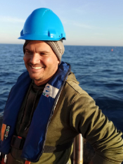

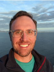
Team Mentors: Amir Haroon, Erin Wallin and Peter KannbergResearch InterestsThe primary research focus lies in improving hydro-geophysical models through the application of electrical and electromagnetic methods that use the electrical resistivity of the subsurface as a proxy to address groundwater-related research questions. By applying geophysical tools to image subsurface properties and processes at various spatial scales we seek to improve our understanding of 1) freshwater-saltwater interactions within the deep coastal transition zone between terrestrial and marine realms, and 2) anthropogenically induced contamination and subsurface structures that control groundwater flow. The field of research is diverse, ranging from novel system development to data acquisition in the field and includes data processing, geophysical modeling, inversion, and interpretation in the lab. Potential Projects
|
2017 Mentors | 2018 Mentors | 2019 Mentors | 2020 Mentors | 2021 Mentors | 2022 Mentors| 2024 Mentors | 2025 Mentors |
[ Top of page ]
