|
|
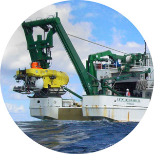
Ship Support : Kaʻimikai-o-Kanaloa
GENERAL DATA
- Built: 1979 (Mod.1993)
- Length: (LOA) 223'
- Beam: 38'
- Draft: 13'6"
- Gross Tonnage:
259
- Displacement:
1,961 tons
- Speed:
- Cruising: 10 knots
- Full: 11 knots
- Minimum: 1 knot
- Range: 15,000NM (60 Days -Fuel)
- Fuel Capacity: 175,744 Gal.
- Endurance: 50
days (Food stores & fresh water)
- Fresh Water
Capacity: 53,038 Gal.
- Watermaker:
3,900 GPD
- Crews
- Ship's Crew: 14
- Science Crew: 19
- Scientists: 10
- Pisces V: 6
- ROV: 3
- Ownership: State of Hawaii
- State ID.#:
HA-343-XS
FACILITIES
- Laboratories
- Rock: 303 sq. ft.
- Wet: 300 sq. ft.
- Clean: 150 sq. ft.
- Dry: 300 sq.ft.
- Conference Room: 256 sq. ft
- Hangar: 1332 sq. ft.
- Incinerator: None.
- Sewage System: Red Fox Marine
Sanitation Device (RF-750M)
- Deck plans of KOK (available
via
the UH Marine Center )
ENGINEERING
- Main Engines: (2) Detroit Diesel
(16D-149TI) 1035 SPH (ea)
- Bow Thruster: 1000 HP (Electric, Derated to
250 HP)
- Service Generator: 1-250KW 12V71 Detroit
Diesel (HOTEL)
- Auxiliary Generator: 1-150KW 8V71 Detroit
Diesel
- Propellers: Twin-Fixed Pitch
Diesel electric (scr) drive with 1000 shaft horsepower
per shaft.
SCIENTIFIC CAPABILITIES
- Primarily designed as support ship for UH manned
submersibles (Pisces IV
& Pisces V )
and an ROV .
- Also capable of conducting research in biology and
chemistry.
- CTD capable.
- SeaBeam
- Winches
- Northern Line coring winch (Model 3355-EHAOW);
- 24.7 mm double armored electro-optical cable
(ROV Umbilical).
- Markey DUSH-6 Hydrographic Winch with capacity
of 7,000M of .322 three conductor cable.
- Stern A-Frame: Moveable (15 ton capacity)
- Cranes
- 1 Pitman Crane (02 Deck) with capacity - 10,000
lbs.,
- 1 Aurora 45F Folding crane, Model 45KTNC 10,000
(Main deck aft) with capacity - 40,000 lbs. at 15
ft, 16,200 lbs. at 25 ft and 10,000 lbs at 45 ft.
- Dark Room and Straza Tower: (4' X 4' square
moon pool)
[ Top of page ]
|
|

