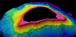
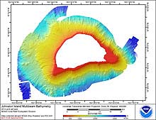
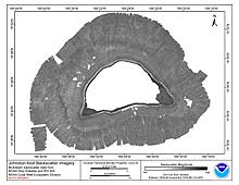
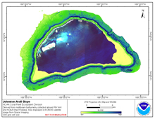
[ Bathymetry | Backscatter | Optical Validation | Seafloor Characterization ]
Johnston Atoll includes 4 islands and a small lagoon and is located at 16°45′N 169°31′W in the Central Pacific, about 885 km (478 nautical miles) south and slightly west of French Frigate Shoals (FFS) in the NWHI. It is a National Wildlife Refuge under the USFWS and public access is by permit only; permits are usually issued for scientists and educators. The atoll was discovered when the American brig Sally ran aground in 1796. The largest island was named Johnston Island for the captain of the frigate HMS Cornwallis from which the island was sighted in 1807.
Click thumbnail maps below to explore PIBHMC’s data sets.
Bathymetry |
Backscatter |
Optical Validation |
Seafloor Characterization |


