[ Bathymetry | Backscatter | Optical Validation | Geomorphology ]
Zipped data files contain 1) grid data file (GMT or ASCII), 2) high-res JPG of image, and 3) explanatory metadata text file (identical to linked file listed below).
40 meter grid

Download this image as a High-res JPG or PDF
Bathymetric data files
- Arc ASCII: Metadata text • Zipped data
5 meter grid

Download this image as a High-res JPG or PDF
Bathymetric data files
- Arc ASCII: Metadata text • Zipped data
Multibeam Bathymetry & WV-2 Derived Depths
Coverage Map
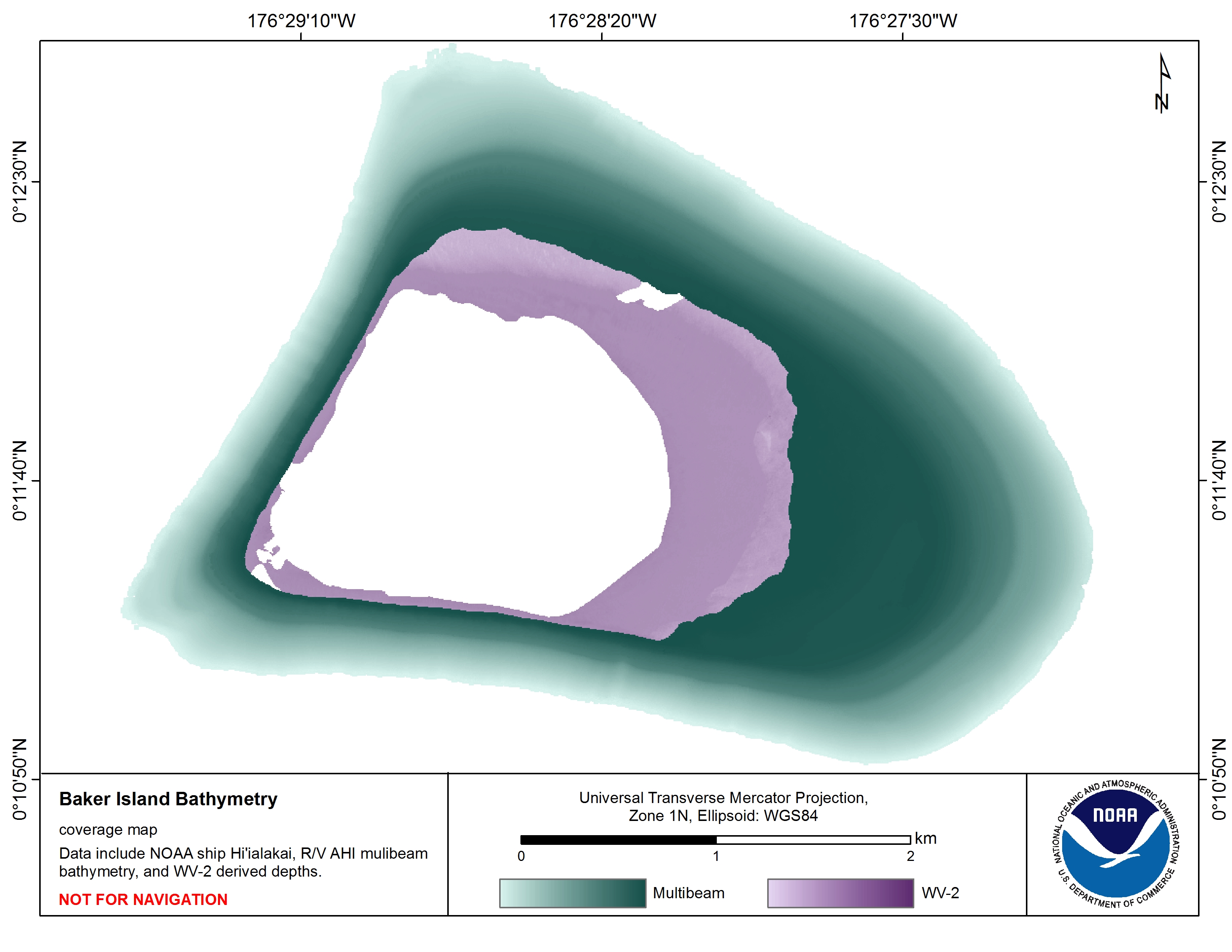
Download this image as a High-res JPG or PDF
Mosaic of bathymetry derived from multispectral WV-2 satellite imagery
5 meter grid
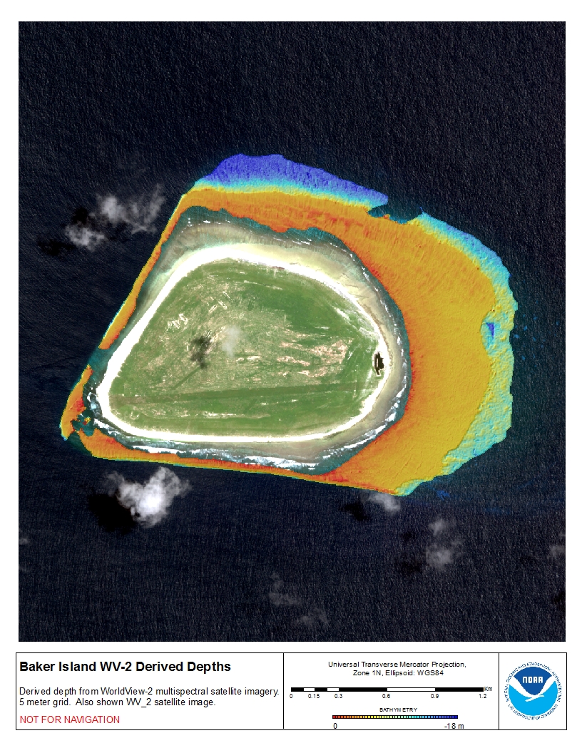
Download this image as a High-res JPG or PDF
Bathymetric data files: WV-2 derived depths bathy data files
- View Metadata: Metadata text
- Zipped Data: Arc ASCII
Mosaic of gridded multibeam bathymetry and bathymetry derived from multispectral World View-2 satellite imagery
5 meter grid
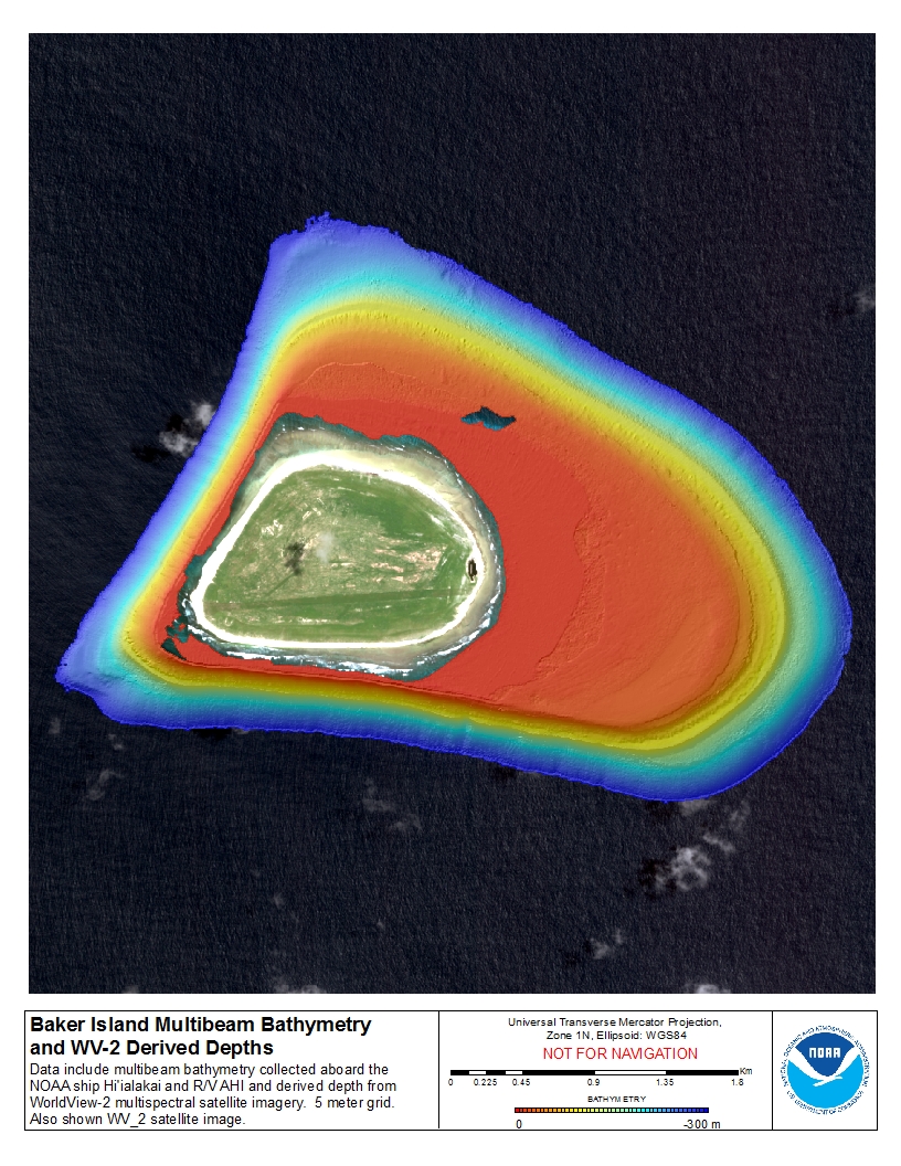
Download this image as a High-res JPG or PDF
Bathymetric data files: WV-2 derived depths, and multibeam from NOAA Ship Hi’ialakai & R/V AHI data files
- View Metadata: Metadata text
- Zipped Data: Arc ASCII