[ Bathymetry | Backscatter | Optical Validation | Geomorphology ]
 |
|
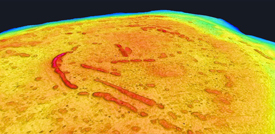
Northeast Bank (also called Muli Seamount) lies approximately 60 km NE of Tutuila and 50 km NW of Ofu Island. Northeast Bank has a plateaued surface with 5 to 6 ridge distinct narrow ridges that are, at places, as shallow as 50 meters. The bank, part of the Samoan hotspot trail, has long been known to Samoan mariners. However, until the multibeam surveys in 2006, their geomorphology was unknown.
Click thumbnail maps below to explore PIBHMC’s data sets.
Bathymetry |
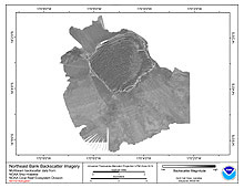
Backscatter |
Optical Validation
Not yet available
|
Geomorphology
Not yet available
|

