Pacific ENSO Update
3rd Quarter, 2007 Vol. 13 No. 3
SEASONAL SEA LEVEL OUTLOOKS
for the U.S-Affiliated Pacific Islands
(i) Seasonal Sea Level Forecast for JAS, ASO, and SON 2007
Forecasts of the sea-level deviations in the USAPI are presented using CCA statistical model. Based on the independent SST values in AMJ 2007, the resulting CCA model has been used to forecast the sea-level of three consecutive month periods: JAS, ASO, and SON 2007 (see Table 1). CCA cross-validation forecast skills for 0, 1, and 2-month leads are
presented in Fig. 3.
Table 1 : Forecasts of sea level deviation in inches for forthcoming seasons
(JAS, ASO, and SON 2007)
Tide Gauge Station |
JAS |
ASO |
SON |
Forecast quality1 |
1. Forecast quality is a measure of the expected CCA cross-validation correlation skill. In general terms, these forecasts are thought to be of useful (but poor) skill if the CCA cross-validation value lies between 0.3 ~ 0.4 (Fig. 3). Higher skills correspond to a greater expected accuracy of the forecasts. Skill levels greater than 0.4 and 0.6 are thought to be fair and good, respectively, while skill levels greater than 0.7 are thought to be very good. |
Lead Time2 |
0 |
1M |
2M |
. |
|
| Guam | +6 |
+4 |
** |
Good |
|
| Palau | +3 |
+3 |
+3 |
V. Good |
|
| Yap | +4 |
+3 |
+2 |
V. Good |
|
| Pohnpei | ** |
** |
+2 |
Good |
|
| Kapingamarangi | +2 |
+2 |
+3 |
Good |
|
| Majuro | ** |
** |
+2 |
Fair |
|
| Kwajalein | ** |
** |
** |
Fair |
|
| Pago Pago | +4 |
+4 |
+3 |
V. Good |
|
| Note: (-) indicates negative deviations (fall of sea level from the mean), and (+) indicates positive deviations (rise of sea level from the mean), N/A: data not available. Deviations of +/-1 in. are considered negligible and denoted by **. Deviations +/- 2 in. are unlikely to cause any adverse climatic impact. | |||||
With a mean skill greater than 0.65 (at 0 to 2-months lead time) in all three consecutive seasons (JAS, ASO and SON), all tide gauges stations except Majuro and Kwajalein are well predicted. Other than Palau, the forecast values of sea-level for JAS, ASO, and SON (Table 1) display rise in all the North Pacific islands. In the south Pacific, Pago Pago displays rise as well. This rising trend is consistent with the on-going ENSO-neutral or transition from ENSO-neutral to La Niña conditions that is expected within the next 3 months. The USAPI are sensitive to ENSO, with rising sea level during La Niña years.
(ii) Tide Predictions (July 1 to September 30, 2007)
NOAA's web site for tide and currents (http://tidesandcurrents.noaa.gov/station_retrieve.shtml?type=Tide+Predictions) has been used to generate the water level plot for the next three months. Predicted water level plots from July 1 to September 30, 2007 for the three major stations (i) Marianas, Guam (ii) Kwajalein, RMI and (iii) Pago Pago, American Samoa are provided below. Observations reveal that the MR, SR, and ML for all these stations are likely to record several inches rise during the JAS season. Guam, FSM and the Marshall Islands are likely to experience a higher tide level (i.e. rise by 2 to 4 inches), and American Samoa may record a rise in tide of 4 to 6 inches during the next 3 months (July 1 to September 30).
Figure 5 (below): Predicted water level for the JAS season 2007 at (a) Marianas, Guam (b) Kwajalein, RMI and (c) Pago Pago, American Samoa. Data from NOAA/NOA/CO-OPS. X-axis: date/time (GMT); Y-axis: height in feet relative to Mean lower low water level (MLLW); MR: Mean-difference between high and low; SR: Difference between high and low tide during full moon (spring tide); and ML: Arithmetic means of high and low tides. |
|

(iii) Observed monthly sea level deviation in Apr-May-June (AMJ), 2007
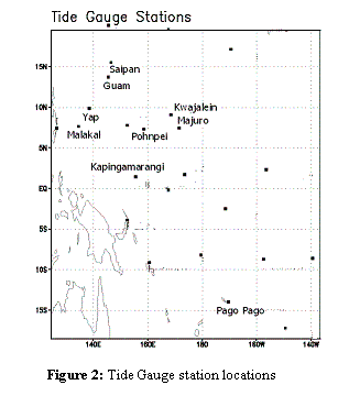
The monthly time series (April to June) for sea level deviations have been taken from the UH Sea Level Center. The full time series (in mm) is available at: ftp://ilikai.soest.hawaii.edu/islp/slpp.deviations. Deviations are defined here as the difference between the mean sea level for the given month and the 1975 through 1995 mean sea level value computed at each station. Locations of all these stations are shown in Figure 2 (top of page).
Table 2: Monthly observed sea level deviations in inches for April, May and June 2007, with year to year standard deviations (SD).
Tide Gauge |
Apr. |
May |
June |
|||
Deviation |
SD |
Deviation |
SD |
Deviation |
SD |
|
| Marianas, Guam | +2.6 |
(3.2) |
+5.0 |
(2.9 |
+7.6 |
(2.8) |
| Saipan, CNMI | +3.5 |
(4.6) |
+5.7 |
(4.7) |
n/a |
(4.2) |
| Malakal, Palau | -1.7 |
(4.6) |
-2.1 |
(4.7) |
-0.5 |
(4.2) |
| Yap, FSM | n/a |
(3.8) |
n/a |
(3.4) |
n/a |
(4.1) |
| Kwajalein, RMI | +7.4 |
(3.0) |
+8.7 |
(2.9) |
+8.0 |
(2.6) |
| Majuro, RMI | +5.8 |
(2.0) |
+3.0 |
(2.3) |
n/a |
(2.7) |
| Pohnpei, FSM | +6.2 |
(2.1) |
+8.2 |
(2.5) |
n/a |
(2.2) |
| Kapingamarangi, FSM | +3.7 |
(1.9) |
+3.1 |
(1.9) |
+0.7 |
(2.1) |
| Pago Pago, American Samoa | +3.3 |
(3.7) |
+4.6 |
(4.3) |
+5.5 |
(3.6) |
Note: - indicate negative deviations (fall of sea-level from the mean), and + indicate positive deviations (rise of sea-level from the mean); n/a: data not available; SD: Year-to-year standard deviations for the month. |
||||||
Table 2 (above) provides monthly observed sea level deviations (in inches). (Also, see Fig. 4 for AMJ seasonal averages.) A considerable positive deviation has been observed in most of the tide-gauge stations in AMJ. While the previous three quarters recorded rise, the rise in AMJ is particularly high. As mentioned, the sea-level variation in the USAPI is sensitive to ENSO-events, with low sea-level typically recorded during El Niño and high sea-level during La Niña events. Consistent with the on-going transition from ENSO-neutral to La Niña conditions, the sea level in this year has already started rising in the vicinity of USAPI. Due to technical problems, sea level data for Yap was not available for the AMJ season.
(iv) Seasonal Extremes for JAS at 20- and 100-year return periods.
The Generalized Extreme Value (GEV) products define the thresholds beyond the seasonal tidal range that have low but finite probabilities of being exceeded on a seasonal scale. Results of the GEV analysis for the season JAS is presented in Table 3 (below). The extreme values are calculated from the 6-hourly sea-level data. The upper limit (at 90% confidence interval) of rise has been shown in the right side of the column, the left side is the estimated rise based on observations. For example, the predicted rise of 6.2 ~ 8.9 inches at Marianas (*) indicates that this station may experience sea level rise of 6.2 to 8.9 inches during JAS within any 20 year period (20 year RP). Likewise, about once every 100 years we can expect the highest JAS tide at Marianas to be as much as 17.2 inches above normal (100 year RP).
| Table 3: Seasonal Extremes (GEV) for JAS | Sea Level Rise (inches) |
|
Station |
20 year RP |
100 year RP |
| Marianas, Guam | 6.2 ~ 8.9 * |
10.8 ~ 17.2 * |
| Saipan, CNMI | 6.9 ~ 8.3 |
9.7 ~ 16.9 |
| Malakal, Palau | 8.0 ~ 9.0 |
10.1 ~ 12.1 |
| Yap, FSM | 8.3 ~ 9.5 |
11.2 ~ 13.3 |
| Kwajalein, FSM | 4.0 ~ 4.6 |
5.1 ~ 6.1 |
| Majuro, RMI | 5.1 ~ 6.5 |
6.8 ~ 9.5 |
| Pohnpei, FSM | 5.7 ~ 6.9 |
6.9 ~ 9.4 |
| Kapingamarangi, FSM | 3.5 ~ 5.0 |
4.2 ~ 6.9 |
| Pago Pago, American Samoa | 4.0 ~ 5.1 |
5.3 ~ 7.4 |
|
Note: Upper boundaries of rise are calculated at the 90% confidence interval. RP stands for Return Period. Bootstrap methods with 5000 iterations were used to estimate these upper limit values of sea level rise. |
||
Note that some of the stations (Marianas, Saipan, Malakal and Yap) display higher potential rise than other locations, particularly at the 100 year RP. These higher values are due to the effects of past storm events, which significantly increased the tidal ranges of the stations within the swath of the storm path. Therefore, while sea levels at Marianas, Saipan, Malakal and Yap were severely affected by a typhoon or tropical storm, other stations remained more or less unaffected by the same storm.
Click here to view probability of exceedence graphs for the JAS season.
Chowdhury M. R , P-S Chu, and Schroeder T (2007): ENSO and Seasonal Sea-level Variability – A Diagnostic Discussion for the U.S-Affiliated Pacific Islands, Theoretical and Applied Climatology, 88: 213-224 (March 2007), Springer-Verlag Wien.