On September 29, 2009, a tsunami caused substantial damage and loss of life in American Samoa, Samoa, and Tonga. The tsunami was generated by a large earthquake in the Southern Pacific Ocean.

Earthquake depth impacts potential tsunami threat

Earthquakes of similar magnitude can cause tsunamis of greatly varying sizes. This commonly observed, but not well-understood phenomenon has hindered reliable warnings of local tsunamis.

Research led by University of Hawai‘i (UH) at Mānoa scientists provides new insight that connects the characteristics of earthquakes—magnitude, depth where two tectonic plates slip past each other and the rigidity of the plates involved—with the potential size of a resulting tsunami.

Previous researchers identified a special class of events known as tsunami earthquakes, which produce disproportionately large tsunamis for their magnitude. Kwok Fai Cheung, SOEST professor in Ocean and Resources Engineering (ORE), Thorne Lay from the University of California – Santa Cruz and co-authors, including ORE postdoctoral researcher Yoshiki Yamazaki, discovered a straightforward explanation for this conundrum. Their findings were published recently in Nature Geoscience.

Using computer models, the team incorporated physical processes that produce earthquakes and tsunamis with a wide range of observations of real-world events, including those classified as tsunami earthquakes. The model results demonstrated that for a given earthquake magnitude, if the rupture extends to shallow depth in the less rigid part of the plate, the resulting tsunami is larger than if the rupture is deeper.

“In a subduction zone, the upper plate is thinner and less rigid than the underthrusting plate near the trench,” explained Cheung. “A concentrated near-trench or shallow rupture produces relatively weak ground shaking as recorded by seismometers, but the displaced water in the overlying deep ocean has enhanced energy and produces shorter tsunami waves that amplify at a high rate as they move toward the shore.” 

“Earthquake and tsunamigenic processes are complex, involving many factors that vary from one event to another,” said Lay, professor of Earth and Planetary Sciences at UC Santa Cruz. “We utilized a simplified numerical model to isolate key earthquake parameters and evaluate their importance in defining tsunami size.”

Having verified that the presence of shallow earthquake rupture can be a more significant factor than the earthquake magnitude for the resulting tsunami size led the researchers to an important question: Can earthquake magnitude continue to be used as the primary indication of potential tsunami impacts?

“The practice of using earthquake magnitude to estimate potential tsunami threat has led to poor predictive capability for tsunami impacts, and more information about the source is required to do better,” said Cheung.

An important aspect of this interdisciplinary research is the synergy of expertise in seismology, with Lay, and tsunamis, with Cheung’s research group, applied to a large set of observations. This study motivates development of new seismological and seafloor geodesy research that can rapidly detect occurrence of shallow rupture in order to achieve more reliable tsunami warning.

While shorelines throughout the Pacific Ocean and along the “Ring of Fire” are vulnerable to tsunamis, the situation is most critical for coastal communities near the earthquake, where the tsunami arrives quickly—when detailed information about the earthquake is not yet available. 

Cheung and Lay continue their collaboration to investigate prehistorical, historical, and future tsunami events to better understand the hazards posed to coastal communities and enable more accurate warning systems. 

Read more on Eurekalert, SciTechDaily and Science Daily.
Operational submarine telecommunications cable span the globe with 20,000 repeaters every ~70 km that could host sensors—initially, temperature, pressure, seismic acceleration. Current cables (green lines); in progress/planned cables (white); and historical earthquakes (red). SMART repeaters are shown every 300 km, actual about 70 km.

Big boost for global network of SMART seafloor cables, early warning systems

The University of Hawai‘i (UH) at Mānoa is leading an effort to advance a global network of SMART seafloor cables and develop early warning systems for tsunamis and earthquakes around Vanuatu and New Caledonia. The international team recently received support of over $7M from the Gordon and Betty Moore Foundation.

“Through this project, we are developing a new ocean and Earth observing capability—sensors integrated in subsea telecommunications cables—and developing simulations and scientific protocols to provide earthquake and tsunami early warnings,” said Bruce Howe, lead investigator of the new grant and professor of Ocean and Resources Engineering in the UH Mānoa School of Ocean and Earth Science and Technology (SOEST).

The Science Monitoring And Reliable Telecommunications (SMART) Subsea Cables initiative is gaining momentum around the world. This effort aims to integrate ocean temperature, pressure and seismic sensors into commercial submarine telecommunications systems that crisscross the ocean floor. As new systems are installed, researchers and communities hope to cost-effectively transform the current telecom network into a combined telecom and planetary-scale ocean, climate and geophysical sensor array capable of informing early warning systems.

“This brilliant project will transform the practical cables that link communications and commerce into a world-wide scientific instrument of profound importance to every person on Earth. We are delighted to help the University of Hawai‘i pioneer this game-changing effort,” said Robert Kirshner, Chief Program Officer for Science at the Gordon and Betty Moore Foundation. 

Project goals

The overarching goal of the newly funded, five-year project is to help bridge the perilous gap between concept and implementation. The team aims to have sensor integration into subsea telecommunications cables become the world standard, leading to a global network for sustained ocean observation, geophysical study of earthquakes, and earthquake and tsunami warning in a world with rising sea levels.

To do this, the team will lay groundwork for the science and early warning use of undersea cables by simulations of the observing system before deployment, data analysis after deployment, and sustained scientific operation.

They will apply results of the simulations to optimize the proposed Vanuatu-New Caledonia cable system and its operation. This will demonstrate the capability of the earthquake and tsunami early warning system based on the SMART sensors in one of the world’s most at-risk country for natural disasters due to its location in the seismically active “Ring of Fire.”

A significant aspect of the project is training staff in the region to increase local expertise in related science, data management to create early warnings and predictions, and telecommunication processes. Included are workshops and courses for Vanuatu Meteorology and Geohazards Department professionals and funding for education of graduate students at the National University of Vanuatu (NUV), UH Mānoa, and partner institutions—providing the science and technical foundation of a lasting observing system.

“It is critical to have a robust work force in preparation for the new SMART cable system,” said Howe. “This will ensure operation and maintenance of the early warning systems which will help mitigate the risks of earthquake and tsunami hazards.”

Lastly, the project will support the international project office of the Joint Task Force Scientific Monitoring And Reliable Telecommunications cables, working to facilitate adoption of scientific sensors in all new subsea telecommunications cables to reach a global scale. This Joint Task Force, recently endorsed by the United Nations Ocean Decade for Sustainable Development, is sponsored by the International Telecommunication Union, World Meteorological Organization and UNESCO-Intergovernmental Oceanographic Commission.

Reducing risk through science, innovation, partnership

“Ideally the incorporation of SMART capability would become a routine function for the submarine cable industry,” said Howe. “Achieving this goal will generate key reductions in human and planetary risk. We hope this project is a demonstration for the global audience about how communities and science can benefit from SMART cables.”

Securing the new funding required local and international collaboration. UH Foundation facilitated working with Gordon and Betty Moore Foundation, thus bringing the project headquarters to UH Mānoa. Project partners include: in the U. S., University of Texas – Austin, Louisiana State University, California Institute of Technology, Subsea Data Systems and Los Alamos National Laboratory; in the South Pacific University of Otago (New Zealand), French Institute for Research and Sustainable Development, National University of Vanuatu, Vanuatu Meteorological and Geohazards Department and The Pacific Community (SPC); and the International Tsunami Information Center.

About the Moore Foundation

The Gordon and Betty Moore Foundation fosters path-breaking scientific discovery, environmental conservation, patient care improvements and preservation of the special character of the Bay Area. This research is funded by the Gordon and Betty Moore Foundation through Grant GBMF10787 to the University of Hawai‘i. Visit Moore.org or follow @MooreFound for more information.

Watch a news story on Hawaii News Now or read on UH News.

Students engaged in integrating a payload into the small satellite on the table.

First space research, exploration certificate cohort graduates

A new earth and planetary exploration technology (EPET) certificate is preparing students for the Earth and space exploration workforce in their major science or engineering discipline, and the first cohort will graduate in December from the University of Hawaiʻi at Mānoa. The certificate program is provided by the Hawaiʻi Institute of Geophysics and Planetology (HIGP) and supported by the Hawaiʻi Space Flight Laboratory.

“The EPET certificate program is one of the only opportunities for UH students to obtain a formal education in an important growth area of the economy, space exploration and aerospace engineering,” said Peter Englert, a professor in HIGP. “It is also one of the few programs where science and engineering students will work together on course projects, an enriching experience, and an opportunity.”

The EPET certificate program consists of four courses totaling 15 credits that are taught in four consecutive semesters starting in the spring. The courses are cross listed with mechanical engineering and form the core of the concentration in aerospace engineering of the Mechanical Engineering Department. Program goals are to provide science and engineering majors with a comprehensive understanding of scientific and engineering knowledge, in theory and practice, to successfully explore from the deepest oceans to the far reaches of our solar system.

“I thoroughly enjoyed the EPET program,” said Lynzee Hoegger, who is in the first cohort of the EPET certificate. “It’s been really great getting to be a part of the bridge between space science and technology. I also enjoyed that we didn’t just hear from one professor with one area of expertise but instead many different professors from many different fields would teach us each week.”

Designing and building spacecrafts

The EPET curriculum provides a modern learning experience by combining lecture-, laboratory-, field- and project-based approaches with effective interdisciplinary group learning strategies to integrate the nature of planetary materials and landforms with the science and engineering tools. These include sensors and scientific instruments, robotic vehicles as platforms for remote sensing and sampling, spacecraft fundamentals, and mission architecture, planning and operation.

“I would recommend the certificate to other students because it gives you a chance to work with people outside of your major and to have to think outside of the box to solve problems that may arise in a space mission,” said Hoegger.

The satellite that students are completing in fall 2021 will likely be part of the Pleiades Mission together with Cal Poly Pomona, Portland State Aerospace Society and Stanford University. The payload is a general radiation detector.

“It is also fun to work on research projects that design and build space flight sensors, space flight missions, and finally a small functioning spacecraft,” said Englert. “Some of these spacecrafts will have an opportunity to be launched while students are still in school.”

The EPET certificate program is for students enrolled in science and engineering undergraduate degree programs at UH Mānoa, other parts of the UH System, and other universities. The program can also accommodate professionals working in the community who wish to upgrade knowledge and skills.

The next cohort of students for the EPET certification program will begin in spring 2022. For more information, see HIGP’s website.

Image of slide 46 of 76535 taken with a polarized light microscope.

Advanced analysis of Apollo sample illuminates Moon’s evolution, cooling

Sophisticated analysis of a rock sample taken from the Moon during the Apollo 17 mission revealed new information about the complex cooling and evolutionary history of the Moon. The findings, from University of Hawai‘i (UH) at Mānoa researchers, were published today in Nature Communications.

Apollo 17 astronauts collected the rock sample troctolite 76535 from the Moon’s surface in 1972, and it remains one of the most scientifically valuable samples of the Moon due to its pristine nature. Further, the rock type is widespread on the Moon and likely contains important clues to understanding lunar formation.

Advanced imaging, high-performance computing

William Nelson, lead author of the study and Earth Sciences graduate student in the UH Mānoa School of Ocean and Earth Science and Technology (SOEST), and co-authors used a specialized electron microprobe to perform high-resolution analysis of troctolite 76535.

“Previous reports suggest the minerals in the Apollo 17 sample were chemically homogeneous,” said Nelson. “Surprisingly, we found chemical variations within crystals of olivine and plagioclase. The pattern of these chemical variations allows us to constrain the earliest, high-temperature cooling histories of these minerals using numerical models of chemical diffusion.”

SOEST researchers used the UH High-Performance Computing cluster Mana to consider the effects of a variety of computer-simulated cooling paths—well over 5 million chemical diffusion models.

Reshaping understanding of Moon formation

“The simulations revealed that these heterogeneities could only survive a relatively short period of time at high temperatures,” said Nelson.

The diffusion patterns preserved in the mineral grains and observed with the microprobe were consistent with a rapid cooling history of no more than 20-million-years at high temperatures. The finding challenges previous estimates of a 100-million-year cooling duration and supports initial rapid cooling of magmas within the lunar crust.

“This is changing our outlook on how an important suite of lunar rocks formed,” said Nelson.

To reconcile high-temperature cooling rates with the generally accepted view of the way in which these rocks formed, the research team proposed that perhaps this rock type is formed by a process called reactive infiltration wherein a melt interacts with rock—changing its chemical and physical makeup.

The study also demonstrates the value of re-examining previously analyzed samples using modern techniques and how quickly new data can reshape our understanding of planetary evolution.

To better understand the observed chemical heterogeneity, the research team is currently investigating how quickly phosphorus can diffuse in olivine crystals. Additionally, they are searching for similar heterogeneities in other Apollo samples.

Read also on Space.com, Inverse, New Scientist, Science Daily, Phys.org, UH News and Eurekalert.

AGILE logo

New program supports Asian American, Pacific Islander students in geoscience

The University of Hawai‘i (UH) at Mānoa is partnering with seven other institutions on a new initiative that fosters belonging and participation among Asian Americans and Pacific Islander (AAPI) students in the geosciences. The National Science Foundation-funded project, titled AGILE (AAPI in Geoscience: Inclusivity, Leadership, and Experience), is led by Daniel Ibarra, at Brown University and Kimberly Lau at Penn State. Through a number of innovative and collaborative programs and events, the grant project aims to improve the awareness of geosciences among AAPI undergraduates and cultivate a national network of mentors that will boost AAPI participation in geoscience graduate programs and careers.

With UH Mānoa being an Asian American and Native American Pacific Islander-serving institution, and the UH Mānoa School of Ocean and Earth Science and Technology (SOEST) being one of the premier geoscience schools in the world, SOEST is particularly well-positioned to play a role in helping increase participation of AAPI in the geosciences.

“The Earth and environmental sciences impact every person on our planet in some way, and so it’s a priority that our field is as inclusive as possible,” said Lau. “Who gets to become a geoscientist is a topic that the community has been focusing on. Through this project, we aim to provide more exposure to the Earth and environmental sciences, as well as create new opportunities for AAPI undergraduates to learn about how they can make an impact.”

The grant funds a number of exciting new initiatives, including a pilot Research Visit Program that will support short visits by faculty, graduate students, and other scientists to AAPI-serving institutions to bring awareness of geoscience careers and graduate school to AAPI students. The project also includes career-development events and workshops, and an Undergraduate Research Internship that will connect students with meaningful geoscience research and learning opportunities. Through all of this, the project plans to expose as many as a thousand undergraduates across the country to geoscience research and careers, establish a new research internship opportunity, and create national cross-career connections between AAPI geoscientists in diversity and inclusion discussions.

David Ho, SOEST Oceanography professor and co-investigator on the new project, will work with the other partners on establishing the research visit program and the research internship program, as well as participate in career development events and workshops. These efforts connect students with invaluable research experience and enhance professional skills needed to succeed in the field of geosciences.

“We AAPI geoscientists don’t typically discuss issues of identity, despite the fact that AAPI representation in the geosciences lags far behind other STEM fields and national demographics,” said Ibarra. “This is an opportunity to highlight AAPI scientists who have pursued careers in geosciences, and create a framework for them to give back to undergrads at AAPI-serving institution, creating a cross-career network of support, which is pretty exciting.”

In addition to Daniel Ibarra, Kimberly Lau, and David Ho, the team includes Sora Kim (UC Merced), Sonya Legg (Princeton University), Randye Rutberg (CUNY Hunter College), Jessica Wang (Bellevue College), and Sam Ying (UC Riverside). The majority of the Principal Investigators on the project identify as AAPI and are associated with Asian Americans and Pacific Islanders in Geosciences (AAPIiG), a new grassroots, member-driven organization founded by Ibarra, Lau, and Christine Y. Chen (Lawrence Livermore National Lab) in 2020.

Portions of this content are courtesy of Mae Jackson, Brown University

Read also on UH News.

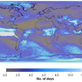
Extreme rainfall days per decade around the globe due to greenhouse warming over the 21st century. The color scale saturates at 12 days to emphasize the response over land, given the very large amplitude over the eastern equatorial Pacific domain.

Extreme weather changes predicted by unprecedented model simulations

There is growing public awareness that climate change will impact society not only through changes in mean temperatures and rainfall over the 21st century, but also in the occurrence of more pronounced extreme events, and more generally in natural variability in the Earth system. Such changes could also have large impacts on vulnerable ecosystems in both terrestrial and marine habitats.

A team of researchers including Malte Stuecker from the University of Hawai‘i at Mānoa School of Ocean and Earth Science and Technolgy (SOEST), explored projected future changes in climate and ecosystem variability and reported that the impact of climate change is apparent in nearly all aspects of climate variability. The study, led by the IBS Center for Climate Physics (ICCP) at Pusan National University in South Korea and published in the journal Earth System Dynamics, emphasized that the impacts range from temperature and rainfall extremes over land to increased number of fires in California, to changes in bloom amplitude for phytoplankton in the North Atlantic Ocean.

Unprecedented model simulations provide detailed look at impacts

The team conducted a set of 100 global Earth system model simulations over 1850-2100, working with a “business-as-usual” scenario for relatively strong emissions of greenhouse gases over the 21st century. The runs were given different initial conditions, and by virtue of the butterfly effect they were able to represent a broad envelope of possible climate states over 1850-2100, enabling sophisticated analyses of changes in the variability of the Earth system over time.

Further, the relatively high resolution (~100 km) of the model, in conjunction with the 100 different realizations, represented an unprecedented set of technical challenges that needed to be met before advancing to the goal of assessing how climate variability is impacted by sustained anthropogenic changes to the climate system.

“We met these challenges by using the IBS/ICCP supercomputer Aleph, one of Korea’s fastest supercomputers,” said Sun-Seon Lee from the ICCP, a co-author of the study who ran the simulations together with her National Center for Atmospheric Research (NCAR) colleague Nan Rosenbloom. For the project, approximately 80 million hours of supercomputer time were used.

Widespread changes

Taken together, the computer simulations reveal that across our planet we can expect widespread changes in climate variability, ranging in timescales from storm events to decadal changes. Each of these changes has important impacts for sustainable resource management. For example, occurrences of extreme rainfall events over the 21st century indicate that extremes are expected to become more commonplace over many regions. These projected changes in rainfall extremes are in fact representative of the omnipresence of changes in extremes in the future across a broad range of climate and ecosystem variables, which has important implications for future adaptation strategies.

“Without substantial mitigation of greenhouse gas emissions together with sustained local adaptation efforts, these ubiquitous changes in climate volatility will extensively impact people and communities across the globe,” said Stuecker, who is an assistant professor of oceanography in SOEST.

In continuing NOAA funded projects, Stuecker, Brian Powell, Chris Sabine and other colleagues at UH Mānoa are currently utilizing these simulations for regional downscaling efforts to assess the impacts of future climate change and ocean acidification on regional fisheries and other coastal systems across the Hawaiian Archipelago.

Global partnership

This work resulted from a collaborative partnership between the IBS Center for Climate Physics at Pusan National University in South Korea and the Community Earth System Model project at the NCAR in the US and also included researchers from the Korea Polar Research Institute, University of Hawai‘i at Mānoa, and the University of Colorado – Boulder. The NCAR is sponsored by the US National Science Foundation and managed by the University Corporation for Atmospheric Research.

Watch the story on Hawaii News Now or read on UH News.

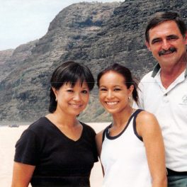
Paul Bienfang (r) with wife, Noni Bienfang, and daughter, Marni Sakumoto.

Family memorializes beloved SOEST professor

As a high school student in Wisconsin, Paul Bienfang was a lifeguard at the city pool, giving swimming lessons to friends and family members. His love for the water was evident at a young age, according to Dave Bienfang, Paul’s brother.

Paul earned bachelor’s, master’s and doctoral degrees at UH Mānoa in biological oceanography, then worked for decades in Hawai‘i’s ocean research, conservation and advocacy. After 24 years with the Oceanic Institute, Paul worked in shrimp aquaculture on Kaua‘i for over a decade, and continued to support private and public entities in a variety of industries in the Hawai‘i community through his consulting and water analysis business. He returned to his alma mater in 2004 as associate professor of oceanography.

“He strongly believed in education and mentoring students,” says his wife, Noni Bienfang. “He headed ciguatera research at Mānoa and taught a course called Living Marine Resources, about fisheries, aquaculture, aquatic pollution and sustainability.

When he died in June 2020, Paul’s family established the Dr. Paul Bienfang Memorial Fund for undergraduate students studying global environmental science at the School of Ocean and Earth Science and Technology. The assistance will go toward costs associated with attendance, such as tuition, fees and textbook purchases.

Paul and Noni’s daughter, Marni Sakumoto, says, “We created the fund to carry on my father’s legacy, to honor who he was as a person: somebody who cared a lot about making other people’s lives better. We honor him by allowing others the same kind of opportunity, for something they’re passionate about.

“It’s just our way of sharing a part of him.”

Read more on UH Foundation News and watch a video of the story.

Ruth Gates' team checks coral for transplant experment.

Darwin in a lab: Coral evolution tweaked for global warming

The Associated Press featured the work of The Coral Resilience Lab at the Hawaiʻi Institute of Marine Biology. An excerpt of the story is below.

“On a moonless summer night in Hawaii, krill, fish and crabs swirl through a beam of light as two researchers peer into the water above a vibrant reef.

Minutes later, like clockwork, they see eggs and sperm from spawning coral drifting past their boat. They scoop up the fishy-smelling blobs and put them in test tubes.

In this Darwinian experiment, the scientists are trying to speed up coral’s evolutionary clock to breed “super corals” that can better withstand the impacts of global warming.

Watch the video report here.

For the past five years, the researchers have been conducting experiments to prove their theories would work. Now, they’re getting ready to plant laboratory-raised corals in the ocean to see how they survive in nature.

“Assisted evolution started out as this kind of crazy idea that you could actually help something change and allow that to survive better because it is changing,” said Kira Hughes, a University of Hawaii researcher and the project’s manager.

— Selective breeding that carries on desirable traits from parents.

— Acclimation that conditions corals to tolerate heat by exposing them to increasing temperatures.

— And modifying the algae that give corals essential nutrients.

Hughes said the methods all have proven successful in the lab.

And while some other scientists worried this is meddling with Nature, Hughes said the rapidly warming planet leaves no other options. “We have to intervene in order to make a change for coral reefs to survive into the future,” she said.”

Read the full story on Associated Press and National Public Radio; and watch the video on YouTube.

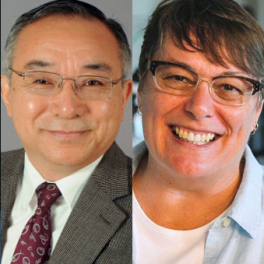
Fei-Fei Jin (l), Ruth Gates (r)

SOEST researchers recognized for global excellence

Four University of Hawaiʻi at Mānoa researchers were honored among the world’s most influential researchers of 2021. From SOEST, Atmospheric Sciences professor Fei-Fei Jin and the late Ruth D. Gates, with the Hawaiʻi Institute of Marine Biology, were named to the 2021 Web of Science’s Highly Cited Researchers list.

The annual list identifies researchers who demonstrated significant influence in their chosen field through the publication of multiple highly cited papers during the last decade. Their names are drawn from the publications that rank in the top 1% by citations for field and publication year in the Web of Science™ citation index.

“The rankings demonstrate the superior quality of work by our faculty across many different disciplines, providing further evidence of our status as one of the world’s great research universities,” said Provost Michael Bruno. “Their research and scholarship fuels the knowledge, creation and innovation that is key to our society’s future, and we are proud to have them as part of our UH ʻohana.“

Fei-Fei Jin

Jin was named to the list in the cross-field category, which identifies researchers who have contributed highly cited papers across several different disciplines. Jin’s research interests cover a wide range of topics, including the dynamics of large-scale atmosphere and ocean circulations, and climate variability. His primary research focuses are understanding the dynamics of El Niño-Southern Oscillation, climate variability in the extratropical atmospheric circulation and global warming.

The late Ruth D. Gates

Gates, recognized in the cross-field discipline, was a tireless innovator and advocate for coral reef conservation. The focus of her most recent research efforts was creating “super corals,” coral species occurring naturally in the ocean that could be trained to become more resilient to these harsh conditions.

David Pendlebury, senior citation analyst at the Institute for Scientific Information at Clarivate said, “It is increasingly important for nations and institutions to recognize and support the exceptional researchers who are driving the expansion of the world’s knowledge. This list identifies and celebrates exceptional individual researchers at the University of Hawaiʻi who are having a significant impact on the research community as evidenced by the rate at which their work is being cited by their peers.”

Read the full story on UH News for more on the two other UH honorees, Shidler College of Business Professor Stephen L. Vargo and Institute for Astronomy (IfA) Astronomer Daniel Huber.

The full 2021 Highly Cited Researchers list and executive summary can be found online here.

Interbedded basalt originating from 3 different volcanoes makes a complex, heterogenous aquifer influencing groundwater levels and groundwater discharge rates. Precipitation infiltrates into the young, porous basalt and flows in the subsurface before discharging to the coastal ocean as SGD. At the same time tides and waves push seawater into the coastal aquifer creating a complex subterranean estuary indicated by pink and blue colors.

Ocean tides are gatekeepers of groundwater discharge to Hawai‘i coastal zone

Groundwater is a vital resource for humans and ecosystems. Submarine groundwater discharge is a process by which water exits coastal aquifers and enters the ocean. This can be terrestrial freshwater or salty seawater that intruded into the porous aquifer at the ocean’s edge. A new study, published in Nature Scientific Reports by University of Hawai‘i at Mānoa researchers, showed that while precipitation and sea level drive coastal groundwater levels, it is sea level, especially tides, that play gatekeeper on the amount of groundwater discharging to Hawai‘i’s coastal zone.

The addition of groundwater to the nearshore nourishes coastal food chains, supporting many traditional Native Hawaiian aquacultural practices, such as loko iʻa (fishponds). However, coastal aquifers and submarine groundwater discharge are increasingly affected by climate variations and sea-level rise.

“While rainfall drives the amount of freshwater in the aquifer, it is difficult to understand and predict the volume and timing of submarine groundwater discharge due to the complex nature of seasonal seawater intrusion, tidal pumping, and wave set-up occurring on daily time scales,” said lead author Trista McKenzie, who was a postdoctoral researcher in the Department of Earth Sciences UH Mānoa School of Ocean and Earth Science and Technology (SOEST) and is currently a postdoctoral researcher at the University of Gothenburg, Sweden. “In places like West Hawai’i where aquifer structures are complex and unknown, long-term observations are the only way to characterize this process.”

In 2016, Henrietta Dulai, professor of Earth Sciences in SOEST, and colleagues constructed an autonomous radon monitor, which can be used to calculate the magnitude of submarine groundwater discharge. The instrument was deployed in Kīholo Bay for several years with the gracious support of Hui Aloha Kīholo and The Nature Conservancy and collected data at an unprecedented length and resolution.

The instrument captured a revealing set of data, as it was deployed through significant weather events and ocean conditions including tropical cyclones, a tsunami, king tides, droughts, an El Niño period, and sea-level anomalies. McKenzie and study co-authors, Dulai and Peter Fuleky, applied traditional and novel time-series analysis techniques to understand the patterns of submarine groundwater discharge—how it is affected by precipitation, tides, and waves and in turn, how it affects coastal salinity.

Data reveal drivers of groundwater discharge

The researchers found when rainfall is low, groundwater discharge and coastal salinity are modulated entirely by tides, with largest discharge at low tide. When precipitation is above a threshold, it becomes a major driver pushing groundwater out of the aquifer and causing lower salinities at the coastline. This pattern is especially pronounced during El Niño periods.

Furthermore, during heavy rains, such as during tropical cyclones, coastal salinity decreases immediately due to freshwater flowing off the land surface. The team’s analysis also showed that high precipitation resulted in higher groundwater levels and a gradual increase in submarine groundwater discharge with a time lag of several weeks.

Supporting sustainable management

“Understanding patterns like these helps improve coastal aquifer management, which are the main water resource for the islands, as well as the management of coastal ecosystems and aquaculture,” said Dulai. “While Native Hawaiians were well aware of submarine groundwater discharge and were extremely successful in managing coastal resources for centuries, ongoing changes in precipitation patterns and sea-level rise due to climate change as well as groundwater withdrawal from the aquifer by humans lead to changes in submarine groundwater discharge patterns.”

The analyses presented in this research are the first step in understanding what to expect under normal and extreme climate events and the team is poised to apply the gained knowledge and work with coastal communities to apply these findings in their management decisions.

Read more on Science Daily, Phys.org, Eurekalert, UH News, Mirage News.