researchers aboard RV K-O-K

Research shows increase in nitrogen levels North Pacific

Human-induced changes to Earth’s carbon cycle — for example, rising atmospheric carbon dioxide and ocean acidification — have been observed for decades. A study published in the journal Science showed human activities, in particular industrial and agricultural processes, have also had significant impacts on the upper ocean nitrogen cycle. David Karl, professor of Oceanography and director of the Director of the Daniel K. Inouye Center for Microbial Oceanography (C-MORE), and collaborators used ocean data and modeling to reconstruct oceanic nitrate concentrations and make predictions about the future of the North Pacific Ocean. Their analysis revealed that nitrate concentration has increased significantly over the last 30 years in North Pacific surface waters.

Read more about it in EurekAlert!, Science Daily, West Hawaii Today, UH System News, Design & Trend, and Business Standard; listen to an interview with Dr Karl on Hawai‘i Public Radio (HPR)’s The Conversation (scroll down to “Pacific Ocean Nitrate Level Research: Dr. David Karl”).
Image of North Kona coral

Good, bad news about algae on coral communities

According to a study published recently in the Philosophical Transactions of the Royal Society – Biological Sciences, just one-third of the coral reefs ecosystems in Hawai‘i are dominated by healthy corals and calcareous algae. The study also identified the key stressors of these reef systems, including declines in herbivorous fish abundance, ocean temperature, and pollution run-off from land. “While some algal cover is natural on Hawaiian reefs, it is unexpected to find that turf algae dominate more than half of all reefs we examined,” said lead author Jean-Baptiste Jouffray of the Stockholm Resilience Centre at Stockholm University. Lisa Wedding, a Hawai‘i Institute of Marine Biology (HIMB) grad student, is also a co-author.

Read more about in PhysOrg, West Hawaii Today, and Conservation International.

tiger shark tagging photo

Update on Hawai‘i tiger shark tracking research

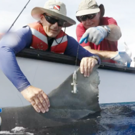
Scientists tracking tiger sharks here in Hawai‘i updated the public with their findings as part of Waikiki Aquarium’s Distinguished Lecture Series on Thursday 20 November at 7 pm in the Mamiya Theatre on Waialae Avenue; admission was free. “I’m going to be providing update on that Maui project and revealing to the public for the first time some new tiger track shark tracks for animals that we’ve tagged around O‘ahu off the North Shore over the last few weeks,” said Carl Meyer, a Hawai‘i Institute of Marine Biology (HIMB) assistant researcher. Each shark is equipped with a tracking device to study its natural behavior and movement patterns around the islands with the goal of gaining a clearer understanding circumstances bringing sharks and humans in contact.

Read more about it and watch the video at KHON2; read about it at UPI.com and UH System News (added 11-26-14) You can track the tagged animals online on PacIOOS’s Hawai‘i Tiger Shark Tracking map. Image courtesy of KHON2.

tsunami runup graphic

Hawai‘i plans for possibility of extreme tsunami

The City & County of Honolulu has updated its tsunami evacuation zone maps, adding a second extended zone in case of an extreme tsunami like the one that struck Kaua‘i about 500 years ago. “In any person’s lifetime there’s like a 5% chance this will happen, so it’s a low probability but it’s high enough that we cannot ignore it,” said Gerard Fryer, Hawai‘i Institute of Geophysics and Planetology (HIGP) affiliate faculty and geophysicist at the Pacific Tsunami Warning Center (PTWC). “As people look at the new evacuation maps they’ll see there’s much more flooding. Then they’ll realize the power of one of these waves will potentially have a much greater effect on the islands than some of the events we’ve seen,“ said HIGP director Rhett Butler, the lead author of the “monster tsunami”  paper.

Read more about it and watch the videos at KITV4 (autoplays) and Hawaii News Now. Link to draft maps and schedule of events at which representatives from the city’s Department of Emergency Management will be on hand to present the new maps, discuss the implications for O‘ahu residents, and answer questions. Also, read about the related archived news item “Evidence of ‘monster tsunami‘ found on Kaua‘i.” Image courtesy of Hawaii News Now.

Sea surface anomaly graphic

Warmest oceans ever recorded

The “Global Warming Hiatus” — a 14-year global pause in ocean surface temperature rise — may be over. “This Summer has seen the highest global mean sea surface temperatures ever recorded since their systematic measuring started. Temperatures even exceed those of the record-breaking 1998 El Niño year,” says International Pacific Research Center (IPRC) climate scientist and Oceanography professor Axel Timmermann. “From 2000–2013 the global ocean surface temperature rise paused, in spite of increasing greenhouse gas concentrations. As of April 2014 ocean warming, however, has picked up speed again.” The trend has continued into Fall, and 2014 will likely go down as the warmest year on record.

Read more about it and watch the video at KITV4 (autoplays); read more about it in UH Mānoa News, Washington Post, Science Daily, New Scientist, Quartz, and Reporting Climate Science.

smoke model image

Monitoring and forecasting air quality around Pahoa

The state Department of Health (DOH) has set up three air-quality monitoring stations to warn of potentially dangerous conditions as a result of the June 27 lava flow threatening Hawai‘i Island town of Pahoa, and is working to make data from the monitors available to the public via a website. Meanwhile, scientists in the Department of Atmospheric Sciences are putting knowledge gained from vog modeling to give Big Island residents a two-day forecast on where the smoke will most likely blow. “Essentially, we input how much burnable material there is at the front of the lava flow and that is burning and producing smoke, and we are modeling the dispersion of that smoke for the residents of the Big Island,” said professor Steven Businger.

Read more about it in West Hawaii Today, KITV4, and Liberty Voice. Image courtesy of AP/US Geological Survey.

Milton Garces was a guest on Bytemarks Cafe # 323.

Milton Garces discusses XLR8UH on Bytemarks Café

Milton Garces, Hawai‘i Institute of Geophysics and Planetology (HIGP) associate researcher and Infrasound Laboratory (ISLA) director, appeared on Bytemarks Café to talk about his Infrasound project and their participation as one of seven student and faculty research teams for the inaugural cohort of the XLR8UH Proof of Concept Center startup accelerator. The Center will harvest promising UH research, develop talented UH entrepreneurs, and connect them to a diverse network of investors and businesses in a program designed to help bring research and products out of the lab and on to the market. Successful technologies may then lead to further funding from the Upside Fund, a UH-focused seed stage venture fund based out of the University of Hawai‘i Foundation (UHF).

Listen to the broadcast on the Bytemarks archive page; read more about XLR8UH in the Pacific Business News and the UH news release.

wave buoy off Aunu'u image

PacIOOS wave buoys are serving Pacific communities

The Pacific Islands Ocean Observing System (PacIOOS) deployed a new wave buoy in the waters off Aunu‘u, American Samoa, on 23 October 2014. The bright yellow buoy is located more than three miles offshore and streams data on ocean and wave conditions. The buoy joins the existing PacIOOS network of 13 real-time wave buoys across the Pacific, providing data on wave height, direction, period, and sea surface temperature. PacIOOS deputy director Melissa Iwamoto said, “The new wave buoy in American Samoa will complement our network in the Pacific and will greatly support the decision-making of various agencies across the Pacific, including the National Weather Service (NWS) and the National Oceanographic Data Center (NODC).”

Read more about it in the UH System News.

Aloha Cabled Observatory

Task force: new ocean telecom cables should be “green”

The global system of submarine telecommunications cables that supports our connected world ignores the external ocean environment, which represents a major missed opportunity for tsunami warning and global climate monitoring, according to a recent report (PDF) by a United Nations task force. “For an additional 5-10 percent of the total cost of any new cable system deployment, we could be saving lives from tsunamis and effectively monitoring global change,” said Rhett Butler, Hawai‘i Institute of Geophysics and Planetology (HIGP) director and chair of an international committee tasked to evaluate the cable opportunity. Ocean and Resources Engineering chair Bruce Howe and Oceanography professor Doug Luther are also contributors to the report.

Read more about it and watch the video at Hawaii News Now; read more about it in Kaunānā, UH System News, West Hawaii Today, the Honolulu Star-Advertiser (subscription required), and the UH press release.

Telly Award winners

“Voice of the Sea” television series wins six Telly Awards

The Voice of the Sea television series, a signature project of the UH Sea Grant (UHSG) Center for Marine Science Education (UH CMSE), recently received six 2014 Telly Awards, including a silver Telly — the most prestigious award —  for Cultural Programming. The Telly Awards are the premier regional television awards honoring excellence in programming. Voice of the Sea promotes ongoing scientific and cultural work in the Pacific from recognized experts in a half-hour television series shown Sundays at 6:00 pm HST on KFVE (K5 The Home Team). “[It] covers topics from traditional navigation to cancer research to endangered animals,” said Kanesa Seraphin, program host and UH CMSE director. Go to the Voice of the Sea website to watch full episodes or learn more about the show.

Read more about it in the UH System News and South Seas Magazine.