satellite dish photo

New research could vastly improve weather forecasting

Groundbreaking new research at SOEST could change weather forecasting here in Hawai‘i in just a few short years by tapping into new weather satellites to provide weather info never before available. The vast ocean surrounding Hawai‘i causes a big void when it comes to land- based weather data. Scientists like Steven Businger, professor of Atmospheric Sciences, think they have an answer for that: tapping into new advanced polar orbiting satellites. Traditional geostationary weather satellites orbit about 36,000 km above the earth’s surface while polar orbiting satellites are at about 400 km, providing a much clearer weather picture.

Read more about it and watch the video at KITV4 (autoplays).
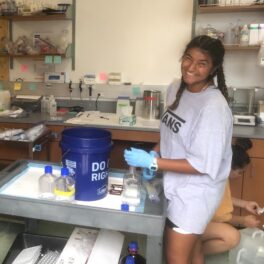
Arno Atoll, Marshall Islands.

Major Pacific coral bleaching may be worst in 20 years

Scientists warn extreme sea temperatures could cause a “historic” coral reef die-off around the world over, following a massive coral bleaching already underway in the North Pacific. A huge swathe of the Pacific has already been affected, including the Northern Marianas Islands, Guam, the Republic of the Marshall Islands, Hawai‘i, and Kiribati. Some areas have recorded serious bleaching for the first time, and experts said the coral die-off could be the worst in nearly two decades. “The worst coral bleaching event ever recorded for the Marshall Islands has been occurring since mid-September,” noted Karl Fellenius, a Majuro-based marine scientist with the University of Hawai‘i Sea Grant College Program (UHSG).

Read more about it in The Guardian, The Daily Mail, and Mashable.

coconut crab image

Giant coconut crab captured on O‘ahu

A nearly 5-pound coconut crab (Birgus latro) was captured scurrying along a busy Honolulu street, and the Hawai‘i Department of Agriculture (HDOA) is hoping it arrived alone; the last time a coconut crab was found in Hawai‘i was in 1989. The coconut crab is a type of terrestrial hermit crab native to areas throughout the Indian and central Pacific Oceans. It’s an invasive species that could cause serious harm if there are more in the state. According to Rob Toonen, associate researcher at the Hawai‘i Institute of Marine Biology (HIMB), the crustaceans can grow up to three feet in length. “Three feet is as big as a trash can. Literally, as big as a trash can,” he said. “A crab that big can do damage if it’s wandering around trying to find things to eat.”

Read more about it and watch the video at KHON2, HNGN, and the Huffington Post; read more about it in the Honolulu Star-Advertiser, Customs Today, and Perfect Science.

snailfish image

New record for deepest fish

A ghostly never-before-seen fish with wing-like fins has set a new depth record for fish. During a recent 30-day expedition aboard the Schmidt Ocean Institute (SOI)’s research vessel Falkor to the Mariana Trench in the Pacific Ocean — the deepest place on Earth — the previously-unknown snailfish was filmed several times floating along the dark sea floor, reaching a record low of 8143 meters below the surface. The unusual fish, spotted on the expedition led by Oceanography professor Jeff Drazen and Hawai‘i Institute of Geophysics and Planetology (HIGP) professor Patty Fryer, has a different body shape from other known varieties of snailfish. It boasts broad, translucent fins, stringy appendages, and an eel-like tail that allows it to glide smoothly.

Read more about it and watch the video at the Washington Post, KHON2, New Scientist, the Guardian, and io9; read more about it in the Honolulu Star-Advertiser (subscription required), UH Mānoa News, at BBC, and Hawaii News Now. Image courtesy of SOI / HADES.

photo of lava burning trees

Air quality in Pahoa monitored by temporary devices

Three temporary particulate monitors have been installed in the Pahoa area of Hawai‘i Island by the Hawai‘i State Department of Health (DOH). These devices measure air quality levels from the June 27 lava flow; the results are posted for residents to see at Clean Air Branch on the state DOH web site. The Department of Atmospheric Sciences has also developed a model to forecast the lava flow smoke in Puna as part of the Vog Measurement and Prediction Project (VMAP). Health officials recommend residents in smoke affected areas avoid outdoor activities — and anyone with respiratory illness or heart disease — along with older adults and children are urged to avoid smoke exposure.

Read more about it in Big Island Now, Hawaii News Now, and the Honolulu Star-Advertiser.

graphic of East Pacific hurricane tracks

El Niño’s fueling effect on intense hurricanes

El Niño, the abnormal warming of sea surface temperatures in the Pacific Ocean, is a well-studied tropical climate phenomenon that occurs every few years. Scientists have observed that El Niño greatly influences the yearly variations of tropical cyclones (a general term that includes hurricanes, typhoons, and cyclones) in the Pacific and Atlantic Oceans. Fei-Fei Jin and Julien Boucharel of SOEST, and I-I Lin at the National Taiwan University recently published a paper in the journal Nature that reports on their discovery of an oceanic pathway that brings El Niño’s heat into the Northeastern Pacific basin two or three seasons after its winter peak — right in time to directly fuel intense hurricanes in that region.

Read more about in the UH System News, EurekAlert!, the Honolulu Star-Advertiser (subscription required), Hawaii 24/7, Reporting Climate Science, Kaunānā, and Raising Islands.

Photo of USS Kailua's wheel

Intact “ghost ship” discovered off coast of O‘ahu

Researchers from the Hawai‘i Undersea Research Laboratory (HURL) and NOAA’s Office of National Marine Sanctuaries (NMS) have announced the discovery of an intact “ghost ship” in 2,000 feet of water nearly 20 miles off the coast of O‘ahu. Sitting upright, its solitary mast still standing and the ship’s wheel still in place, the hulk of the former cable ship Dickenson, later the USS Kailua, was found on the seabed last year on a maritime heritage submersible mission with HURL’s submersible pilot Terry Kerby. “It is always a thrill when you are closing in on a large sonar target with the Pisces submersible and you don’t know what big piece of history is going to come looming out of the dark,” said Kerby.

Read more about it and watch the video at KHON2 and Popular Mechanics; read about it in UH System News, NBC News; Honolulu Civil Beat, Kaunānā, The Guardian, Science 2.0, LiveScience, and EurekAlert!.

Image of comet dust

Comet dust found in Antarctica

Researchers have discovered comet dust preserved in the ice and snow of Antarctica, the first time such particles have been found on Earth’s surface. The discovery unlocks a promising new source of this material. The oldest astronomical particles available for study, comet dust can offer clues about how our solar system formed. Until recently, the only way scientists could collect comet dust without going to space has been by flying research planes high in the stratosphere. Hawai‘i Institute of Geophysics and Planetology (HIGP) research professor John P. Bradley is a co-author of the paper published in the journal Earth and Planetary Science Letters.

Read more about it in news.sciencemag.org and Tech Times.

Map graphic of ocean basins

Asymmetry in pattern of recent sea level change

The oceans aren’t level. Over the span of decades, atmospheric weather patterns push water around, causing sea levels in connected ocean basins to rise and fall somewhat predictably. However, since 2000 the two huge basins in the Southern Hemisphere — the Indian and the Pacific —  have broken their trend, rising jointly over 2 mm per year. A paper in Geophysical Research Letters by Philip Thompson, associate director of the UH Sea Level Center (UHSLC), and Mark Merrifield, director of UHSLC and the Joint Institute for Marine and Atmospheric Research (JIMAR), proposes that this new development, found using satellite-derived sea height data, could be due to changes in a large climate system that wraps around the entire Southern Hemisphere.

Read more about in Wired.

coral microCT scan image

Increased ocean acidity breaks down coral reefs

Coral reefs persist in a balance between construction and breakdown. As corals grow, they construct the complex calcium carbonate framework that provides habitat for fish and other reef organisms. Simultaneously, bioeroders, such as parrotfish and boring marine worms, breakdown the reef structure into rubble and the sand that nourishes our beaches. This balance is threatened by increasing atmospheric carbon dioxide, which causes ocean acidification (decreasing ocean pH). Prior research has largely focused on the negative impacts of acidification on reef growth, but new research from scientists at the Hawai‘i Institute of Marine Biology (HIMB) demonstrates that lower ocean pH also increases reef breakdown.

Read more about it and watch the video visualization at EurekAlert!; read more about in the Honolulu Star-Advertiser, Maui Times, Raising Islands, Hawaii News Now, Ka Leo, UH System News, and Nature World News.