Photo of beach narrowing at Ewa Beach

Rising seas could displace thousands of Ewa Beach residents

Two years ago, research by SOEST revealed that flooding from the combination of a one-meter rise in sea level and a hurricane or a tsunami could affect 80 percent of the economy located between Pearl Harbor and Waikiki, with the total cost of those impacts reaching into the tens of billions of dollars.

Now, as part of the statewide effort to prepare a Sea Level Rise Vulnerability Assessment and Adaptation Report (SLR report) by the end of next year, as required under 2014’s Act 83, SOEST researchers have been focusing their sea-level-rise modeling efforts on areas outside Honolulu’s urban core, looking not at tsunami or storm surge-related flooding, but that associated with groundwater inundation, coastal erosion, seasonal (non-storm) wave inundation, and a 100-year coastal flooding event. Using their modeling results, consulting and engineering firm Tetra Tech has been analyzing the potential social and economic impacts, census block by census block.

At a sea level rise vulnerability and adaptation workshop in February sponsored by the state Department of Lands and Natural Resources, the state Office of Planning, SOEST and UH Sea Grant, Tetra Tech’s Catherine “Kitty” Courtney and SOEST associate dean Chip Fletcher provided a sobering glimpse of what could be in store for O‘ahu’s Ewa Beach, which already has a narrow, chronically eroding shoreline.

Read more about it in the Honolulu Civil Beat.

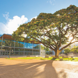
POST Building

News conference on POST lab explosion

The University of Hawaiʻi at Mānoa held a news conference to discuss the explosion that occurred in a laboratory at the Pacific Ocean Science and Technology Building on March 16. Speaking at the March 17 news conference was UH Mānoa Chancellor Robert Bley-Vroman, School of Ocean and Earth Science and Technology Dean Brian Taylor and Environmental Health and Safety Director Roy Takekawa.

At the news conference Taylor announced that a structural engineer had confirmed that the building was sound and would be reopened. Watch the video at the UH System News.

Pisces retrieves I-400 bell

HURL research vessels retrieve historic bell off sunken sub

It was a small brass bell on a giant Japanese submarine — the I-400. The World War II vessel was large enough for a crew of 144 and three planes to boot. The year was 1946 when the U.S. captured the sub and then torpedoed it to keep its secrets out of Russian hands.

Re-discovered three years ago by the crew of the Hawai‘i Undersea Research Laboratory (HURL), the little bell sat in waters more than 2,000 feet deep until the Bowfin Museum secured the proper permits for its retrieval. “We located this bell and we got to talking about the fact that this bell should really be in a museum in all to see. When we are down on the wrecks that we find, it really connects you,” said HURL pilot Terry Kerby.

Read more about it — including how HURL’s two Pisces submersibles retrieved the bell by working together — in the UH System News, at Live Science, and at New Historian; watch the video report at KITV4.

UPDATE: Read and watch the KITV4 report about the postponed HURL mission to the South China Sea.

Oahu North Shore erosion image

NOAA awards UH Sea Grant over $800K for coastal hazard preparedness

To help Hawai‘i communities reduce their vulnerability to natural hazards and climate change, NOAA’s National Ocean Service has awarded the University of Hawai‘i Sea Grant College Program (Hawai‘i Sea Grant) $845,160 in grant funding through the Regional Coastal Resilience Grants Program.

Hawai‘i is particularly vulnerable to coastal hazards. Since the state is heavily reliant on tourism, and most of the development and infrastructure in Hawai‘i are concentrated on or near the coast, it is highly susceptible to flooding, coastal erosion, sea-level rise and coastal disasters. The project, titled “Building Resilience to Coastal Hazards and Climate Change in Hawai‘i,” aims to address these critical issues and increase the state’s resilience to coastal hazards and the impacts from climate change.

Read more about it in the UH System News, KNON2, Ka Leo, and Big Island Now.

Photo of Azura wave energy device

Ocean energy projects key to getting Hawaii to 100% renewable

Wave energy and ocean thermal energy conversion, or OTEC, are two of the renewable energy resources that Hawai‘i will need to explore to bring the state closer to its 100 percent renewable energy goal by 2045, the head of the state’s Energy Office told PBN.

The Hawaii Natural Energy Institute (HNEI) is actively involved with the wave energy projects in the state, namely, the projects located offshore from the Marine Corps Base Hawai‘i in Kāne‘ohe in Windward O‘ahu.

“Those projects are expanding in their size and capacity,” Mark Glick, administrator for the state Energy Office, said. “We are eagerly watching to see if wave energy can be scalable. We will learn a lot about this in 2016–17.”

Read more about it in the Pacific Business News.

Photo of Hawaii drought

El Niño brings record low rainfall to state

Winter is supposed to be the wet season in Hawai‘i, but so far this year, that hasn’t been the case. All the islands are “abnormally dry,” according to the United States Drought Monitor, which also says the leeward areas of Kaua‘i, Maui County and the Big Island are under moderate drought. And the leeward Haleakala slopes on Maui from Kihei to Wailea are already in severe drought.

It’s a reversal from our wet summer, when Diamond Head was lush and green in September.

State climatologist and Atmospheric Sciences (ATMO) professor Pao-Shin Chu has the data to prove this is an El Niño year. Chu said the pattern follows a typical El Niño year, which also brought a record number of tropical cyclones in the Central Pacific. It also brought huge north shore swells, including the one that brought the Eddie Aikau big wave surf competition.

Read more about it and watch the video report at Hawaii News Now.

HI-SEAS crewmember image

Space simulation crew hits halfway mark and sets sights on August re-entry

The six crew members of the fourth Hawaiʻi Space Exploration Analog and Simulation (HI-SEAS) have spent more than six months of their 12-month mission in a solar-powered dome on the slopes of Mauna Loa on Hawai‘i Island. The crew has been living in isolation as part of a UH Mānoa research project simulating long-duration space travel.

“It’s fun to know you’ve made it halfway,” said crewmember Tristan Bassingthwaighte. The doctor of architecture candidate at UH Mānoa said, “Getting halfway is a great validation in the work you’re doing for yourself, academically or just personally. You also find you’re listening to Life on Mars by David Bowie a lot more often.”

This fourth mission is the longest in HI-SEAS history, and will end in August 2016. As with the previous two missions in the NASA funded study, the current mission is focused on crewmember cohesion and performance.

Principal investigator Kim Binsted is co-investigator at the UH-NASA Astrobiology Institute (UHNAI), professor of Information and Computer Sciences (ICS), and graduate student in Geology and Geophysics (G&G).

Read more about it and watch the video report at Kaunānā.

Photo of damage to Kamehameha Highway.

Contraflow to last another week as crews shore up crumbling highway

North Shore residents will have to endure at least another week of contraflow on Kamehameha Highway in Ka‘a‘awa on the island of O‘ahu, after another section of the road crumbled into the ocean. Repairs begin Tuesday 01 March, and will last for about a week, with work from 7 am – 6 pm daily.

The state says work taking place this week is just a temporary fix, and will continue to work on a long-term solution to prevent further coastal erosion. The problem is, those improvements won’t start until 2017 while Chip Fletcher (professor of Geology & Geophysics and SOEST Associate Dean for Academic Affairs) and Panos Prevedouros (professor of Civil Engineering) say the HDOT needs to act fast.

Fletcher says Ka‘a‘awa has had an erosion problem for at least 25 years, but blames the seasons especially strong surf as the reason for why the shoulder lane crumbled. “I’m not surprised the road is undercut. I actually thought it would have happened awhile ago,” he said.

“This erosion is likely to continue as long as we continue to have north waves in the winter time wrapping into that area. Once the trade winds come back — we’ve had a winter of very low trade winds so far this year — once the trade winds kick in again, which they may do any week now, they are going to exacerbate the erosion problem”, Fletcher continued.

Read more about it and watch the video report at KHON2, and see the follow-up report also at KNON2.

Plankton (credit: Christian Sardet/Tara Oceans/CNRS Phototheque)

Plankton network linked to ocean’s biological carbon pump revealed

The biological carbon pump is the process by which carbon dioxide (CO2) is transformed to organic carbon via photosynthesis, exported from the surface ocean as sinking particles and finally sequestered in the deep sea. While the intensity of the pump is directly correlated to the abundance of certain plankton species—free-floating micro-organisms—the underlying ecosystem structure driving the process has remained poorly understood.

By analyzing samples collected by the Tara Oceans expedition (2009–2013), an interdisciplinary team of biologists, computer scientists and oceanographers, led by Lionel Guidi, affiliated researcher of Oceanography and CNRS researcher at Laboratoire d’Océanographie de Villefranche (France), has shed new light on these microbes, their interactions and the main functions associated with the biological pump in nutrient-poor ocean regions—areas which represent more than 70 percent of the surface ocean. One future objective for the team is to repeat this work for nutrient-rich oceanic regions, to determine whether the planktonic networks are different in various marine environments.

The ocean is the largest carbon sink on the planet. The recent findings will enable researchers to better understand the sensitivity of this network to a changing ocean and to better predict the effects that climate change will have on the functioning of the biological carbon pump, which is a key process for removing carbon from the atmosphere and sequestering it into the deep sea at global scale. This work highlights the important role played by plankton in the climate system.

Read more about it in the UH System News.

Photo of Daini Katsu Maru

Fishing boat set adrift by 2011 Japan tsunami going home

A Japanese fishing boat that was washed out to see during the 2011 Japan tsunami and made its way to O‘ahu’s Alan Davis Beach in April 2015 is finally making the journey home. Experts say the Daini Katsu Maru drifted 5,000 miles following Japan’s devastating earthquake and tsunami in March 2011, which killed more than 15,000 people and destroyed entire villages. On Saturday, efforts to return the 20-foot long boat got underway at Honolulu Harbor.

DLNR has been working with the Japanese government in coordinating the boats return. Researchers at the University of Hawai‘i believe the boat drifted eastward for two years before getting caught up in the so-called North Pacific Garbage Patch. “Later, when right conditions came, wind and current conditions, it was washed on O‘ahu,” said Nikolai Maximenko, senior researcher at International Pacific Research Center (IPRC).

Read more about it and watch the video report at Hawaii News Now.