Asian dust transport over N Pacific. Credit: NASA; Robert Simmon, Arlindo da Silva, Peter Colarco.

Climate modulates fertilization of North Pacific Ocean with Asian dust

The vast subtropical “gyres” – large systems of rotating currents in the middle of the oceans – cover 40 percent of the Earth’s surface and have long been considered biological deserts with stratified waters that contain very little nutrients to sustain life. These regions also are thought to be remarkably stable, yet scientists have observed the region’s chemistry changes periodically, especially levels of phosphorous and iron, affecting the overall nutrient composition and ultimately its biological productivity.

In a new study published in Proceedings of the National Academy of Sciences, researchers from the University of Hawai‘i (UH) at Mānoa, Oregon State University (OSU) and elsewhere, documented what induces these variations: changes in the amount of iron that is deposited into the ocean via dust from Asia.

The study, led by Ricardo Letelier at OSU and David Karl with the UH Mānoa Center for Microbial Oceanography: Research and Education, used three decades of observation data from the Hawai‘i Ocean Time-series (HOT) program, which is based at UH Mānoa and funded by the National Science Foundation.

“We now know that these areas that were thought to be barren and stable are actually quite dynamic,” said Letelier. “Since these areas cover so much of the Earth’s surface, we need to know more about how they work in order to better predict how the system will respond to climate variations in the future.”

Both phosphorous and iron are key components for life and the researchers noticed that the levels of those nutrients in North Pacific gyre surface waters changed significantly during the three decades of the study.

The team was able to relate these changes to the iron input from Asian dust – a combination of the desertification of that continent, with combustion, especially wildfires and factory output and the wind patterns across the North Pacific Ocean – that accounted for the variance and provided varying amounts of nutrients to sustain life.

And a key to that variance is the Pacific Decadal Oscillation, an ocean-atmosphere relationship that varies between weak and strong phases of atmospheric pressure in the northeast Pacific.  In years when the low pressure weakens, winds from Asia become stronger, move more southward, and bring more dust, fertilizing the ocean surrounding Station ALOHA, the open ocean field station of the HOT program. When the pressure strengthens, the opposite takes place.

Strong winds can bring significant amounts of iron, allowing organisms to grow and utilize all the phosphorus in the upper layers of the ocean. However, because most of the iron is not soluble, deep waters are enriched in phosphorus relative to iron.  Hence, when winds are weaker, there is little iron input to fertilize and remove any excess phosphorus in the upper layers that may be introduced through deep water mixing.

As the Artic warms, the scientists say they expect to see long-term changes in wind patterns across the North Pacific. In addition, the evolution of land use and pollution driven by anthropogenic activity in Asia will affect the sources and magnitude of iron and other nutrients carried by wind across the ocean.

How these changes will affect the transport of iron-rich dust into the eastern Pacific and affect the productivity in this vast oceanic region remains an open question.

In addition to Karl, UH Mānoa researchers Karin Bjorkman, Niklas Schneider and Angelicque White are co-authors on this study.

Read more on Eurekalert.

News | Posted on
Ocean Life Climate Atmosphere Earth
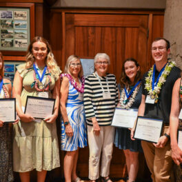
2019 ARCS Scholars, from left, Sarah Tucker, Evan Kawamura, Luke Campillo, Shayle Matsuda, Evan Lechner, Lauren Ward, Christopher Light, David Webb, Ashley Chontos, Brennan Yamamoto, Alina Pang, Jessie Kai and Chantell Balaan.

SOEST graduate students recognized by ARCS Foundation

Several other University of Hawaiʻi at Mānoa graduate students received ARCS Scholar Awards at the ARCS Foundation Honolulu Chapter’s recent year-end banquet.

ARCS, which stands for Achievement Rewards for College Scientists, is dedicated to keeping the U.S.competitive in STEM fields. The organization annually awards $5,000 grants to outstanding UH doctoral students who demonstrate potential for expanding knowledge and applying technological solutions.

Lauren Ward, an earthquake modeler in the SOEST Department of Earth Sciences, received the Toby Lee ARCS Award in Earth Sciences and the additional $1,000 ARCS Scholar of the Year Award for her efforts to refine simulations of the San Andreas Fault System and its crustal deformation response to the earthquake cycle. Her work may improve seismic hazard estimates for complex fault systems.

Evan LechnerARCS Farrar Award in Oceanography
Lechner examines the movement of carbon and oxygen into and out of estuary systems, with the goal of creating more resiliency for sustainable coastal initiatives. He is tracking changes in HeʻeiaFishpond as restoration efforts replace invasives, such as mangrove, with native species.

Shayle MatsudaARCS Honolulu Award in Coral Reef Science
Matsuda studies the algae and bacterial communities that corals select as symbiotic partners. Identifying patterns in the microbial structure and community composition, which can differ across coral colonies, may help to identify mechanisms that could make corals more resistant to stress, thus more likely to survive climate change. The award was designated in memory of the late groundbreaking UH coral reef scientist Ruth Gates, who was Matsuda’s advisor.

Sarah Tucker, Maybelle Roth ARCS Award in Conservation Biology
Tucker uses genetic tools to examine the ecological roles of three marine bacteria, including one that produces the oxygen in one of every five breaths humans take. Tucker considers both abiotic (such as rainfall, acidity and nutrients) and biotic (such as predation) environmental drivers.

One of 15 ARCS Foundation Inc. chapters nationwide, the Honolulu chapter has awarded close to $2 million in unrestricted awards to about 600 UH Mānoa graduate students since 1974.

Read more on UH News.

GES graduates focus on sustainability and stewardship in Hawai‘i

Three recent graduates of the Global Environmental Science (GES) Bachelor of Science degree program in the University of Hawai‘i at Mānoa School of Ocean and Earth Science and Technology (SOEST) demonstrate stewardship as they work toward a healthy and sustainable Hawai‘i.

When Honour Shore Ai Lin Booth began surfing regularly as a teenager, her mother always reminded her to use sunscreen, and she would argue that sunscreen was putting chemicals into the environment. The question of how much sunscreen actually goes into the environment remained with her into college. This question inspired her to develop her research project with mentor, Professor Philip Williams in the UH Mānoa Department of Chemistry. Since entering UH Mānoa and the GES program in the fall of 2016, Honour has been on the Dean’s List, received various scholarships, and attended conferences including the International Coral Reef Symposium. In addition, Honour was selected as a Peter J. Rappa Sustainable Coastal Development Fellow, which gave her the opportunity to work with the City & County of Honolulu Office of Climate Change, Sustainability and Resiliency, an achievement of which she is most proud. This spring, Honour graduated with a Bachelor of Art degree in Chemistry. Honour was born and raised in Honolulu, Hawai‘i.

Noʻeau Machado knew the GES program was perfect for him as soon as he read about it. The program allowed him tailor his curriculum to study the environment, sustainability, and science, and also Hawaiian culture and sustainable food production systems. He wanted a research project which allowed him to give back directly to Hawaiʻi. Noʻeau chose a research project at Heʻeia Fishpond under the mentorship of oceanography Associate Professor Rosie Alegado, whom he deeply respects. Since entering UH Mānoa and the GES program in the fall of 2015, Noʻeau has consistently been on the Dean’s List and has been a recipient of various scholarly awards, including the ʻŌiwi Distinguished Scholars Award and ʻOiwi Undergraduate Research Fellowship, both from the Lāhui Hawaiʻi Research Center. Noʻeau was born and raised in Kāneʻohe, Hawai‘i.

Cuong Tran was admitted to UH Mānoa in the fall of 2015, and decided to transfer to the GES program after participating in a service project trip to Molokai in the spring of 2016, where he rediscovered his passion for environment conservation. Cuong has always enjoyed going to the beach. Baby Beach in his hometown of Lāhainā is his “happy place”, a place to think, reflect, and get inspired. A family tragedy along this very beach propelled him into researching anthropogenic climate change, which affects shoreline communities. Cuong conducted his research with earth sciences professor and SOEST Associate Dean and Professor Chip Fletcher. Cuong is consistently on the Dean’s List and recipient of multiple scholarships and awards, including the NOAA Ernest F. Hollings Scholarship and National Science Foundation Graduate Research Fellowship. He is an active member of honor societies on campus and has participated in several conferences. Cuong was selected as a student marshal to represent and lead the SOEST graduating class in the 108thAnnual Commencement Exercises. Cuong was born in Ho Chi Minh City, Vietnam, and raised in Lāhainā, HI.

The GES program trains passionate and high-quality students to be knowledgeable in Earth-system science and to think creatively about the challenges facing communities and natural resources now and in the future.  As a GES degree requirement, each student is guided by a faculty mentor and performs original scientific research, writes a research thesis and presents their findings publicly. Mentors include SOEST faculty, global leaders in the fields of ocean, earth and space science, as well as technology. Throughout the GES degree program, students are engaged in fieldwork, laboratory work, and field trips, and have access to deep ocean and coastal research vessels, SOEST’s world-class Hawai‘i Institute of Marine Biology, and an active volcano.

Read also on UH News.

Hurricane Lane 2018 (Credit: NOAA)

Forecasters predict busy 2019 hurricane season

During a press conference held at SOEST, the National Weather Service Honolulu Forecast Office released its annual forecast for the upcoming hurricane season and now is the time to start preparing for the upcoming months.

Forecasters predict this season will have a 70 percent chance of being a higher than normal season with the likelihood of five to eight tropical cyclones in the Central Pacific. These include tropical depressions, tropical storms and hurricanes.

“This outlook reflects the forecast for El Niño to likely continue through the hurricane season. Also, ocean temperatures in the main hurricane formation region are expected to remain above-average, and vertical wind shear is predicted to be weaker-than-average,” said Gerry Bell, NOAA’s lead seasonal hurricane forecaster at the Climate Prediction Center, which collaborated on this outlook. Bell added, “All of these conditions point to an above-normal season.”

Hurricane season in Hawaiʻi occurs roughly between June 1 and November 30.

Last year, Hurricane Lane dumped up to 50 inches of rain and caused damage to parts of Hawaiʻi Island and Maui. University of Hawaiʻi campuses were forced to close.

“As we prepare for another active hurricane season in the central Pacific, we urge everyone to have an emergency plan now, so that you are ready for the devastating impacts that a tropical cyclone could bring to the State of Hawaiʻi,” said Chris Brenchley, director of NOAA’s Central Pacific Hurricane Center. “It is essential that you know where and how to get official information, even in the event of a power failure, and that you have your emergency supply kit ready well before any storms threaten.”

Prepare you home and family

The Hawaiʻi Sea Grant publication, Homeowner’s Handbook to Prepare for Natural Hazards,  provides useful tips regarding readiness for natural hazards that may affect Hawai’i.

The Hawaiʻi Emergency Management Agency has great tips and resources to Prepare Your Family and Prepare Your Home.

Sign up for alerts

All members of the UH community are urged to sign up for UH Alert to receive emergency text alerts. If you have already signed up, log in to ensure that contact information is up-to-date.

There is the Pacific Disaster Center’s Disaster Alert desktop version and app (iOS version available at iTunes) with updated information.

Notifications affecting UH campuses will be posted on the emergency information webpage, as well as on social media:

For more, visit the UH emergency information website.

Ebeye Island in the Kwajalein Atoll, Marshall Islands. Credit: NASA

Ebeye’s Challenge, Hawaiʻi’s Lessons

Hawaii Public Radio (HPR) interviewed SOEST associate dean and geologist Chip Fletcher, who is also the vice-chair of the Honolulu Climate Change Commission, after his recent visit to the Third National Dialog on Climate Change in the Republic of the Marshall Islands. Fletcher delivered the keynote address during the conference held on Ebeye, an islet in the Kwajalein Atoll, Marshall Islands. The options the Marshallese community face could be considered in adaptation planning in Hawai‘i.

Below is an excerpt from the HPR story.


Kwajalein Atoll consists of a ring of reef islets around a large central lagoon. Several of those islets house U.S. military installations and most local residents who service those installations live on Ebeye.

Fletcher says Ebeye’s over 13 ,000 people live on one square mile of a low sand and gravel island that has an average elevation less than two meters above sea level.

“This is one of the most vulnerable populations in the country, if not the world.”

On Ebeye there are only 4-6 blocks between the lagoon and the ocean.  Fletcher was there as the country considers its options against continual flooding and sea level rise:  build walls, or elevate the land.  World Bank officials were there assessing public opinion on a planned wall, six feet or more above street level.

The effect on culture and daily life would be drastic, Fletcher says, “You’d be living in this town, and if you look to the ocean, you’d see the back of a wall.”

The wall will cut air circulation, and destroy the view, but Fletcher points out that continual erosion has to be stopped, and repeated wave inundation must be mitigated especially with the threat of hurricanes.

As Ebeye islanders cope with frequent flooding, and infrastructure breakdowns, a crisis seems near.  Still, Fletcher is wary of simple-sounding solutions.

“I have to admit that maybe the wall is a trap.  Thinking that building this wall is a solution…it’s very simplistic thinking to a problem that’s extremely complex when you look at the socio-economic, the social justice, the cultural, the health elements of all this.

In 1956, the U.S. Atomic Energy Commission called the Marshall Islands “by far the most contaminated place in the world.” Overcrowded Ebeye has been called the “Slum of the Pacific,” and one major daily chore is finding clean water.

“So is the solution, instead, maybe new building codes?” Asks Fletcher. ”And if you were to implement new building codes, it would be an opportunity to give these folks real houses and real infrastructure.”

Fletcher is interested in leveraging climate mitigation to create better communities.

He says, “The takeaway for Hawai‘i is, Let’s think very comprehensively about our adaptation steps in the very earliest stages and the only way to do that is for everybody to be well informed.”

* * *

A global youth climate strike is set for May 24, Friday, with over 13 hundred cities around the world participating.  Honolulu’s action will start at 4pm at the corner of Fort Street and Beretania, then proceed to the waterfront.  More about the world wide efforts can be found at Fridays for Future and Climate Strike.

Listen to the interview on HPR.


News | Posted on
Ocean Life Climate Atmosphere Earth
Voice of the Sea title superimposed on kalo (taro) field

Voice of the Sea wins five Telly Awards out of record-shattering number of entries

The University of Hawai‘i Sea Grant College Program (Hawai‘i Sea Grant) is proud to announce that, out of 12,000 entries received from all 50 states and 5 continents, our Voice of the Sea television series has received five 2019 Telly Awards for episodes focused on environmental and cultural issues in Hawai‘i.

Voice of the Sea won two bronze Telly awards in the Educational Institution category for “Designing Future Coastal Communities” and “Visiting the Hawai‘i Institute of Marine Biology.” These episodes highlight the University of Hawai‘i at Mānoa’s School of Architecture and the Hawai‘i Institute of Marine Biology. Both episodes delve into the cutting-edge work the university is doing to understand sustainability, community resilience, and tropical marine ecosystems.

Voice of the Sea also won two bronze awards for “Adapting Culture to Climate Change” and “Hidden Benefits of Farming Kalo” in the Cultural category. These episodes explore how cultural practitioners, university faculty, community members, and non-profit organizations are working together to understand the changes in our environment, and how centuries-old traditions are critical to optimizing today’s food production and water quality.

Lastly, Voice of the Sea won a bronze award for “Water Resources Research” in the Education category. The episode features the Water Resources Research Center at the University of Hawai‘i, and how its research is furthering our understanding of the unique water and wastewater management issues in Hawai‘i and the Pacific.

This Saturday and Sunday, May 25 and 26, Voice of the Sea will highlight EXPORTS (EXport Processes in the Ocean from Remote Sensing) researcher Dr. Brian Popp, an oceanographer with the University of Hawai‘i, along with 100s of colleagues from more than 20 institutions across the country.

EXPORTS is an epic research project funded by NASA and the National Science Foundation to study the ocean’s carbon cycle. The aim of the research is to understand how carbon moves from the atmosphere to the deep ocean in order to more accurately predict future climate conditions.

“The carbon humans are putting into the atmosphere is warming Earth,” Mike Sieracki, program director in the National Science Foundation’s Division of Ocean Sciences, noted in a NASA press release. “Much of that carbon eventually finds its way into the ocean and is transported to the deep ocean, where it is sequestered and will not return to the atmosphere for a long time. This project will help us understand the biological and chemical processes that remove the carbon, and establish a foundation for monitoring these processes as the climate changes.”

Planning for the expedition has taken over a decade to coordinate scientists, satellites, remote underwater vehicles, and two research vessels. The School of Ocean and Earth Science and Technology’s (SOEST) Dr. Popp is leading one of the expedition’s projects, in collaboration with former SOEST Young Investigator Hilary Close, now a professor at the University of Miami.

To watch the 30-sec Promo of the episode visit vimeo.com/330700174  or https://youtu.be/AKPl_QHEKyw. To learn more about EXPORTS and view the first EXPORTS episode which premiered in April, visit http://seagrant.soest.hawaii.edu/exports-sally-ride/

Voice of the Sea airs on TV Saturdays at 4:00 pm and Sundays at 5:30 pm, on K5 The Home Team (KFVE). It is a signature project of the University of Hawai‘i Sea Grant Center for Marine Science Education. To watch full episodes or learn more about Voice of the Sea visit voiceofthesea.org.

The Telly Awards were established in 1979 to honor excellence and support creativity in local, regional, and cable TV programming. Sabrina Dridje, managing director of the Telly Awards noted in a release “With record-shattering number of entries, this year’s Telly Award entrants truly represent the most innovative video and television work being made for all screens.”

News | Posted on
Ocean Life Climate Energy Atmosphere Earth
A new ocean acidification monitoring station was successfully deployed in Fagatele Bay, American Samoa. Credit: PacIOOS.

New ocean acidification monitoring station in American Samoa

NOAA, the Pacific Islands Ocean Observing System (PacIOOS), and partners have launched a new buoy in Fagatele Bay within the National Marine Sanctuary of American Samoa to measure carbon dioxide and other important seawater characteristics within the bay’s vibrant tropical coral reef ecosystem.

“This new monitoring effort in a remote area of the Pacific Ocean will not only advance our understanding of changing ocean chemistry but will also help us communicate these changes to diverse stakeholders in the Pacific Islands and across the United States,” said Derek Manzello, coral ecologist with NOAA’s Atlantic Oceanographic and Meteorological Laboratory.

Fagatele Bay is home to more than 160 species of coral, as well as giant clams, fish, dolphins, and the critically endangered hawksbill sea turtle. Coral reefs and shellfish are particularly vulnerable to the impacts of increasing carbon dioxide in our ocean. As the ocean absorbs carbon dioxide from the atmosphere, the acidity of seawater increases. This is known as ocean acidification, which can threaten the ability of shellfish and corals to build their skeletons, hamper new coral growth and accelerate reef erosion. The loss of coral reefs impacts local economies, affects the health of fisheries and tourism, and exposes coastal communities to increased storm surge.

“PacIOOS is excited to collaborate with NOAA and many local resource management agencies to implement this valuable ocean observing asset in the Pacific Islands region” said Chip Young, PacIOOS Operations Coordinator. “This new buoy site in the Southern Hemisphere will support the ongoing coral reef research being conducted by NOAA and other agencies in the region with near real-time observations, and complement two similar existing coral reef monitoring sites in Kāneʻohe Bay and on the South Shore of O‘ahu, Hawai‘i.”

The buoy measures carbon dioxide in the atmosphere as well as seawater measurements of carbon dioxide, temperature, salinity, pH, dissolved oxygen, turbidity, and chlorophyll. All data can be viewed online on the PMEL and PacIOOS websites.

“Each buoy is unique based on the location and partners involved,” said Adrienne Sutton, oceanographer at NOAA’s Pacific Marine Environmental Lab who oversees NOAA’s ocean acidification mooring network. “It takes a whole village to create and manage an ocean acidification observing site like this.”

Partners in the project include the National Park of American Samoa, Department of Marine and Wildlife Resources of American Samoa, Coral Reef Advisory Group of American Samoa, Pacific Islands Ocean Observing System (PacIOOS) and NOAA’s Ocean Acidification Program, Pacific Marine Environmental Laboratory, Atlantic Oceanographic and Meteorological Laboratory, Coral Reef Conservation Program, Pacific Islands Fisheries Science Center, and National Marine Sanctuary of American Samoa.

PacIOOS redeployed its wave buoy off Tanapag, Saipan.

Recovered wave buoy back providing critical data for ocean users

On May 10, 2019, the Pacific Islands Ocean Observing System (PacIOOS) based at the University of Hawaiʻi at Mānoa School of Ocean and Earth Science and Technology redeployed its wave buoy outside of Tanapag, Saipan, after it broke free from its mooring during Super Typhoon Yutu in October 2018.

The wave buoy was adrift for more than six weeks. In December 2018, approximately 800 nautical miles into the Philippine Sea, the U.S. Coast Guard Cutter Sequoia, stationed in Guam, recovered the buoy in challenging ocean conditions while patrolling the high seas,

The yellow wave buoy provides valuable wave and ocean information. Data on wave height, direction and period, as well as sea surface temperature, are transmitted in real-time and are publicly available online.

“We are so grateful for the U.S. Coast Guard’s support and effort to recover the drifting wave buoy. Without their partnership, we would have lost this important ocean observing instrument,” said PacIOOSDirector Melissa Iwamoto. “The buoy is now back on station and we are excited to continue to provide high-quality data to our stakeholders in Saipan and the region.”

The Tanapag wave buoy is one of three PacIOOS wave buoys in the Mariana Islands; the other two are located off Ritidian Point and Ipan in Guam. Wave buoy data benefit a large variety of ocean users, agency officials and community members to make safe decisions. Fishermen, surfers, commercial tour operators and many others regularly check the data to get a better understanding of the ocean conditions.

Read the full story on the PacIOOS website.

Learn more about the other PacIOOS wave buoys deployed around the Pacific.

Photo of Earth's Moon

Water formation on the Moon demonstrated by UH Mānoa scientists

For the first time, a cross-disciplinary study has shown chemical, physical, and material evidence for water formation on the Moon. Two teams from the University of Hawaiʻi at Mānoa collaborated on the project: physical chemists at the UH Mānoa Department of Chemistry’s W.M. Keck Research Laboratory in Astrochemistry and planetary scientists at the Hawaiʻi Institute of Geophysics and Planetology (HIGP) in SOEST.

Although recent discoveries by orbiting spacecraft such as the Lunar Prospector and the hard lander Lunar Crater Observation and Sensing Satellite suggest the existence of water ice at the poles the Moon, the origin of this water has remained uncertain. Lunar water represents one of the key requirements for permanent colonization of the Moon as a feedstock for fuel and energy generation (hydrogen, oxygen) and also as “drinking water.”

The breakthrough research is outlined in “Untangling the formation and liberation of water in the lunar regolith,” lead-authored by UH Mānoa postdoctoral fellow Cheng Zhu and colleagues in the Proceedings of the National Academy of Sciences.

Chemistry Professor Ralf I. Kaiser and HIGP’s Jeffrey Gillis-Davis designed the experiments to test the synergy between hydrogen protons from solar wind, lunar minerals and micrometeorite impacts. Zhu irradiated samples of olivine, a dry mineral that serves as a surrogate of lunar material, with deuterium ions as a proxy for solar wind protons.

Deuterium irradiated only “experiments did not reveal any trace of water formation, even after increasing the temperature to lunar mid-latitude daytime temperatures,” Zhu explained. “But when we warmed the sample, we detected molecular deuterium, suggesting that deuterium—or hydrogen—implanted from the solar wind can be stored in the lunar rock.”

Kaiser added, “Therefore, another high-energy source might be necessary to trigger water formation within the Moon’s minerals followed by its release as a gas that can be detected.”

The second set of deuterium irradiation experiments was followed by laser heating to simulate the thermal effects of micrometeorite impacts. A burst of ions with mass-to-charge ratios matching that of singly ionized heavy water was observed in the gas phase during the laser pulses. “Water continued to be produced during laser pulses after the temperature was increased, suggesting that the olivine was storing precursors to heavy water that were released by laser heating,” said Zhu.

To image these processes and interpret the broader impact on the Moon and other bodies, HIGP’s Hope Ishii and John Bradley used focused ion beam–scanning electron microscopy and transmission electron microscopy in the Advanced Electron Microscopy Center. They observed sub-micrometer-sized surface pits, some partially covered by lids, suggesting that water vapor builds up under the surface in vesicles until they burst, releasing water from lunar silicates upon micrometeorite impact.

“Overall, this study advances our understanding on the origin of water as detected on the Moon and other airless bodies in our Solar System such as Mercury and asteroids and provides, for the first time, a scientifically sound and proven mechanism of water formation,” HIGP’s Gillis-Davis concluded.

UPDATE: Read HIGP planetary scientist Paul Lucey’s comments on lunar ice and future research in Scientific American.


Left to right: Don Walsh, Patricia Fryer, Steve Chappell, Victor Vescovo. Photo credit: Paul-Henri Nargeolet.

SOEST geologist Patricia Fryer advises expedition to world’s deepest ocean

Patricia Fryer, professor in the Hawaii Institute of Geophysics and Planetology, participated as science advisor for the recent Mariana Trench expedition led by extreme explorer Victor Vescovo. During the expedition, which ended on May 9, 2019, the submersible DSV Limiting Factor dove four times in the Challenger Deep area, reaching the greatest depth record, and once in the Sirena Deep, the second deepest part of the Mariana Trench.

Fryer, who is also an alumni of the SOEST Department of Earth Sciences (formerly Department of Geology and Geophysics), was requested on this expedition for her expertise in the Mariana Trench. She was there when first remotely-operated vehicle from the United States dove to the Challenger Deep in 2009. And Fryer was a member of the expedition in 2012 during which James Cameron became the first person to complete a solo dive to the deepest place on Earth to date.

“Being a part of this recent expedition was thrilling!” said Fryer. “This exemplifies the incredible, incremental advances we are making as a scientific community in looking at the world’s deepest ocean.”

The Limiting Factor was designed and built by Triton Submersibles, for Vescovo’s Five Deeps Expedition with the goal of reaching the deepest point in each of Earth’s five oceans. As the only submersible certified to dive to unlimited ocean depth, the Limiting Factor dove in the Puerto Rico Trench in the Atlantic, the South Sandwich Trench in the Southern Ocean, the Java Trench in the Indian Ocean and most recently the Challenger Deep in the Pacific. The Molloy Deep in the Arctic is the last of the remaining dives to complete the Five Deeps Expedition goal.

Vescovo brought back sediment and a couple of rocks from the Sirena Deep that Fryer is examining at UH Mānoa. First, Fryer will image the surface of rocks with a scanning electron microscope to assess the microbial and other seafloor creatures than may exist on the rocks and exposed portions of the mantle in this area. Next, she will make extraordinarily thin slices of the rocks to identify the minerals present and the texture of the rocks. Depending on what she finds there, Fryer may learn more about the mantle’s stress history in this geologically active area.

One thing that is clear, is in terms of how rocks are altered in the deep sea, microbial and geochemical activity are intimately linked. Fryer is interested in understanding the limits and origins of life and what factors influence it. The Limiting Factor submersible will be made available for future dives and will open a new era of hadal marine discovery.

The Five Deeps Expedition is being filmed by Atlantic Productions for a five-part Discovery Channel documentary series due to air in late 2019.

Read more on BBC, The Washington Post and Independent.