


As sea level rises, much of Honolulu and Waikiki vulnerable to groundwater inundation
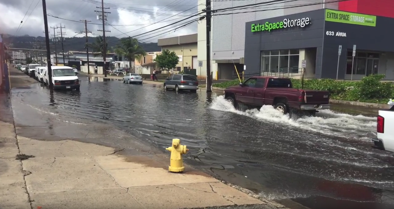 Street flooding in Honolulu
 New research reveals a large part of the the heavily urbanized area of Honolulu and Waikīkī is at risk of groundwater inundation—flooding that occurs as groundwater is lifted above the ground surface due to sea level rise. Shellie Habel, lead author of the study and doctoral student in the Department of Geology and Geophysics (G&G) and colleagues developed a computer model that combines ground elevation, groundwater location, monitoring data, estimates of tidal influence and numerical groundwater-flow modeling to simulate future flood scenarios in the urban core as sea level rises three feet, as is projected for this century under certain climate change scenarios.
“This flooding will threaten $5 billion of taxable real estate; flood nearly 30 miles of roadway; and impact pedestrians, commercial and recreation activities, tourism, transportation and infrastructure,” said Habel. “The flooding will occur regardless of seawall construction, and thus will require innovative planning and intensive engineering efforts to accommodate standing water in the streets.”
“We’re talking about new wetlands forming in our urban core, and it’s all driven by sea-level rise,” said co-author Charles “Chip” Fletcher, G&G professor and SOEST Associate Dean of Academic Affairs.
The study not only found the water table already close to the ground surface — within 2 feet at high tide in many places — but 86 percent of the 256 active cesspools in the study area are already likely flooded by groundwater.
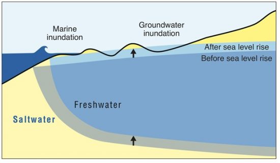
Sea level rise lifts freshwater, causing groundwater inundation in low-lying areas. Image courtesy of UH Mānoa Coastal Geology Group and Nancy Hulbirt.
Coastal geologist Fletcher first identified the problem in a research paper published five years ago. He and colleague Kolja Rotzoll, who also added to the current paper, along with G&G professor Aly I. El-Kadi, named it “groundwater inundation.” Now, Habel has taken the research a step further by developing a computer model that considers a variety of factors — ground elevation, groundwater location, monitoring data, estimates of tidal influence and three-dimensional groundwater-flow modeling — to simulate flooding in the urban core as sea level rises.
Read more about it in the Honolulu Star-Advertiser; read more about it and watch the video report in the UH System News.