


Tsunami detection network uses navigation systems on commercial ships
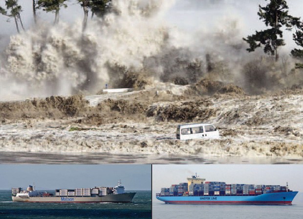 UH Mānoa researchers have equipped 10 Matson and Maersk Line ships with real-time geodetic GPS systems and satellite communications to create a network of low-cost tsunami sensors. Image courtesy of SOEST.
Accurate and rapid detection and assessment of tsunamis in the open ocean is critical for predicting how they will impact distant coastlines, enabling appropriate mitigation efforts. Scientists from SOEST are using commercial ships operating in the North Pacific to construct a network of low-cost tsunami sensors to augment existing detection systems.
The researchers, funded by NOAA, are partnering with Matson, Maersk Line and the World Ocean Council to equip 10 ships with real-time geodetic GPS systems and satellite communications. The newly built pilot network of GPS-equipped ships enables each vessel to act as an open-ocean tide gauge. Data from these new tsunami sensors are streamed, via satellite, to a land-based data center where they are processed and analyzed for tsunami signals.
“Matson was an obvious partner for this project due to their long history in Hawaiʻi and shared interest in community safety and coastal hazards,” said James Foster, HIGP associate researcher and lead investigator for the project. “The World Ocean Council’s unique connection within the industry allowed us to bring Maersk Line into the collaboration.”
Read more about it in the Huffington Post, UH System News and the Hellenic Shipping News.