


NOAA: Central Pacific will see more hurricanes than average
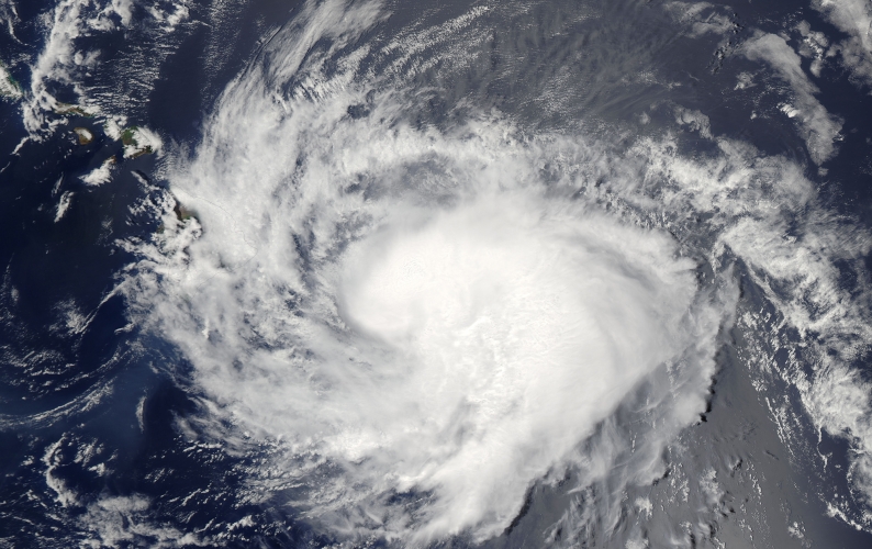 Hurricane Iselle approaching Hawaii (at left) on 07 August 2014. Image courtesy of the National Aeronautics and Space Administration: Image by Aqua/MODIS.
Forecasters say the 2015 hurricane season in the central Pacific region will see more storms than average because of warmer ocean water and less wind shear.
Tom Evans, the acting director of the National Oceanic and Atmospheric Administration (NOAA)’s Central Pacific Hurricane Center (CPHC), said at a news conference Tuesday that the prediction is based largely on current El Niño conditions in the region. El Niño is the warming of the water on the surface of the ocean along the equator, he said, and there are more storms on average during El Niño years.
“At least four out of the seven weather models predict stronger El Niño conditions for 2015 than those that occurred in 1997–98,” said Axel Timmermann, a professor of Oceanography and researcher at the International Pacific Research Center (IPRC).
Dennis Hwang, a coastal hazard mitigation specialist at the University of Hawai‘i’s Sea Grant program, shared some of the lessons learned from the busy 2014 hurricane season. “We dodged three major bullets last year,” he said of hurricanes Iselle, Julio, and Ana. “There were major damages, but it could have been a lot worse.”
He said people should stock up on food, water, medication and gasoline when preparing for a major storm. He added that people should keep important documents, a radio and cash on hand when tropical storms approach. “Have a kit, have a plan and practice it,” he said. “The whole idea here is to be weather ready.”
The 2015 hurricane season lasts from Monday 01 June through Monday 30 November. Most of Hawai‘i’s tropical cyclones happen in August, according to NOAA. The next tropical storm to form in the central Pacific basin will be named Ela.
Read more about it in the New York Times and West Hawaii Today.