


Forecasting hurricanes in “cone of uncertainty” a rough challenge
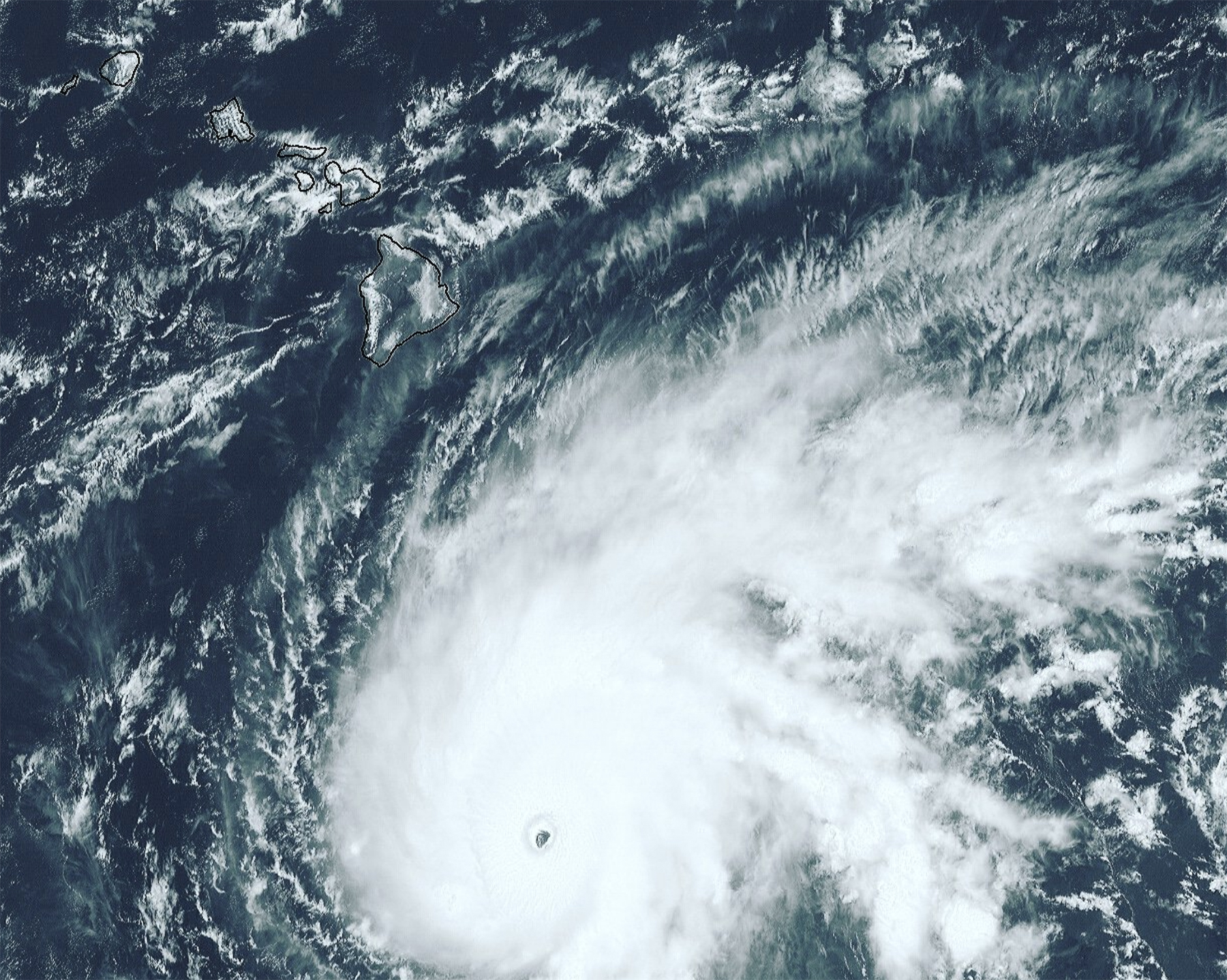 A satellite image of Hurricane Lane to the Southeast of the Hawaiian Islands on 21 Tuesday 2018.
Only two weeks ago, Hurricane Hector passed safely to the south of the islands, as many hurricanes do. A strong ridge of high pressure to the north of Hawai‘i acted as a kind of brick wall, keeping the storm from wandering far enough north to do damage. Hurricane Lane appears to be different. A trough of low pressure to the west of Hawai‘i is generating higher-altitude winds out of the southwest expected to push the hurricane to the north, toward the islands.
Despite advances in dynamic prediction models, it’s challenging to predict the pivot point of a hurricane that’s turning course, said John Bravender, warning coordination meteorologist at the Central Pacific Hurricane Center. On the scale of the globe, the differences are not big. The models may only vary by a couple hundred miles. But out here in the middle of the Pacific, that difference “means day and night,” said Pao-Shin Chu, professor of Atmospheric Sciences and the state climatologist.
Read more about it the Honolulu Civil Beat. Read about natural hazard preparedness via the UH Sea Grant Program.