Explore world’s deepest ocean trench with live feed from expedition
 A rare encounter with a swimming dandelion siphonophore on Dive 17 at Farallon de Medinilla. This dandelion is actually comprised of many individuals that all work together with some protecting the colony, some catching food, some reproducing, etc. These animals are usually observed anchored to seafloor. Courtesy of the NOAA Office of Ocean Exploration and Research, 2016 Deepwater Exploration of the Marianas.
Starting today, NOAA Ship Okeanos Explorer will begin the third of three cruise legs to explore the deepest oceanic trench on the planet, the Marianas Trench in the western Pacific. Leg 3 will take place June 17 – July 10, as the exploration team maps and explores the northern part of the the Marianas Trench Marine National Monument (MTMNM) and the Commonwealth of the Northern Marianas Islands (CNMI).
Anyone with an internet connection can virtually explore the deep sea with scientists and researchers from their computer or mobile device. Live streaming video is available during each and every dive starting on June 17.
This mission will help identify and better understand new geological phenomena and habitats – such as extreme life living in the deepest oceanic trench on the planet, enormous mud volcanoes, active hydrothermal vents, chemosynthetic communities, and possibly deep-sea coral and sponge habitats – for which the MTMNM was designated.
Patricia Fryer, geology professor in the University of Hawai‘i School of Ocean and Earth Science and Technology is on-board for Leg 3. She is a veteran of 46 marine research expeditions, often in the role of chief scientist, and her research has focused on the very deepest parts of the Mariana Trench, including the question of why the Challenger Deep is so deep.
During this expedition, the exploration strategy of the Okeanos Explorer will be employed: seafloor mapping using multibeam sonar; water column exploration using a Conductivity, Temperature and Depth Profiler (CTD); and remotely operated vehicle imaging and video using the ROV Deep Discoverer. Scientists from around the world will be participating in the explorations in real time through telepresence technology as they investigate the biological habitats and geologic history of the region.
Exploration Command Center on UH Mānoa campus
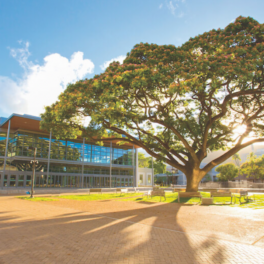
In the Hawaiʻi Institute of Geophysics Building at UH Mānoa, NOAA and UH Mānoa’s School of Ocean and Earth Science and Technology established an Exploration Command Center—a location where live video feeds from the ship and ROVs are displayed and scientists on land can communicate with the ship-board team, enabling tele-presence collaboration.
This expedition is part of a major three-year effort to systematically collect information to support science and management needs within and around the U.S. marine national monuments and NOAA’s national marine sanctuaries in the Pacific.
Highlight videos from the first leg of the exploration are available here, including videos of a city of basket sea stars, a dandelion siphonophore, and an unidentified jellyfish.
Read more about the expedition KUAM News and NOAA’s 2016 Deepwater Exploration of the Marianas.


