|
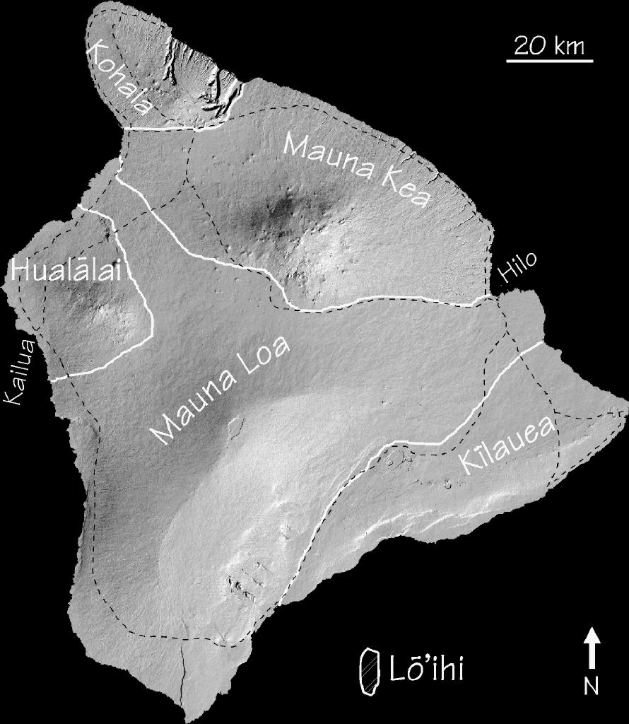
Shaded relief image (from USGS digital elevation data) to show
Mauna Loa in relation to the other volcanoes of the Big Island.
Volcano boundaries are in white, major roads are dashed, in
black. The scenes below are annotated cut-outs from this
image. The geological interpretations are those of numerous
authors, most of whom at one time or another worked at the
Hawaiian Volcano Observatory. [125174-byte jpeg]
|
|
The Kealakekua fault, which has been draped by many lava flows.
The oldest west flank flows are exposed at the inland base of
the fault. The small south-pointing peninsula in Kealakekua bay
is the location of the monument to Captain Cook. [Image size: 63233 bytes]
|
|
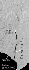
Ka Lae (South Point) and the Kahuku Pali. The pali (cliff) has
the appearance of a scissors fault with the ocean end having
dropped more, but it is more likely that the upland end has
simply been more deeply buried. [Image size: 112614 bytes]
|
|
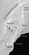
The Ninole Hills and Wood Valley on the SE flank of Mauna Loa.
The oldest subaerial Mauna Loa lavas are exposed in the Ninole
Hills. The Ninole Hills and Wood Valley are nestled within the
curve of old avalanche scars. A mudflow down Wood Valley killed
31 during the Great Ka'u Earthquake of 1868. The umbilical to
the Hawai'i Undersea Geo Observatory (HUGO) will come ashore at
Honu'apo. [Image size: 145024 bytes]
|
|
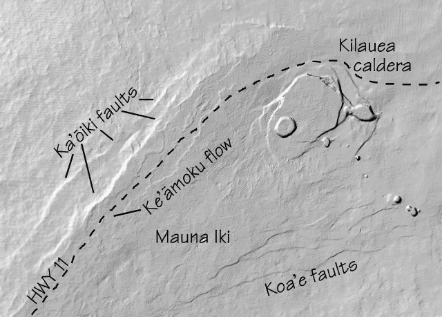
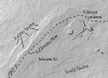
The Mauna Loa-Kilauea boundary in the vicinity of Kilauea
caldera. The Ka'oiki faults are old Mauna Loa analogs of the
present-day Hilina fault system on Kilauea. The Ke'amoku flow is
a large Mauna Loa flow that erupted not long before the arrival of
Westerners. [Image size: 91082 bytes]
|
|
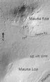
The saddle between Mauna Loa and Mauna Kea. The morphological
differences between the two volcanoes are very obvious in these
data. H is Pu`u Huluhulu, a well-known landmark on the Saddle
Road. [Image size: 210044 bytes]
|