[ Bathymetry | Backscatter | Optical Validation | Geomorphology ]
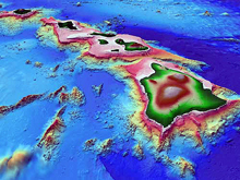
Molokai, formed from two extinct volcanoes, covers an area of 673 sq. km and reaches 1515 m at its highest point. Generally situated between Maui and Oahu at 21° 08’N, 157° 00′ W, the island has 142 km of shoreline and an estimated 998 sq. km of reef (Hawaii Coral Reef Network). The island is one the four members of the Maui Group (also including Maui, Lanai and Kahoolawe), situated together on a shallow, submerged bank. In the recent geological past, the islands formed a single land mass (Maui Nui) during periods of lowered sea levels. Like all of the main Hawaiian islands, it is considered a high island and contributes significant nutrient and sediment runoff to coastal waters. Molokai’s human population was counted at 6,717 in 1990, mostly scattered around the island. There are fishing restrictions around the town of Kaunakakai, and the Hawaiian Islands Humpback Whale National Marine Sanctuary spans 3642 sq. km of the waters among and around the Maui Group. Penguin Bank is a flat-topped feature with a surface area of 1015 sq. km that extends from the west coast of Molokai approximately 70 km to the southwest, and the State of Hawaii is considering implementing bottomfishing restrictions for the area.
Click thumbnail maps below to explore PIBHMC’s data sets.
Bathymetry |
Backscatter Imagery
Not yet available
|
Optical Validation |
Geomorphology
Not yet available
|

