[ Bathymetry | Backscatter | Optical Validation | Benthic Habitat | Geomorphology]
The collection and analysis of photographic data to ground truth and interpret multibeam data layers with the goal of characterizing seafloor habitats.
West Hawai’i | TOAD Coral Cover Map

Download this image as a High-res JPG or PDF
West Hawai’i: North Area | TOAD Coral Cover Map
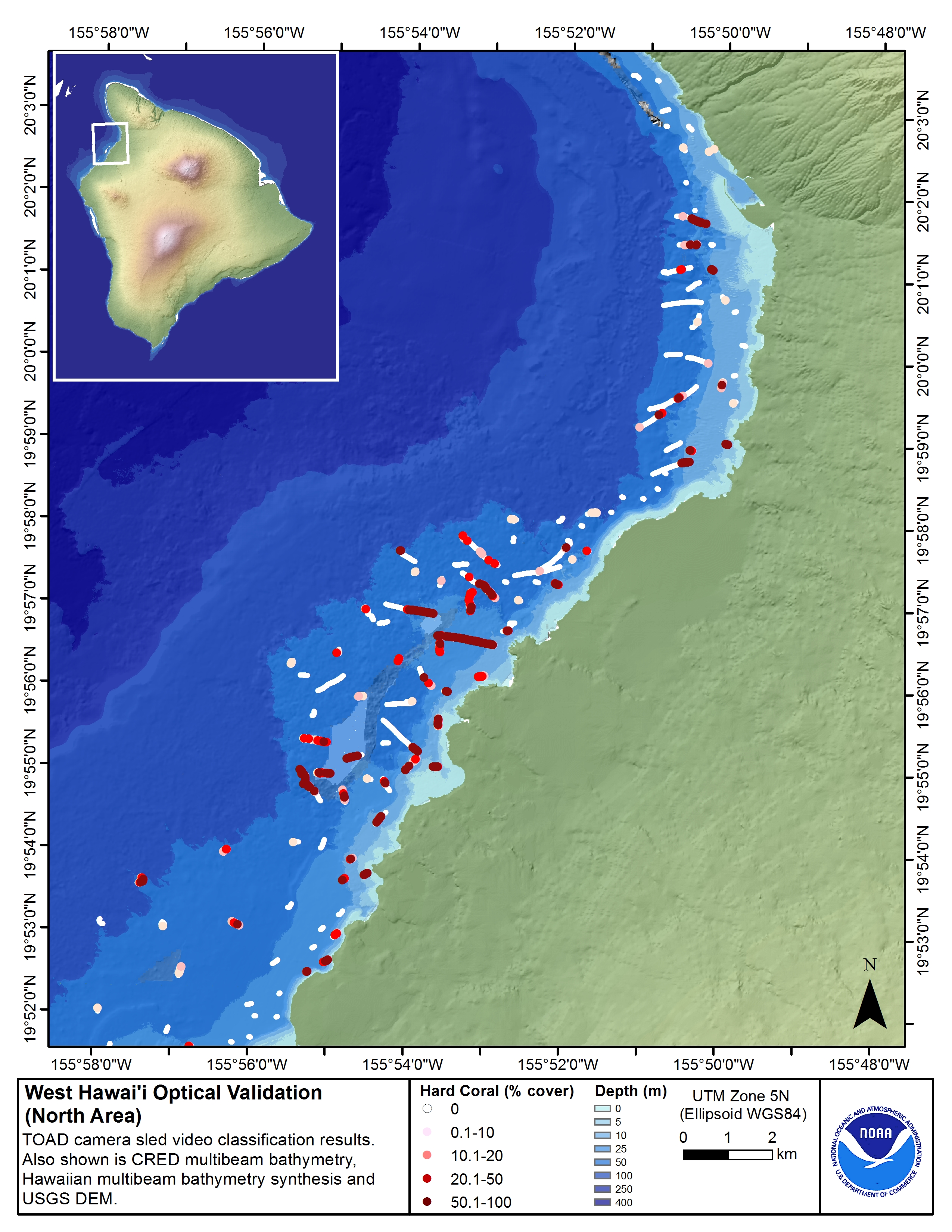
Download this image as a High-res JPG or PDF
West Hawai’i: South Area | TOAD Coral Cover Map
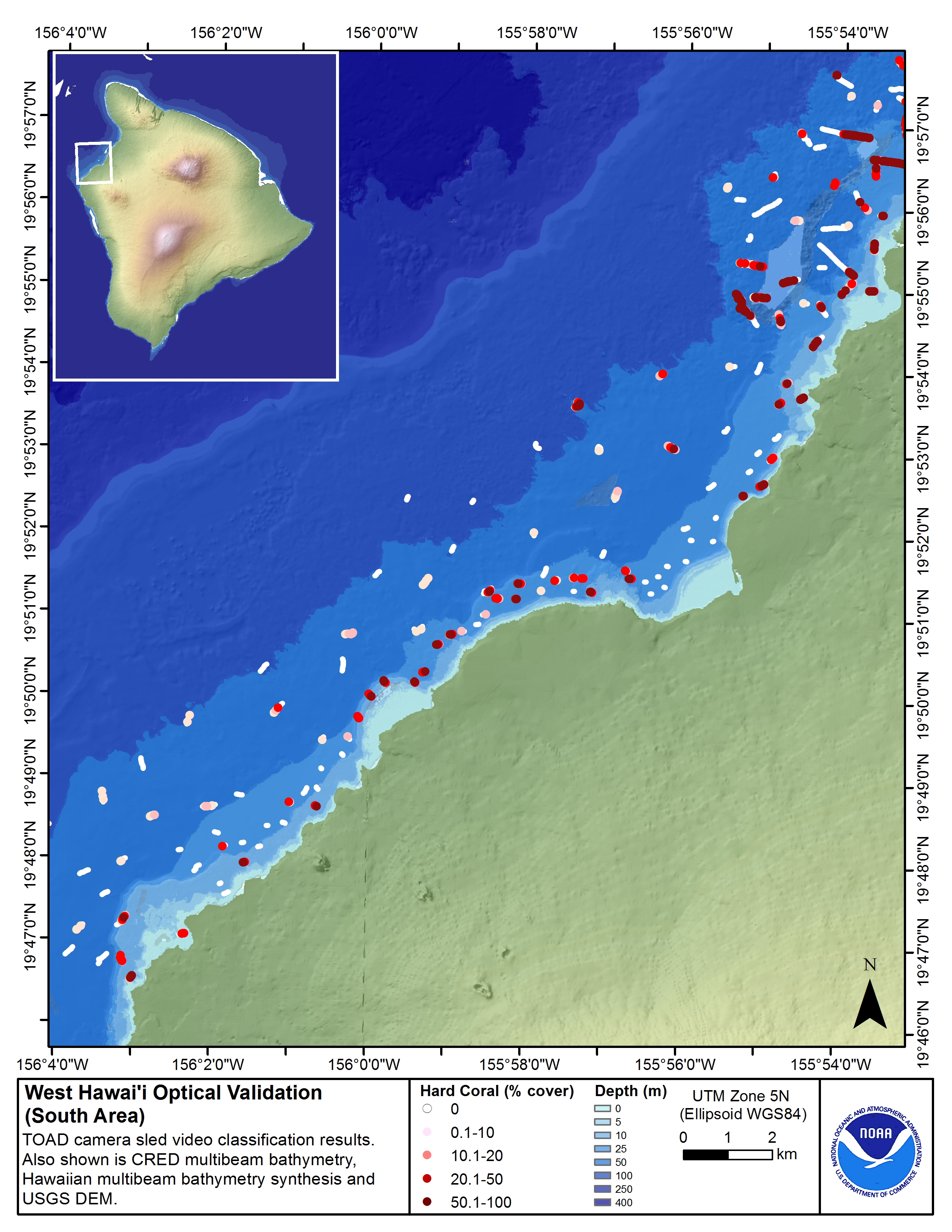
Download this image as a High-res JPG or PDF
|
Descriptions of optical data products. |
|
Download: Accessory Files |
These maps above display optical validation observation locations and percent coverage of scleractinian coral overlaid on bathymetry and landsat imagery northwest of Hawai’i island. Optical data were collected by CRED TOAD camera sled from the NOAA survey launch R/V AHI during cruise SB1207 and SB1505.
The optical data are classified by substrate type, type of live growth on bottom, geomorphic zone, and the size and abundance of holes in the substrate. Although what we show here is the percentage of coral, the shapefiles contain data on all those categories, enabling users to map the occurrence of any combination of characteristics that are included in the classification scheme. (See sidebar for shapefiles.)
West Hawai’i | Scleractinian Coral Cover and Sand Map
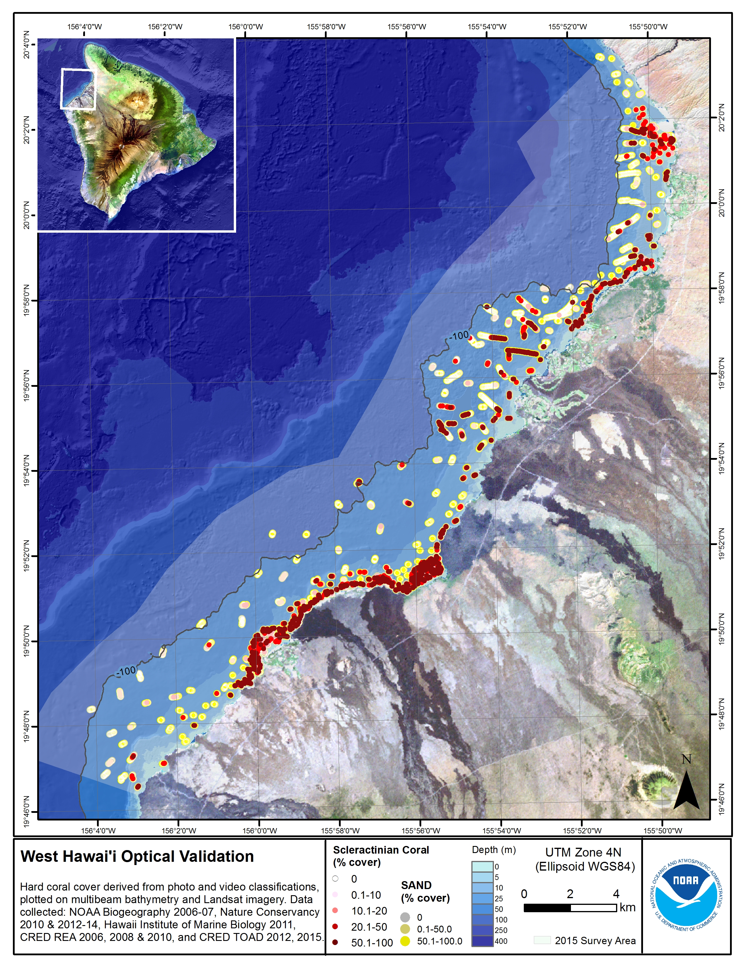
Download this image as a High-res JPG or PDF
West Hawai’i: North Area | Scleractinian Coral Cover and Sand Map

Download this image as a High-res JPG or PDF
West Hawai’i: South Area | Scleractinian Coral Cover and Sand Map
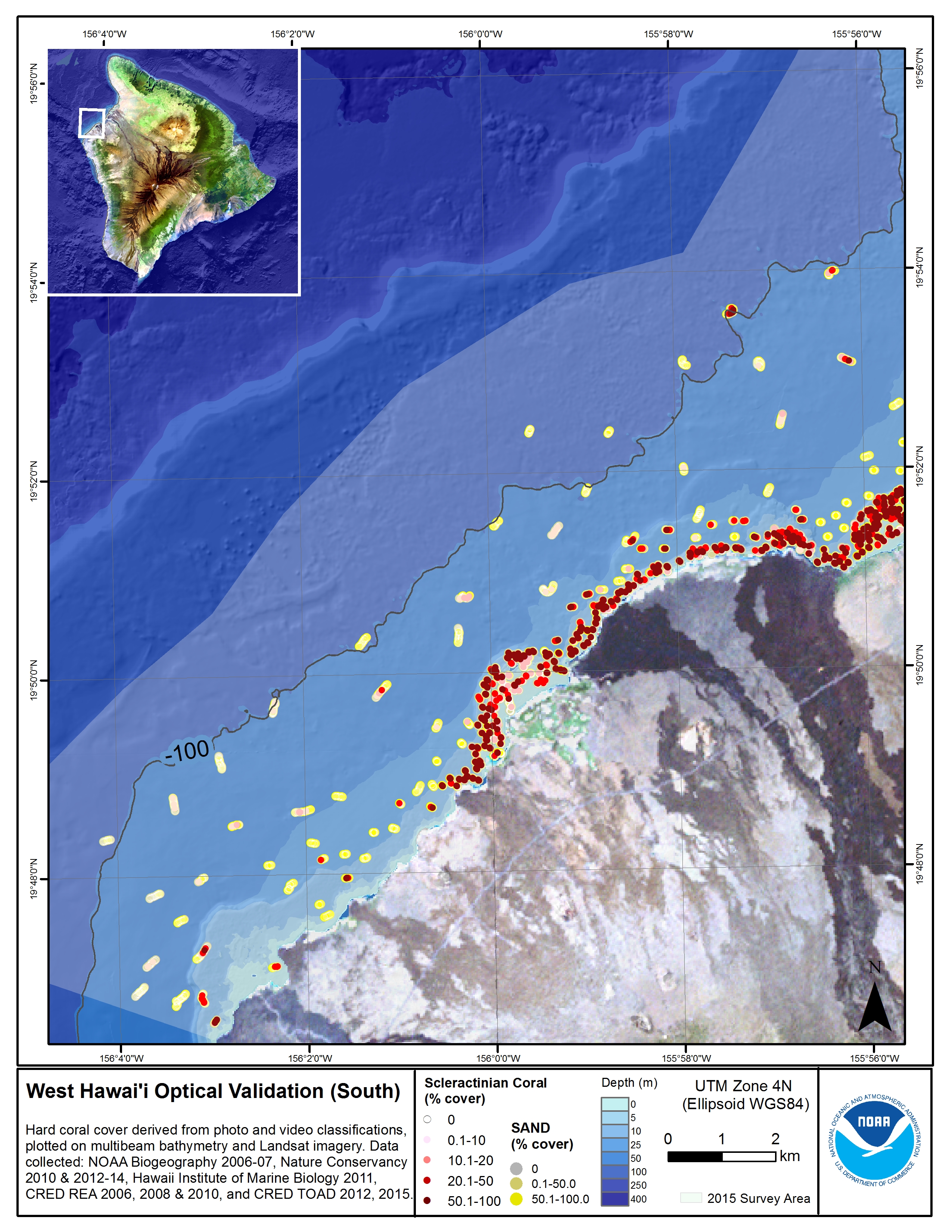
Download this image as a High-res JPG or PDF
- View: Metadata
- Download: JPG/PDF & metadata