[ Arakane Reef | Pathfinder Reef | Santa Rosa Reef | Stingray Shoals ]
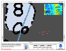
Pathfinder Bank is located approximately 275 km west of Anatahan in the West Mariana Arc. Pathfinder Bank is 3 km southeast of its plotted position on NOAA’s Nautical Chart 81004 and includes areas shallower than 10 m, rather than the 8 fathoms (15 m) shown on the chart. It was mapped in September 2003 using single-beam sonar and an underwater video camera during the NOAA MARAMP cruise. Hard and soft corals were found on ridges of carbonate pavement, separated by channels containing rubble.
Click thumbnail maps below to explore PIBHMC’s data sets.
Bathymetry
Not yet available
|
Backscatter
Not yet available
|
Optical Validation |
Geomorphology
Not yet available
|
