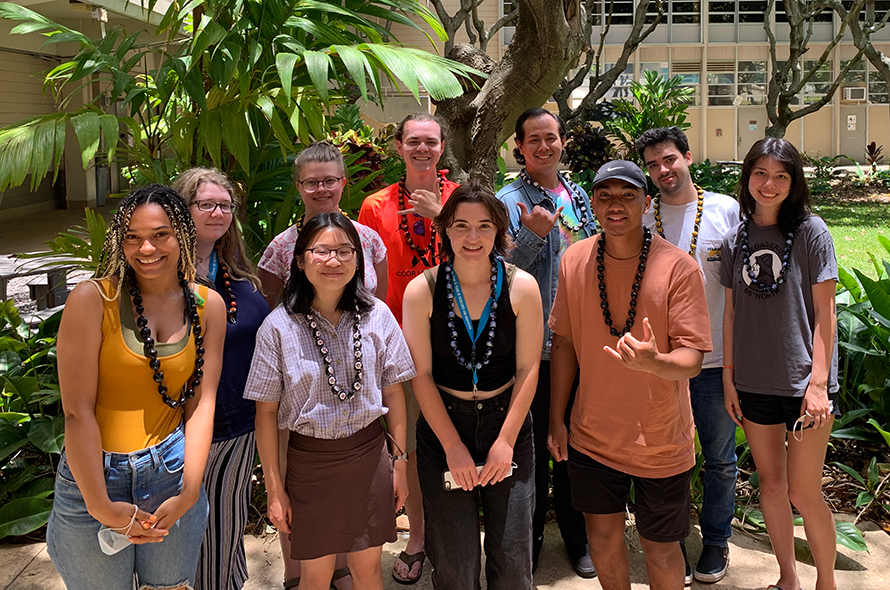
The 2021 ESVI REU cohort of participating students from across the US.
ESVI REU Program 2021
Follow us on Facebook!
This was our 5th summer of the ESVI NSF/REU site program. Our program offers undergraduate students a unique opportunity to visit Hawai‘i and work with individual faculty mentors on cutting edge research projects. Our 10 REU students conducted research on-campus for the month of June, and then continued their research remotely for an additional 5 weeks in July. Each student spent nine weeks working on a research project with their individual mentor or mentor pair.
In addition to research, our group had many cohort activities on their summer calendar:
- A three-day geologic field trip to the Big Island,
- East O‘ahu geology field trip,
- Several professional development workshops sponsored by the UHM SURE (Summer Undergraduate Research Experience) program, and
- Several ESVI REU short courses: MATLAB, GIT version control, Python programing.
The program concluded with a joint research symposium with other summer research programs on the UHM campus, sponsored by the 2021 UHM SURE Program.
Click on the small poster images below to see a larger version.
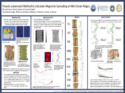 Silvia Alemany [Bryn Mawr College. Mentor: Apuzen-Ito]. Silvia’s project examined critical gradients of fault scarps to calculate the fraction of plate extension accommodated by magmatism. Silvia developed a script that calculates the fraction of plate separation accommodated by normal faulting, as well as the amount of extension accommodated by magmatism (M) using high-resolution bathymetry data collected by seagoing surveys. The identifiable patterns in this ongoing analysis of the Chile Ridge will allow for exploration of other mid-ocean ridges where M has not been previously analyzed, and how variations in M influence the segmentation style of a variety of mid-ocean ridge boundaries.
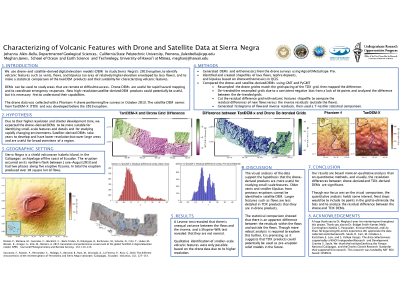 Johanna Alen-Bella [California State Polytechnic University. Mentor: Jones]. Johanna’s project examined Digital Elevation Models (DEMs) and orthomosaics of the Sierra Negra shield volcano in the Galapagos archipelago based on five
Phantom 4 drone surveys collected from the caldera rim in October 2018. Johanna identified and mapped volcanic features in the DEMs and orthomosaics using PyGMT and QGIS. Results show that the drone DEM is detailed enough to identify a range of volcanic features, including vents and fissures, and may be better suited to track rapid changes in the study area than satellite-based DEMs, which often require years to develop.
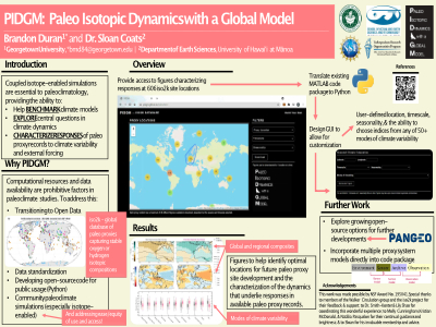 Brandon Duran [Georgetown University. Mentor: Coats]. Brandon’s project was focused on the development of PIDGM (Paleo Isotopic Dynamics with a Global Model), a web-based tool to provide the paleoclimate community with access to output from a suite of forced transient
iCESM simulations of the Common Era, for specific application of characterizing the dynamics underlying variations in water isotopic ratios at proxy sites. Brandon's efforts also included work on a supplementary graphical user interface, allowing users to generate similar PIDGM figures but for any location on the globe, and with a number of other customizable options, including the ability to analyze 40+ modes of climate variability.
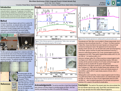 John Fast [University of Hawai‘i at Manoa. Mentor: Sharma]. The goal of John’s project was to use micro-Raman spectroscopy to identify and understand the chemical makeup of surface aerosols emitted from Kilauea Volcano on the Big Island of Hawai‘i. Using 785 and 514 nanometer lasers, John analyzed and identified several sulfuric compounds present in vog aerosols: sulfuric acid, ammonium sulfate, ammonium hydrogen sulfate, and methanesulfonic acid.
 Jacob Flores [Leeward Community College, UH. Mentor: Nugent and Torri]. Jacob’s project examined the relationship between the atmospheric environment and rainfall on the island of O‘ahu. Jacob analyzed two time series of wind speed data using MATLAB in order to recognize significant patterns: (1) Thirty years of vertical soundings (an ascending balloon recording such variables like atmospheric pressure, wind speed and direction, temperature, etc.) collected from Hilo, HI that show atmospheric conditions on any given day, and (2) thirty years of rain gauge data collected from 158 stations scattered throughout O‘ahu that give total daily rainfall at each station. Results suggest a correlation between trade wind speed and rain amount.
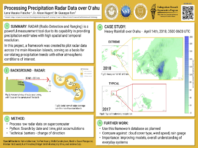 Lena Fleischer [Colorado College. Mentor: Nugent and Torri]. Lena processed raw radar data collected from 2016-2019 at four sites across the main Hawaiian Islands using LROSE to produce an estimate of quantitative precipitation from radar reflectivity. A Python script was created to semi-automatically plot radar data, producing visualizations of precipitation accumulation over the Islands. The program produces an image displaying precipitation accumulation for a specified time frame. Applications for these images include correlating radar-derived rainfall patterns with wind speed, wind direction, observed rain gauge measurements, and cumulus cloud cluster type.
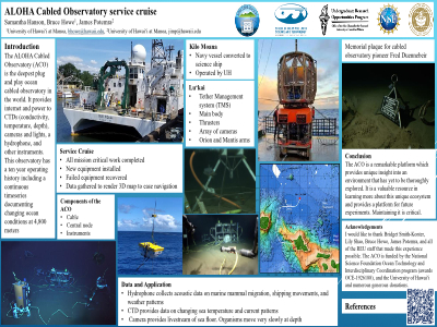 Samantha Hanson [Brigham Young University - Hawai‘i. Mentor: Potemra and Howe]. Samantha’s participated in a June 2021 research cruise to the ALOHA Cabled Observatory on the Research Vessel Kilo Moana. Cruise activities included installation of a new CTD and camera with lights, equipment servicing, and acquisition of images for the construction of a 3D map that will make navigating easier for future missions. One of the new lights was used to illuminate a commemorative plaque which was put in place to honor Fred Duennebier, a pioneer of cabled observatories.
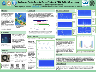 Yulia Kornikova [Reed College. Mentor: Potemra and Howe]. Yulia’s project examined
18 months of 24kHz ocean-bottom hydrophone data from the Station ALOHA Cabled Observatory (ACO) from January 2020 - May 2021. Yulia computed spectrograms of the audio files for visualization, analysis and annotation of the data. Her results suggest a variety of sounds identified as whales, in addition to some unidentified ocean noise.
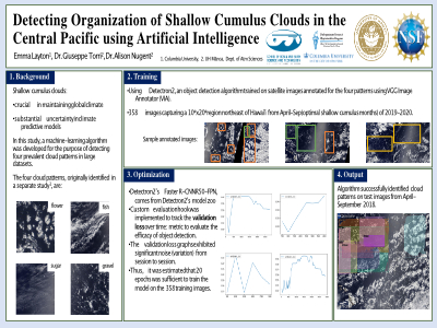 Emma Layton [Columbia University. Mentor: Nugent and Torri ]. Emma’s project was aimed at developing a machine-learning algorithm for the purpose of detecting four prevalent cloud patterns in a large dataset to simplify identification of temporal and spatial trends in mesoscale-level patterns of cumulus clouds. A convolutional neural network was trained to identify these patterns on 2019 and 2020 June-July-August daily satellite images of the Hawaiian islands. The model was then applied to daily screen captures from 2000-2018. The neural network recorded the frequency of each detected pattern, and based on the proximity and breadth of formations, categorized a certain day as dominated by one of the four patterns. This data was compared with weather radar, rain gauge, and radiosonde data to verify the environmental profiles for each pattern type and identify correlations between the four convective organizations.
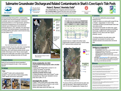 Aston Ramos [University of Hawai‘i at Hilo. Mentor: Dulai]. Aston’s project examined submarine groundwater discharge (SGD), which is known to transport nutrients that have degraded water quality, from Shark’s Cove Kapo’o tide pools on the North Shore of O’ahu. In collaboration with the Mālama Pūpūkea-Waimea (MPW) organization, Aston worked to confirm SGD and to quantify nutrient fluxes through analysis of geochemical tracers (radon, radium, salinity). In the northern zone, nutrients were 2-3x higher with elevated CECs (contaminants of emerging concern) compared to the southern zone, suggesting that the comfort station or other wastewater sources contribute to the degradation of water quality.
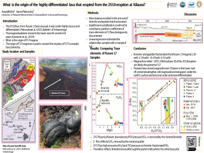 Araela Richie [Diablo Valley College. Mentor: Pietruszka ]. Araela’s project examined trace element abundances of Fissure 17 (F17) lava of the 2018 Kīlauea Volcano to infer its parental magma. Models were made to infer the type of minerals other than olivine, clinopyroxene, and plagioclase that crystallized from the F17 magma. Araela's results suggest that recent Pu‘u ‘Ō‘o and Halema‘uma‘u magma can be ruled out as a parent of the F17 magma, but older magma from 1955 or the 1960s are suitable parents.
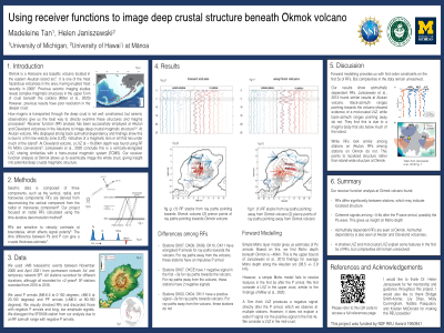 Madeleine Tan [University of Michigan. Mentor: Janiszewski ]. Madeleine’s project examined seismic receiver function data of Okmok volcano on Umnak Island, Alaska, one of the most hazardous, explosive volcanoes in the Aleutians. Using receiver function analysis of waveforms for M6 and larger teleseismic earthquakes, Madeleine investigated sharp boundaries in the crust beneath Okmok and the surrounding region in order to understand its deeper crustal magmatic system. Madeleine's results show Ps arrivals that are consistent with a Moho depth of ~40km, particularly at stations outside the caldera, although data variability suggests complex crustal structure with heterogeneity may be spatially localized beneath individual stations.
2017 ESVI REU Cohort | 2018 ESVI REU Cohort | 2019 ESVI REU Cohort | 2020 ESVI REU Cohort | 2021 ESVI REU Cohort
[ Top of page ]
